- Manendragarh
-
Manendragarh मनेन्द्रगढ़ — city — Coordinates Country India State Chhattisgarh District(s) Koriya Population 75,000 Time zone IST (UTC+05:30) Manendragarh is a City in the Indian state of Chhattisgarh.
The nearest airport is at Raipur in Chhattisgarh. Manendragarh Railway Station is on the Anuppur-Chirmiri rail route. There are many coal mines around here. Manendragarh was originated by some tribals around 100 years ago.
National Highway 47 has its route through Manendragarh. Amrit Dhara Waterfall is a nearby attraction. "Sidh-Baba" mount is famous for the Lord Shiva temple.
Contents
Demographics
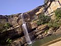
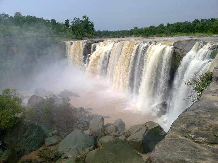
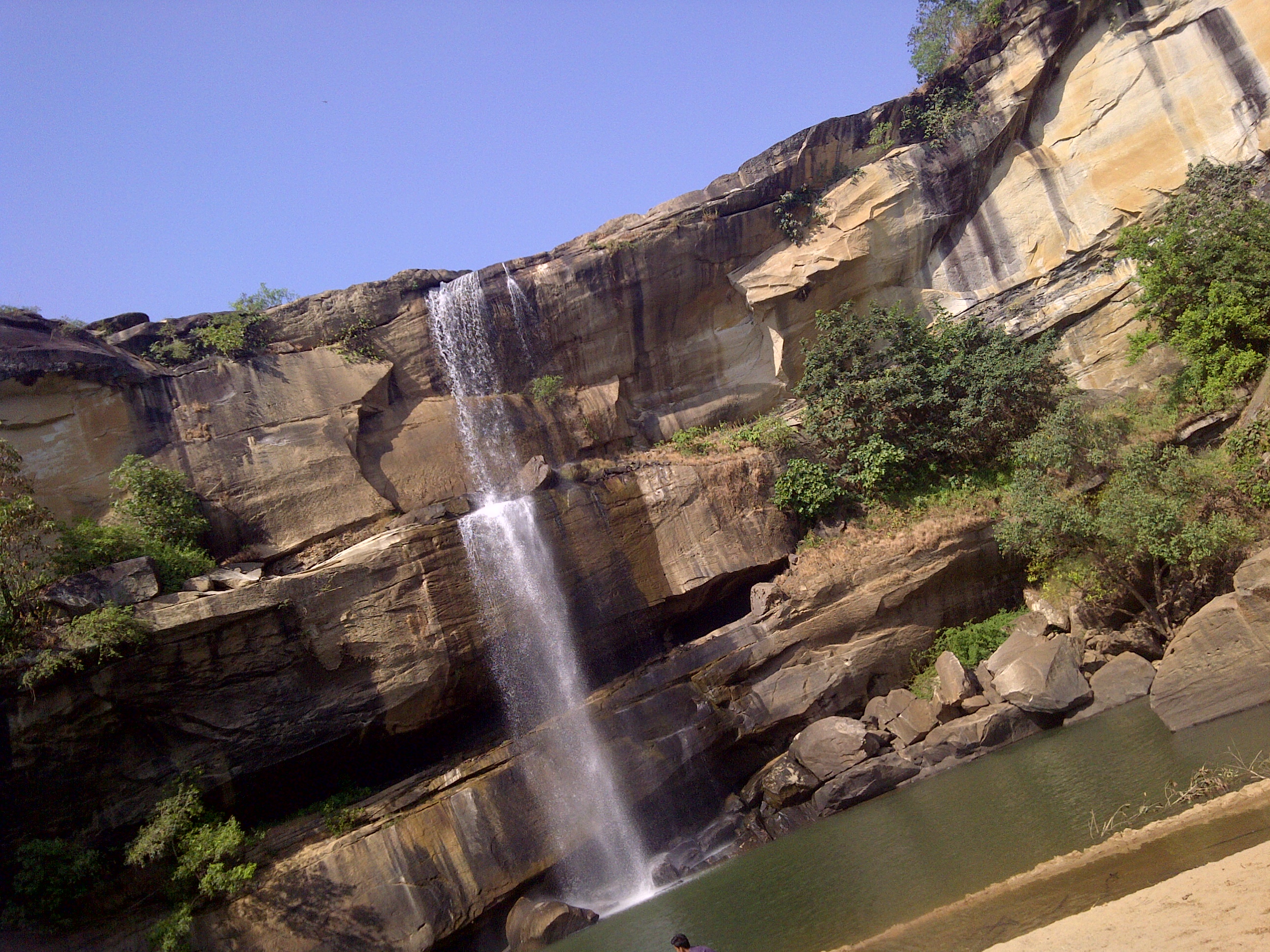
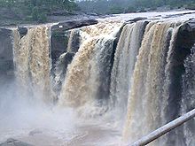 Amrit Dhara
As of the 2001 India census,[1] Manendragarh had a population of 73,548. Males constitute 53% of the population and females 47%. Manendragarh has an average literacy rate of 72%, higher than the national average of 59.5%: male literacy is 79%, and female literacy is 64%. In Manendragarh, 13% of the population is under 6 years of age. Manendragarh is the hub of rural items.
Minerals
Region of Manendragarh has vast reserves of high-grade coal. The main coal belts are in the Hasdo basin. There are small deposits of limestone, fire clay and red oxide in Manendragarh.
Drainage
A part of Manendragarh region lies in the Ganga basin and the remaining portion is in the Mahanadi basin. Gopad is the major tribute of Son and originates about 10 miles North of Mendra village. It drains the Northern portion of the District. Hasdeo a major tributary of Mahanadi has its origin in Mendra village.
Forest
Manendragarh region has vast range of forests. Up to the last decade of the 19th century, Manendragarh region was a vast stretch of forest dotted here and there with villages. These forests were very dense and thick. Forests and coal play a very important role in the economy of this area.
Coal fields
Jhagrakhand or Hasdev Coalfields. Coal plays a very important role for the economy of the district.
Botany
Most common trees of Korea District are Sal, Mahua, Tendu, Palas, Char, Bija, Harra, Bahera, Sisam, Kusum, Salya, Khair, Arun, Gamhar etc. Bamboos are mostly available in the forests.
Rivers
The Hasdeo :- The Hasdo is the largest river flowing towards the South. It rises from 23º30´ North by 82º30´ East on the Sonhat Plateau and drains the South-Western part of the District. In this District, the river course resembles an upturned 'S' and flows for about 95 km. After a course of about 72 km, it enters Bilaspur District at 23º North. It receives the waters of the Gej and the Chornai on the left bank and the Tan and the Ahiran on the right before it meets the Mahanadi. The total length of the river is 245 km. The valley is narrow. Important settlements along the river are Sonhat, Ghugra, Manendragarh, Kosgain, Korba and Champa.
Place to visit near Manendragarh
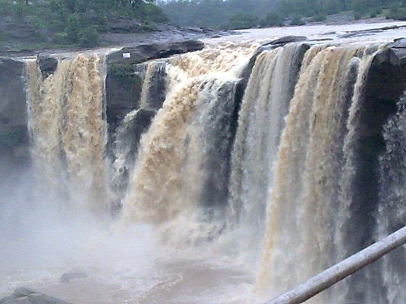
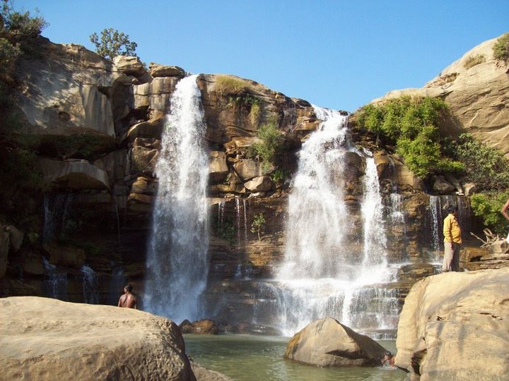
• Amrit Dhara Waterfall (15 km) : the natural beauty of Koriya is known all over India. The place is full of dense forests, mountains, rivers and waterfalls. Amrit Dhara Waterfall in Koriya is among the most famous waterfalls . The area around is also a famous picnic spot. People go for picnic and family get together to this place. The Amrit Dhara waterfall is easily accessible from Koriya and other parts of Chhattisgarh. There is a Shiva Temple here too. In 1936, Ramanuj Pratap Singh Judeo, the King of Koriya State, started a mela (fair) here on Mahashivratri, and the practice is followed till today.
• Siddh Baba Temple is situated on one of the hills of the town
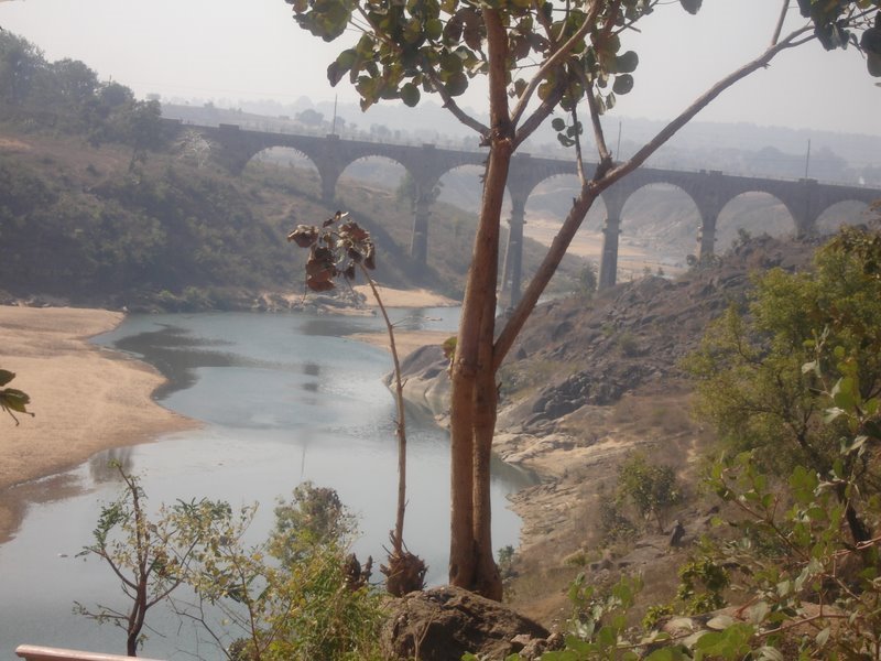
• Hasdeo River is a preferred Picnic spot for people of Manendragarh
• Biharpur is also a very good picnic spot for the people of manendragarh located 35 km away from MDGR(Manendragarh)
Education
School
- Kendriya Vidyalaya (Railway)
- Kendriya Vidyalaya (S.E.C.L.)
- St. Joseph's Misson School(2nd Branch)
- Vijay English Medium Hr. Secondary School
- Shardesh Hr. Secondary School
- Boys Central High School
- Girls Central Vishva Vidyalaya
- Sarswati Shisu Mandir
- St. Joseph's Convent School
- St. Patric's scool Lalpur
- Blossem's School(Primary Classes)
- Universal Public School
- Sarswati Vidhya Mandir(Govt. HINDI MEDIUM School)
- Khalsa Education Society
- st.josephs convent high school
College
- Govt. Vivekanand college
- Sarswati kanya Maha Vidyalaya
- Rajiv Gandhi Computer Collage
- R.N.S.Shiksha Mahavidyalaya (B.Ed.Collage)
Place to stay
Hotels, lodges*, restaurants#
- Agrawal Lodge*
- hasdio In 3 star
- Bharat Restaurant#
- Celebration Restaurant# (9977185185)
- Central Lodge*
- Green Park#
- Hariyana Bhavan*
- Hotel Hasdev Inn* (7869908458)
- Hotel Midtown*
- Hotel Royal*
- Hotel Vinay*
- Maharaja Agrasen Dharamshala* (9301587520)
- Park View#
- Rajeshthan Bhavan*
- Relish Restaurant 3 star #
- Tiwari Restaurant#
- Yatri Nivas*
Transport
Manendragarh train schedule
Train no. Train name MDGR DEP 28242 CHRM DURG EX PASS 21.20 51606 CHIRIMIRI SAGOUR FAST 03.55 51754 CHRM REWA FAST PASS 15.45 51755 MDGR CHRM PASS 13.15 58220 CHRM BSP FAST PASS 21.20 58221 CHRM CHD FAST PASS 09.25 58223 MDGR ABKP PASS 07.25 Train no. Train name MDGR ARV 18235 BPL CHRM PASS 06.20 18241 DURG ABKP EX PASS 06.20 51605 KTE CHRM FAST PASS 23.20 51753 REWA CHRM FAST PASS 07.45 51756 CHRM MDGR PASS 10.45 58219 BSP CHRM PASS 06.20 58222 CHD CHRM FAST PASS 18.30 58224 Ahuyiy PASS 17.15 By road
- National High way 47 is connecting Manendragarh from other part of state, Buses services are operate between different city of Madhya Pradesh, Chhatisgrah, Uttar Pradesh, Jharkhand and Bihar
By air
- Nearest airport is Raipur
- Another nearby airport is Jabalpur
Manendragarh also has some other beautiful places such as herbal garden nearby pump house in AMAKHERWA and nursery at Surajpur road nearby chota nagpur (c.g.).
-

amrit dhara
-
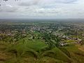
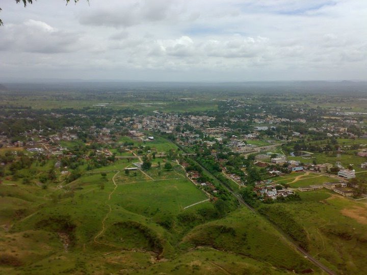
mountain view
-
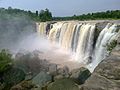
amrit dhara
-
Kharam Ghonga
-
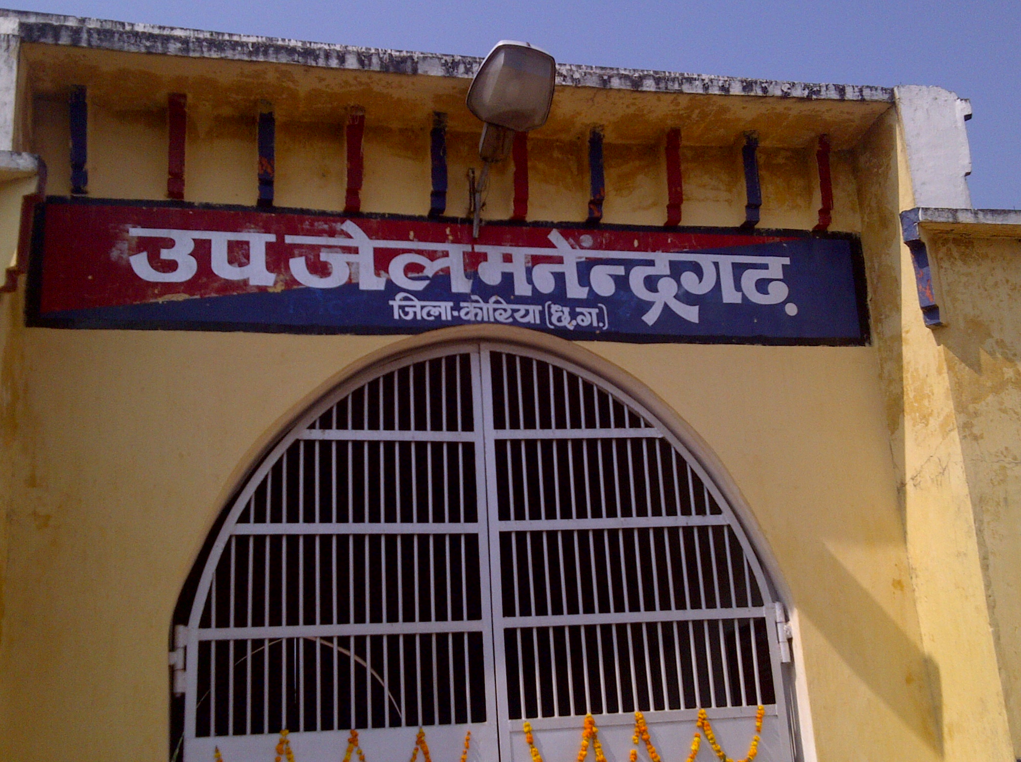
Manendragarh Jail
-

Perfect view of Pump House
References
- ^ "Census of India 2001: Data from the 2001 Census, including cities, villages and towns (Provisional)". Census Commission of India. Archived from the original on 2004-06-16. http://web.archive.org/web/20040616075334/http://www.censusindia.net/results/town.php?stad=A&state5=999. Retrieved 2008-11-01.
Categories:- Cities and towns in Koriya district
Wikimedia Foundation. 2010.