Clontarf Road railway station

Clontarf Road railway station
Clontarf Road Iarnród Éireann
Bóthar Chluain Tarbh
8139 Clontarf Road 2008-05-03 1430.jpg
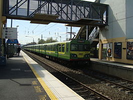
Location
Place Dublin
Local authority Dublin City Council
Operations
Station code 109
Platforms in use 2
Iarnród Éireann - Ireland railway stations
A B C D E F G H I J K L M N O P Q R S T U V W X Y Z

Clontarf Road railway station (Irish: Bóthar Chluain Tarbh) is a railway station in Dublin, Ireland, on the DART commuter rail line.

Contents

Location

It is located at the south-western end of Clontarf Road on Dublin's Northside, on the border between Clontarf and Fairview, and serves people living and working in those areas, as well as Marino and East Wall. The station is situated just north of Fairview DART depot. It was built in the late 1990s to serve the densely populated areas about, and also East Point Business Park.

Previous station for area

The area was last served by the old Clontarf Station, almost a kilometre north on the line. The remnants of that station can still be seen at the rail bridge over Howth Road, halfway between the start of that road and Killester village centre.

This original Clontarf station was opened on 25 May 1844 and finally closed on 3 September 1956.[1]

Preceding station Iarnród Éireann Iarnród Éireann Following station
Killester   DART
Trans-Dublin
  Dublin Connolly
    From 2015    
Killester   DART
Line 2
  Docklands

External links

References

  1. ^ "Clontarf station". Railscot - Irish Railways. http://www.railscot.co.uk/Ireland/Irish_railways.pdf. Retrieved 2007-08-31. 

Coordinates: 53°21′47″N 6°13′37″W / 53.3631°N 6.2270°W / 53.3631; -6.2270


Wikimedia Foundation. 2010.

Игры ⚽ Нужен реферат?

Look at other dictionaries:

  • Clontarf railway station — (Irish: Cluain Tarbh) was a railway station in Dublin, Ireland, on the Dublin and Drogheda Railway line. Location The remnants of the station can still be seen at the rail bridge over Howth Road, halfway between the start of that road and… …   Wikipedia

  • Clontarf, Dublin — Clontarf Cluain Tarbh   Town   …   Wikipedia

  • Dublin Connolly railway station — Coordinates: 53°21′06″N 06°14′57″W / 53.35167°N 6.24917°W / 53.35167; 6.24917 …   Wikipedia

  • Docklands railway station — Docklands The station building as seen from Sheriff St, 23 March 2007 …   Wikipedia

  • Clontarf and Hill of Howth Tramroad — The Clontarf and Hill of Howth Tramroad Company (C HoHTCo) operated a tram service from central Dublin via Dollymount in Clontarf to Howth Harbour in the Dublin area of Ireland from 1900 to 1941. Formed in the 1880s, it was a separate entity from …   Wikipedia

  • Dublin–Belfast railway line — Dublin to Belfast line Enterprise Class 3000 at Lisburn. Overview Type Commuter rail, Regional rail and Heavy rail …   Wikipedia

  • List of railway stations in Ireland — This article lists railway stations both in the Republic of Ireland and Northern Ireland. In The Republic of Ireland A * Adamstown * Arklow * Ashtown * Athenry * Athlone * Athy * Attymon B *Bagenalstown *Balbriggan *Ballina *Ballinasloe… …   Wikipedia

  • N4 road (Ireland) — N4 road Location Primary destinations: (bypassed routes in italics) County Dublin Dublin City Chapelizod …   Wikipedia

  • Fairview, Dublin — Infobox Irish Place name = Fairview gaeilge = Fionn Radharc crest motto = map pin coords = left: 62px; top: 80px north coord = 53.365 west coord = 6.23 irish grid = area = elevation = province = Leinster county = Dublin town pop = rural pop = n/a …   Wikipedia

  • Fairview DART depot — is a railway depot used for servicing electrical multiple units on the Dublin Area Rapid Transit system. There is a three road shed, train wash and sidings. It is located just south of Clontarf Road DART station on the Dublin Belfast railway line …   Wikipedia

Share the article and excerpts

Direct link
Do a right-click on the link above
and select “Copy Link”