- North Hayling railway station
-
North Hayling 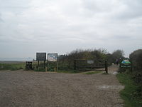
Site of station, now a car-park for a nature reserve. Location Place Havant Area Havant, Hampshire Grid reference SU717028 Operations Pre-grouping LBSCR Post-grouping Southern Railway
Southern Region of British RailwaysPlatforms 1 History 17 July 1867 Opened 4 November 1963[1] Closed Disused railway stations in the United Kingdom Closed railway stations in Britain
A B C D–F G H–J K–L M–O P–R S T–V W–Z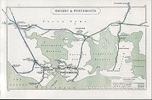
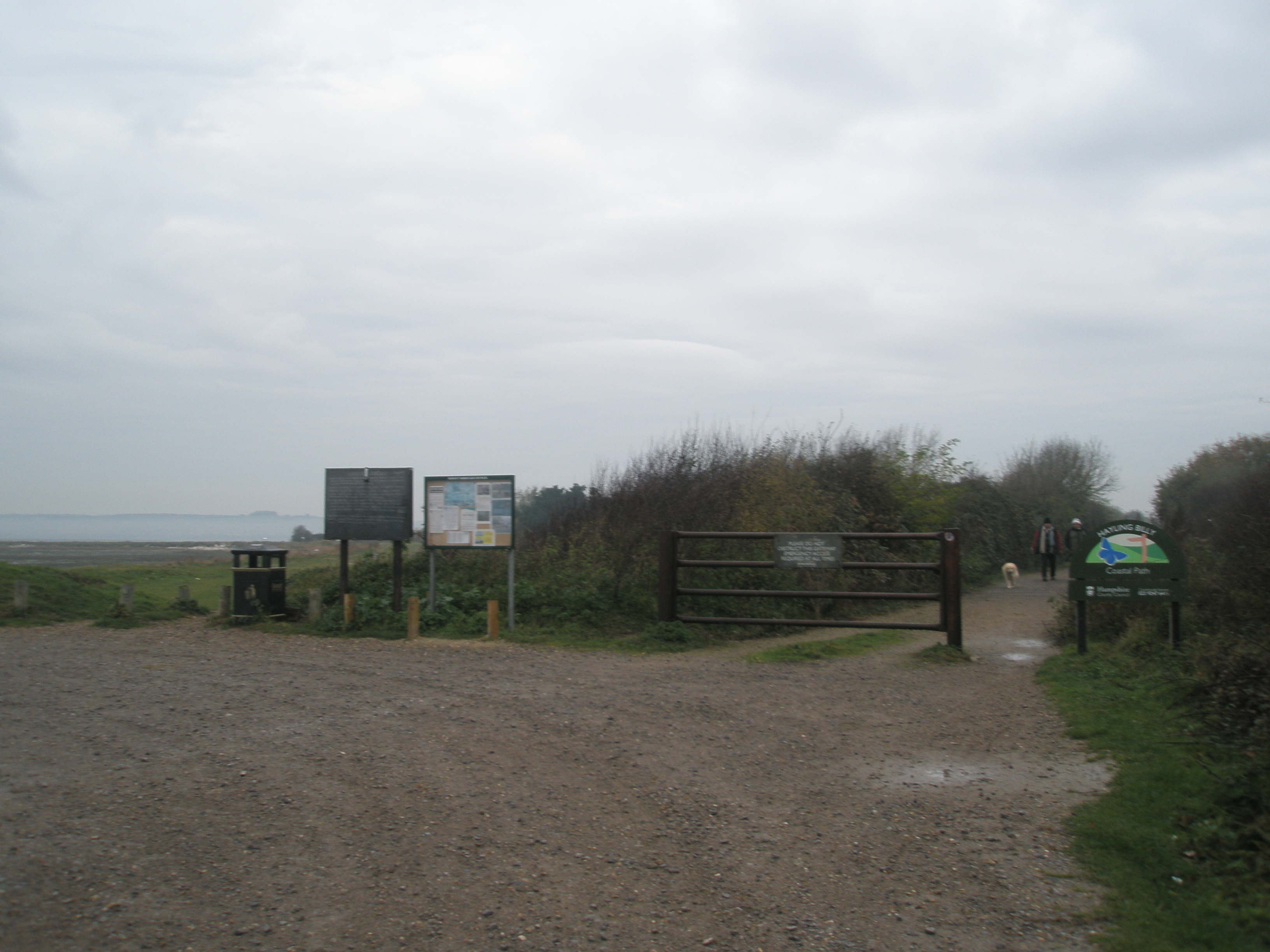
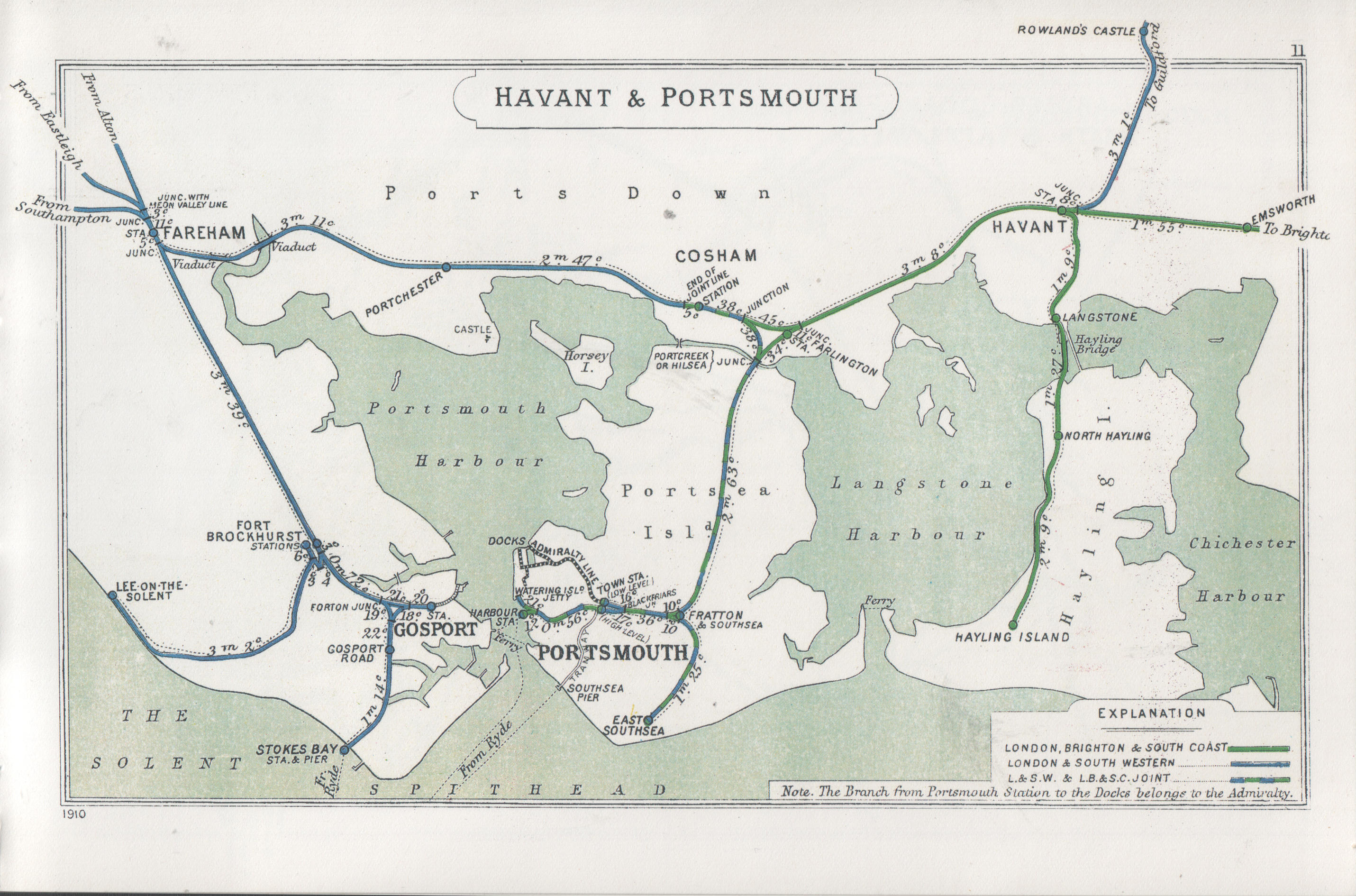
North Hayling station was a halt[2] on the single track Hayling Island branch, most often used to load oysters caught by local fishermen[3], but also ornithologists and ramblers[4]. The station, along with the line was closed, in 1963[5]. The station was located on the west coast of Hayling Island, very close to the coast[6]. The station was very basic, with a timber concourse and wooden shelter[7]. The station has been demolished and a section of the trackbed is now a footpath.[8].
Preceding station Disused railways Following station Langston Southern Region of British Railways
Hayling Island branch lineHayling Island Notes
- ^ Old Hampshire Gazetteer
- ^ "Hampshire railways remembered" Oppitz,L Newbury, Countryside 1988 ISBN 1853060208
- ^ ”A Guide to Hayling Island branch line” Pierce Jones,V/Walton,R. :Hayling Island, waltondesign,2005 ISBN 200070960X
- ^ "Southern Holiday Lines in Hampshire and the Isle of Wight" Bennett,A: Cheltenham, Runpast 1994 ISBN 187075431X
- ^ "Branch Line to Hayling" Mitchell,V./Smith,K (In association with Bell,A): Midhurst, Middleton Press, 18984 ISBN 0906520126
- ^ "Catching the train to Hayling Island: a history" Newell, L: Havant, Havant Borough Council,2005 ISBN X200076629
- ^ Memories of the Hayling Island Branch:Produced by Ian Heys for "Branch Line Videos", Catalogue Number 418-514424
- ^ “The Hayling Billy Leisure Trail” Marshall,B Havant, Bosmere Hundred Society,1992 ISBN 101922442X
External links
Coordinates: 50°49′13″N 0°59′01″W / 50.82031°N 0.98350°W
Closed railway stations in Hampshire Didcot, Newbury and Southampton Railway Woodhay · Highclere · Burghclere · Litchfield · Whitchurch · Barton Stacey · Sutton Scotney · Worthy Down · King's Worthy · Winchester (Chesil)Basingstoke and Alton Light Railway Meon Valley Railway Sprat and Winkle Line
Fullerton to Hurstbourne LineAndover Town · Clatford · Fullerton Junction · Stockbridge · Horsebridge · Mottisfont · Longparish · WherwellFawley Branch Line Lymington Branch Line Southampton and Dorchester Railway Hayling Island Branch Line Fareham to Gosport Line Lee-on-the-Solent Branch Line Fort Gomer Halt · Browndown Halt · Elmore Halt · Lee-on-the-SolentStokes Bay Line Gosport Road and Alverstone · Stokes BaySouthsea Railway Bordon Light Railway West of England Main Line Salisbury and Dorset Junction Railway Other stations Basingstoke · Bishops Waltham · Denvilles halt · Durley Halt · Farlington Halt · Itchen Abbas · Knowle Halt · Northam · Nursling · Paulsgrove Halt · Southampton Terminus · Weyhill · Woodcroft HaltRingwood, Christchurch and Bournemouth Railway Southampton and Dorchester Railway Categories:- Railway stations opened in 1867
- Railway stations closed in 1963
- Disused railway stations in Hampshire
- South East England railway station stubs
Wikimedia Foundation. 2010.