- Mount Edgcumbe House
-
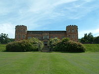

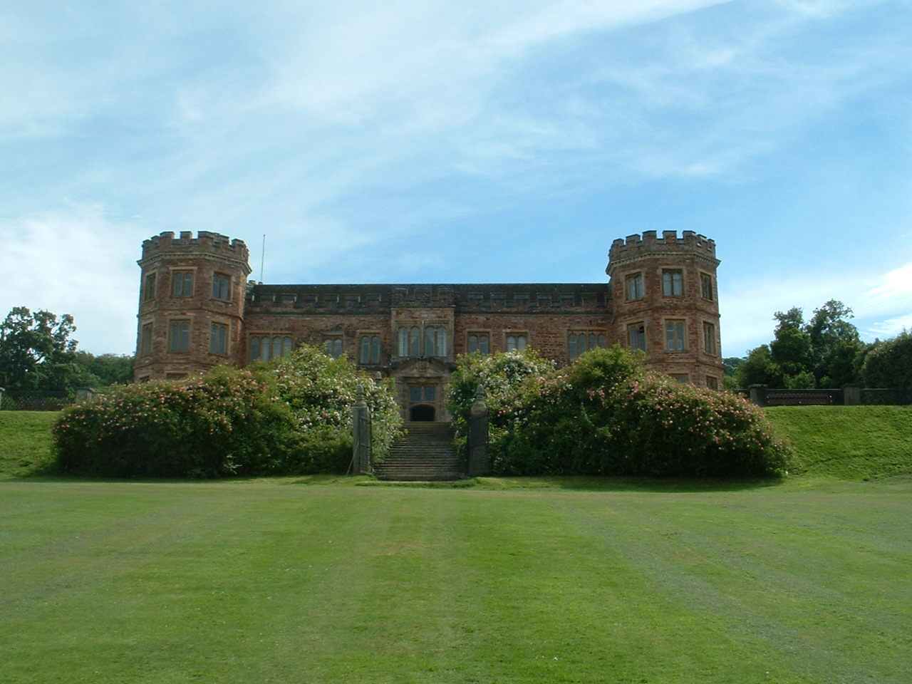
Mount Edgcumbe House is a stately home in south-east Cornwall. It is a Grade II listed building and the gardens are listed as Grade I in the Register of Parks and Gardens of Special Historic Interest in England.
It is situated within Mount Edgcumbe Country Park, in the parish of Maker on the Rame Peninsula, overlooking Plymouth Sound. The main entrance to the park is in the village of Cremyll. The house was formerly the seat of the Earls of Mount Edgcumbe.
The house was built between 1547 and 1553. It was gutted by German bombs in 1943, and restored from 1958 onwards by the 6th Earl. In 1971, the 7th Earl sold the house and park to Cornwall County Council and Plymouth City Council, and it has been open to the public since 1988. Its interiors have been restored to 18th century styles. It is currently run by Ian Berry, the park manager, and Nicholas Butcher, the Head ranger, assisted by Gary Fry and Craig Penwill.
The estate is jointly owned by Cornwall County Council and Plymouth City Council[1] and is one of the region's most popular historic tourist destinations. It is open daily all year round to visitors from 8 am to dusk, and the park houses the National Camellia Collection.
The House and Earl's Garden are only open to visitors during the summer from the beginning of April until the end of September. The country park, on the Rame Peninsula, is the earliest landscaped park in Cornwall and is very popular with walkers. One can walk from the Cremyll Ferry [4] through the estate to the villages of Kingsand and Cawsand.
A classic car show is held annually in the park grounds, hosted by the Friends of Mount Edgcumbe [5], and a variety of other events, which include art classes with Louise Courtnell, theatre performances and a forestry school, are also held there.
Historical features of interest
Barn Pool, a sheltered deep water anchorage used by Vikings in 997. Offshore is the shipwreck Catharina von Flensburg, 1786.
Barrow, c.1200 BC - a Bronze Age burial mound, re-used as a "Prospect Mound" in the 18th century. A prospect mound is an artificial mound, generally conical, placed within a garden or park to provide a viewing point to overlook the garden or park.
Blockhouse, c.1545 - a small fort built on the shoreline during King Henry VIII's reign, to defend the mouth of the Tamar and the Edgcumbe's town of Stonehouse opposite.
Coastguard Station at Rame, originally a Lloyds Signal Station, where signaling was done from passing ships to the station by flags during the day and by lights at night, it became a radio station in 1905, then transferred to the Coastguards c.1925. Now run by Coastwatch.
Cremyll Ferry [6], c.1204 - a major ferry crossing between Devon and Cornwall since Medieval times.[2] The ferry still operates a foot passenger service between Cremyll and Plymouth
The Deer Wall, c.1695 - a stone wall with outer ditch protecting the Amphitheatre from deer, now incomplete.
Folly, c 1747 - an artificial ruin which replaced a navigation obelisk. The folly was built from medieval stone from the churches of St. George and St. Lawrence, Stonehouse.
Formal Gardens, c.1750 to 1820 - Italian, English and French style gardens. More additions to the grounds include recently the New Zealand and American gardens(1989)and Jubilee Gardens (2003).
Maker Church, first mentioned in 1186, enlarged in the 15th century. Maker is the family church of the Edgcumbe family.
Milton's Temple, c1755 - a circular Ionic temple, with a plaque inscribed with lines from the poem Paradise Lost, "overhead up grew, Insuperable heights of loftiest shade....." John Milton, (1608–1674).
The Orangery, situated in the Italian Garden the Orangery is thought to have been built as early as 1760. The building is now a fully licensed restaurant [7].[3]
Stables c.1850 - The stables, dairy, smithy, sawmill and stores, all essential to the running of the estate. (This area, recently developed is now open to visitors).
Deer on Rame Peninsula, In 1515 Sir Piers Edgcumbe was given permission by King Henry VIII to empark deer. Their descendents roam freely on the Peninsula to this day.[4]
References
- English Heritage: Images of England, architectural description of listed building
- Plymouth City Council: Mount Edgcumbe Website
- Visit Cornwall: Images of the house and park
- The Friends of Mount Edgcumbe
- Events taking place at Mount Edgcumbe Country Park
External links
Categories:- Gardens in Cornwall
- Country houses in Cornwall
- Museums in Cornwall
- Historic house museums in Cornwall
- Grade II listed buildings in Cornwall
- Grade I listed garden and park buildings
Wikimedia Foundation. 2010.