- Massamá
-
Massamá — Parish — 
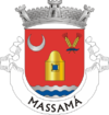
Coat of armsCountry Portugal Municipality Sintra Area – Total 2.78 km2 (1.1 sq mi) Population (2001) – Total 28,176 – Density 10,135.3/km2 (26,250.2/sq mi) Coordinates 38°45′24.36″N 09°16′29.41″W / 38.7567667°N 9.2748361°WCoordinates: 38°45′24.36″N 09°16′29.41″W / 38.7567667°N 9.2748361°W Massamá (Portuguese pronunciation: [mɐsɐˈma]) is a Portuguese parish, located in the municipality of Sintra, and a suburb of Lisbon. Separated from Queluz in 1997, it has an area of 2.78 km² and a population of 28,176 (2001 est.)
The parish consists of three different zones. The old zone is known as the 2nd phase, a newer zone is known as the 6th phase, while the newest zone, Massamá-Norte (North Massamá, also known as 7th phase) is located outside the parish of Massamá, belonging to Belas parish, though it's usually considered as a zone from Massamá, as it is connected to the rest of Massamá. Belas town is actually several kilometers from Massamá Norte.
Although the town already has enough people to be considered a city, it hasn't yet been made one due to political issues and lack of infrastructure such as fire department, police department and cinemas.
Agualva | Algueirão - Mem Martins | Almargem do Bispo | Belas | Cacém | Casal de Cambra | Colares | Massamá | Mira-Sintra | Monte Abraão | Montelavar
Pêro Pinheiro | Queluz | Rio de Mouro | Santa Maria e São Miguel | São João das Lampas | São Marcos | São Martinho | São Pedro de Penaferrim | Terrugem Categories:
- Parishes of Sintra
- Lisbon geography stubs
Wikimedia Foundation. 2010.
