- Bozkurt (district), Denizli
Infobox Settlement
pushpin_
settlement_type = Town
subdivision_type = Country
subdivision_name = TUR
timezone=EET
utc_offset=+2
map_caption =Location of Bozkurt (district), Denizli within Turkey.
timezone_DST=EEST
utc_offset_DST=+3official_name = Bozkurt
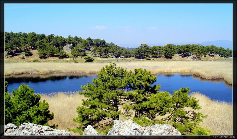
image_caption = One of thecrater lake s in Karagöl near Bozkurt
image_blank_emblem =
blank_emblem_type =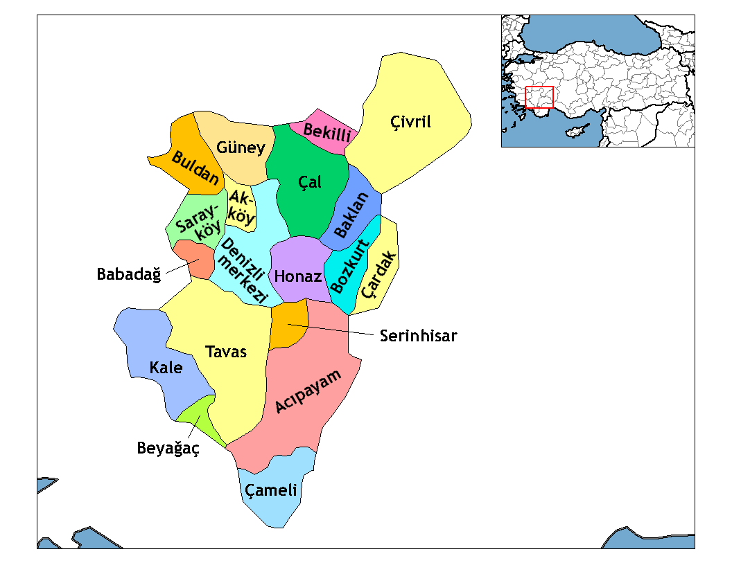
subdivision_type1=Region
subdivision_name1 = Aegean
subdivision_type2=Province
subdivision_name2 = Denizli| population_total = 11708|population_footnotes=
total population| =
population_urban = 7671|population_footnotes=
population_as_of =| 2000
population_footnotes = [http://www.bozkurt.gov.tr]
population_density_km2 =
area_total_km2 =
elevation_m = 867|latd = 37
latm = 82
latNS = N
longd = 29
longm = 61
longEW = E
postal_code_type=Postal code
postal_code = 20x xx
blank_info = 20|blank_name=Licence plate
area_code =
leader_name =
website = [http://www.bozkurt.bel.tr www.bozkurt.bel.tr]
leader_name1 =
gwebsite = [http://www.bozkurt.gov.tr www.bozkurt.gov.tr]Bozkurt is a town and a rural district of
Denizli Province in the Aegean Region ofTurkey . The town is situated on a plain convert|52|km|mi|0|abbr=on east of the city ofDenizli . The altitude of the town is 866.8 m, and the district area is around convert|400|km2|sqmi|-1|abbr=on. The population (2000 census) is 11,708 of which 7,671 live in the small town of Bozkurt itself (with the remainder in surrounding countryside). It is quite close to theLake Acıgöl and the neighboring town ofÇardak .This is high country inland from the Aegean and
Mediterranean , and has hot, dry summers and cold, wet winters.During the
Russo-Turkish War (1877–1878) refugees fromBulgaria were settled on the plain, which was then known as Hanabat after aSeljuk Turk ishcaravanserai that stands within the boundaries of the present-day neighboring district of Çardak. Immigration from Bulgaria continued until recent times. This is an agricultural district, with irrigation systems currently being constructed.A notable sight of interest is Karagöl, literally "the black lake". Situated on top of the mountain on the slopes of which the town of Bozkurt is located, Karagöl is at an altitude of 1,250 m. and is area of dense forests centered around several small
crater lake s which are also fed by streams. The lakes are much visited due to the natural beauty of the scenery and for their fish.

Wikimedia Foundation. 2010.