- Kabataş (district), Ordu
Infobox Settlement
settlement_type = Town
subdivision_type = Country
subdivision_name = TUR
timezone=EET
utc_offset=+2
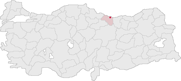
map_caption =Location of Kabataş within Turkey.
timezone_DST=EEST
utc_offset_DST=+3official_name = Kabataş
image_caption =
image_blank_emblem =
blank_emblem_type =
subdivision_type1=Region
subdivision_name1 = Black Sea
subdivision_type2=Province
subdivision_name2 = Ordu| population_total = 9800|population_footnotes=
population_as_of =| 2003
population_footnotes =
population_density_km2 =
area_total_km2 =
elevation_m = 701|latd = 40
latm = 45
latNS = N
longd = 37
longm = 27
longEW = E
postal_code_type=Postal code
postal_code = 52
area_code = 0452
blank_info = 52|blank_name=Licence plate
leader_name =
website = [http://www.kabatas.gov.tr/ www.kabatas.gov.tr]Kabataş is a town and district of
Ordu Province in the Black Sea region ofTurkey .Formerly the village of "Karay", Kabataş is in the
Canik Mountains, 40 km inland from theBlack Sea coast. The area was conquered by theAnatolian Turkish Beylik ofHacı Emiroğulları in 1380.External links
* [http://www.kabatas.gov.tr/ District governor's official website] tr icon
* [http://www.kabatas.bel.tr/ District municipality's official website] tr icon
Wikimedia Foundation. 2010.
