- Claro (wapentake)
-
Coordinates: 54°00′58″N 1°21′00″W / 54.016°N 1.350°W
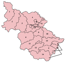
Claro was a wapentake of the West Riding of Yorkshire, England. It was split into two divisions. The Upper Division included the parishes of Farnham, Fewston, Hampsthwaite, Kirkby Malzeard and Pannal and parts of Aldborough, Knaresborough, Otley, Little Ouseburn, Ripley, Ripon and Whixley, many of which formed exclaves. The Lower Division included the parishes of Allerton Mauleverer, Goldsborough, Hunsingore, Kirk Deighton, Kirkby Overblow, Leathley, Spofforth with Stockeld, Weston and parts of Addingham, Aldborough, Harewood, Ilkley, Kirk Hammerton, Otley, Ripley and Whixley.
At he time of the Domesday Book the wapentake was known as Burghshire, named from Aldborough. In the 12th century the name was changed to Claro, from Claro Hill near Coneythorpe, presumably its meeting place.[1]
References
- ^ Smith, A.H. (1961). The Place-names of the West Riding of Yorkshire. 5. Cambridge University Press. p. 1.
Categories:- Ancient subdivisions of Yorkshire
- North Yorkshire geography stubs
- West Yorkshire geography stubs
Wikimedia Foundation. 2010.

