- Mammoth Spring
-
Mammoth Spring River 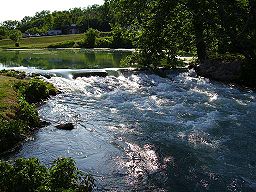 Mammoth Spring outlet pool, near normal conditions. Pictured from the east looking west.
Country United States State Arkansas Region Ozark Plateau City Mammoth Spring Source Spring River watershed Mouth Spring River - location Mammoth Spring, Fulton County, Ozark Plateau, Arkansas - elevation 500 ft (152 m) - coordinates 36°29′51″N 91°32′08″W / 36.4975°N 91.53556°W [1] Length 0.1 mi (0 km) Discharge for Mammoth Spring - average 347 cu ft/s (10 m3/s) 1981-2009[2] - max 694 cu ft/s (20 m3/s) Mammoth Spring is a very large first magnitude spring and is the largest spring in the state of Arkansas and one of the three largest springs within the Ozark Plateau region. It is located in Mammoth Spring State Park, a state park of Arkansas, in the extreme north-central part of the state at the town of Mammoth Spring. The outlet pool of the spring is located a just to the east of U.S. highway 63 and roughly 500 hundred feet south of the Missouri border. Mammoth Spring's large outlet pool can easily be seen by travelers on US 63. The spring's large volume of water rushes a few hundred feet before merging with the Warm Fork of the Spring River to form the Spring River headwaters. The cold water provides excellent trout fishing conditions in addition to ample water for float trips on the Spring River. It was declared a National Natural Landmark in June, 1972.[3]
Contents
Description
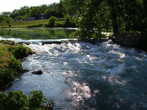
Rainfall in southern Missouri seeps into the water table and flows through a vast system of passages and cavities. These cavities form a main channel and the groundwater reaches the surface at the town of Mammoth Spring, Arkansas. The emerging water forms a 10 acre (40,000 m²) spring pool that drains over a high stone dam. The spring generates a flow of 10 m³/s (344 cubic feet per second). The water emerges at a constant 14 °C (58 °F). The spring itself cannot be viewed at the Mammoth Spring site because its mouth is more than 21 m (70 ft) below the surface of the large spring pool.
Nine miles northwest of Mammoth Spring visitors can see a portion of the underground river that feeds the spring at a collapsed cave at a Missouri State Park called Grand Gulf State Park. The remains of a portion of the cave are now a 40 m (130 ft) deep chasm with a natural bridge over it. Dye tests have proven that the water flowing through the 40 m (130 ft) chasm at Grand Gulf exits through the existing cave and emerges at Mammoth Spring.
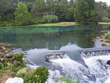 Mammoth Spring as viewed from the south looking north.
Industrial use
The spring was used to power a grist-mill from the times of the earliest settlers. The Mammoth Spring Milling Company constructed a dam and a water-powered grist-mill just below the site. In 1925 the dam was purchased by the Arkansas-Missouri Power Company which constructed a hydroelectric plant at the dam. This plant supplied power to the surrounding area until 1972.
Park
In 1957, Mammoth Spring State Park was established. Surrounding land claims could not be acquired until 1972, however. Prior to 1972, the Mammoth Spring Cattle Sales Barn was co-owned and ran by local entrepreneur Bert Kenneth Bishop and his associate, roughly on the site of where the Welcome Center now stands. Local farmers would routinely come to the site to sell livestock and other wares, such as Howard Green, who sold home-made walking sticks. Following this period in history, the State legislature voted to condemn the land and join the plot to the state park.
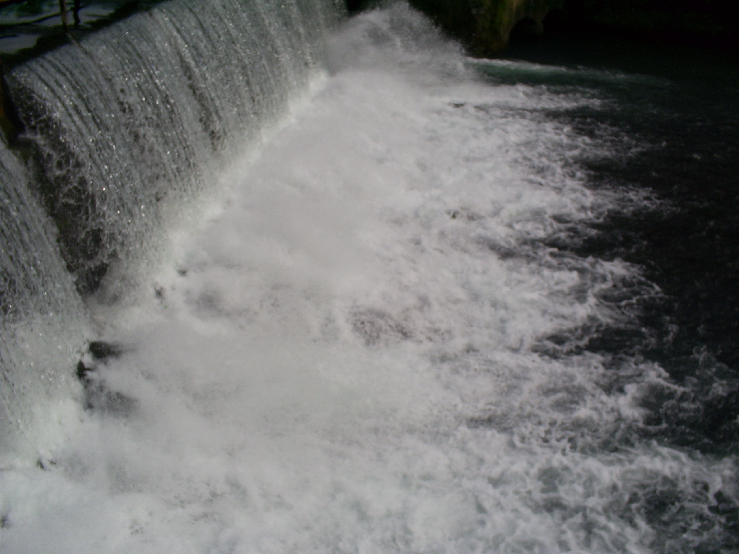
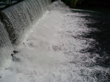 Mammoth Spring dam
The original Frisco Depot was restored in 1971 and now functions as a repository for artifacts and memorabilia related to the railroad and the spring area. The State Park provides a visitor's center, picnic areas, walking trails, and tour access to the dam and hydro plant.
The United States Fish and Wildlife Service maintains a fish hatchery near the spring.
See also
- List of Arkansas state parks
- List of Arkansas rivers
- List of Missouri rivers
- List of Ozark springs
References
- ^ http://nwis.waterdata.usgs.gov/ar/nwis/peak?site_no=07069190&agency_cd=USGS&format=html
- ^ http://waterdata.usgs.gov/nwis/annual?referred_module=sw&site_no=07069190&por_07069190_2=278782,00060,2,1981,2011&start_dt=1981&end_dt=2009&partial_periods=on&year_type=C&format=html_table&date_format=YYYY-MM-DD&rdb_compression=file&submitted_form=parameter_selection_list
- ^ "National Natural Landmark summary". National Park Service. February 5, 2004. http://www.nature.nps.gov/nnl/Registry/USA_Map/States/Arkansas/NNL/MS/index.cfm. Retrieved 2009-05-10.
External links
Categories:- Arkansas state parks
- Protected areas of Fulton County, Arkansas
- Springs of Arkansas
- National Natural Landmarks in Arkansas
- Hydroelectric power plants in Arkansas
- Buildings and structures in Fulton County, Arkansas

Wikimedia Foundation. 2010.