- Ōkawa, Fukuoka
-
Ōkawa
大川市— City — 
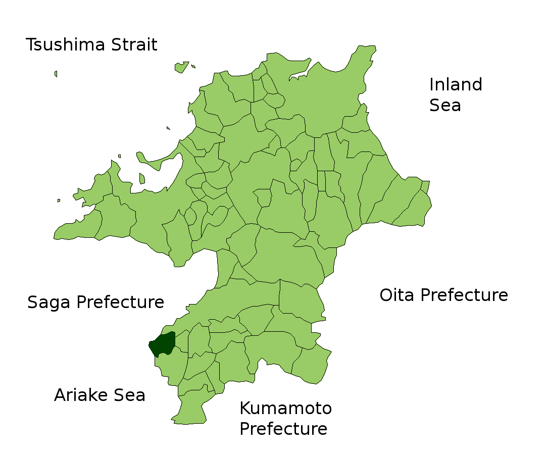
FlagLocation of Ōkawa in Fukuoka Prefecture

 Ōkawa
ŌkawaCoordinates: 33°12′N 130°23′E / 33.2°N 130.383°ECoordinates: 33°12′N 130°23′E / 33.2°N 130.383°E Country Japan Region Kyūshū Prefecture Fukuoka Prefecture Area – Total 33.61 km2 (13 sq mi) Population (October 1, 2007) – Total 38,374 – Density 1,140/km2 (2,952.6/sq mi) Time zone Japan Standard Time (UTC+9) City symbols - Tree Princess tree - Flower Canna lily Phone number 0944-87-2101 Address 256-1 Ōaza Sakami, Ōkawa-shi, Fukuoka-ken
831-8601Website City of Ōkawa Ōkawa (大川市 Ōkawa-shi) is a city located in Fukuoka, Japan.
As of October 1, 2007, the city has an estimated population of 38,374 and the density of 1,140 persons per km². The total area is 33.61 km².
The city was founded on April 1, 1954. The name means 'big river'.
Contents
Geography
Ōkawa is located in southern Fukuoka Prefecture next to the border with Saga Prefecture. The Chikugo River flows from northeast to southwest through the city, which is relatively flat. At the centre of Ōkawa, the Hanamune River flows into the Chikugo River as a tributary.
Neighboring municipalities
Sister cities
External links
 Media related to Ōkawa, Fukuoka at Wikimedia Commons
- Ōkawa official website (Japanese)
 Fukuoka Prefecture
Kitakyūshū Wards - Moji-ku
- Wakamatsu-ku
- Tobata-ku
- Kokurakita-ku
- Kokuraminami-ku
- Yahatahigashi-ku
- Yahatanishi-ku

Fukuoka (capital city) Wards Cities Districts See also: Towns and villages by district
This Fukuoka Prefecture location article is a stub. You can help Wikipedia by expanding it.