- River Adur
The Adur is a
river inSussex ,England . The Adur district ofWest Sussex is named after it. The river used to be navigable for large vessels up to the town ofSteyning , where a large port used to be situated. However over time the river silted up its valley and the port moved to the deeper waters nearer the mouth inShoreham-by-Sea .Watercourse
The Adur begins as two separate branches, the western Adur and the eastern Adur, which meet just west of
Henfield .The western Adur rises at
Slinfold from where it flows aroundCoolham and then through Shipley, where it meets Lancing Brook and flows on toWest Grinstead andKnepp Castle . The western Adur is tidal as far north as Bines Bridge nearBines Green , south of West Grinstead.The eastern Adur rises at Ditchling Common, in
East Sussex , from where it crosses into West Sussex and meets another major stream atTwineham . AtShermanbury , the eastern Adur is fed by the Cowfold Stream.From west of Henfield, the two branches of the river meet, before flowing between
Upper Beeding andBramber , pastCoombes , through a gap in theSouth Downs nearLancing College where the Adur is fed by the Ladywell Stream. The river continues on to theEnglish Channel atShoreham-by-Sea . The mouth of the Adur is now two miles (3km) from the town centre of Shoreham due tolongshore drift .Etymology
The word "Adur" is believed to derive from the Celtic (Welsh) word for water, "dwyr" [http://www.adur.gov.uk/your-environment/river-adur.htm] . The river shares the root of its name (
dur- ) with several other rivers aroundEurope .History
From Norman times the county of Sussex was divided into sub-divisions known as "
rapes ". Each rape was typically centred on a river and river port and was guarded by a castle. Bramber rape was centred on the port of Bramber and the river Adur, with Bramber Castle located close to the river. At various times in the medieval period, Bramber, Steyning and New Shoreham were all major ports on the river. [http://www.british-history.ac.uk/report.aspx?compid=18212] The western Adur also flows close toKnepp Castle , near Shipley. [http://www.knepp.co.uk/]Geobox River
name = Adur
native_name =
other_name = Beeding River, Bramber Water, Sore - all archaically
other_name1 =
map_size =
map_caption =
country = England
country1 =
region = Sussex
region1 =
city =
city1 =
length =
length_imperial =
watershed =
watershed_imperial =
discharge_location =
discharge_average =
discharge_average_imperial =
discharge_max_date =
discharge_max =
discharge_max_imperial =
discharge_min_date =
discharge_min =
discharge_min_imperial =
discharge1_location =
discharge1_average =
discharge1_average_imperial =
source_name = Western Adur
source_location =Slinfold
source_region =
source_country =
source_country1 =
source_lat_d =
source_lat_m =
source_lat_s =
source_lat_NS =
source_long_d =
source_long_m =
source_long_s =
source_long_EW =
source_elevation =
source_elevation_imperial =
source_length =
source_length_imperial =
source1_name = Eastern Adur
source1_location = Ditchling Common
source_meet =Twineham
mouth_name =English Channel
mouth_location =Shoreham-by-Sea
mouth_country =
mouth_region =
mouth_country1 =
mouth_elevation =
mouth_elevation_imperial =
mouth_lat_d =
mouth_lat_m =
mouth_lat_s =
mouth_lat_NS =
mouth_long_d =
mouth_long_m =
mouth_long_s =
mouth_long_EW =
tributary_left = Lancing Brook (near Shipley)
tributary_left1 = Ladywell Stream
tributary_right = Cowfold Stream
tributary_right1 =
image_size =
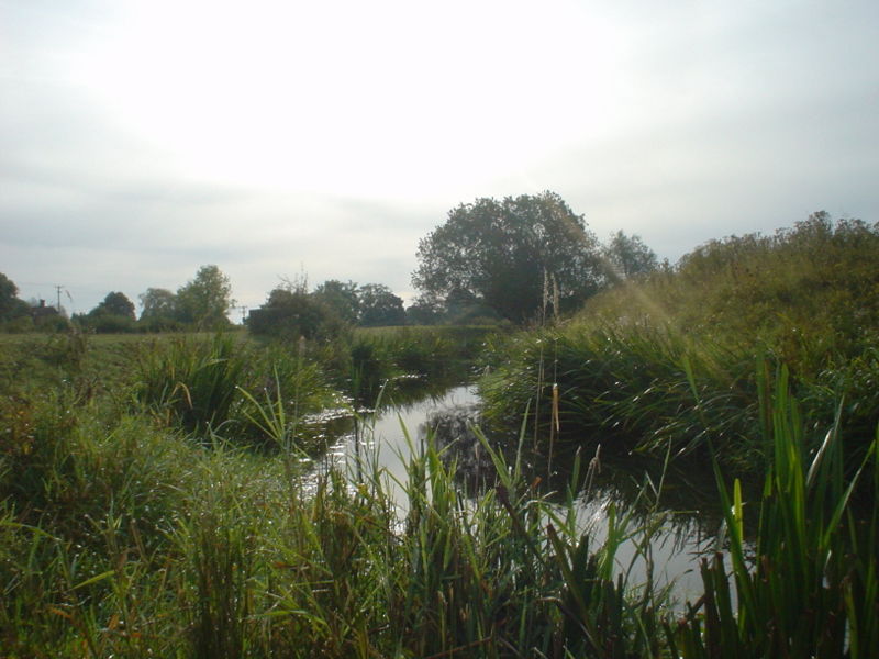
image_caption = The Adur, downstream from Wineham Bridgeettlements
*
Slinfold
* Shipley
*West Grinstead
*Ditchling
*Twineham
*Wineham
*Shermanbury
*Bramber
*Upper Beeding
*Coombes
*Shoreham-by-Sea ee also
*
Rivers of the United Kingdom
*Shoreham-by-Sea External links
* [http://www.adur.gov.uk/your-environment/river-adur.htm Adur District Council - The River Adur]
* [http://www.adur.org.uk/ Guide to Adur River and District]
* [http://www.environment-agency.gov.uk/subjects/flood/floodwarning/F3F4 Environment Agency flood warnings about river Adur]
* [http://www.glaucus.org.uk/Adur.htm River Adur Guide]
* [http://www.glaucus.org.uk/Adur2005.html Adur Valley Nature Notes (including Shoreham-by-Sea)]
* [http://www.waterscape.com/canals-and-rivers/river-adur River Adur Information]
* [http://www.sussex-adur.org.uk/index.php/river-adur/ River Adur Conservation Society]
Wikimedia Foundation. 2010.