- Wittenham Clumps
-
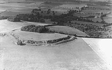 Wittenham Camp in 1939, photograph by Major George Allen (1891–1940).
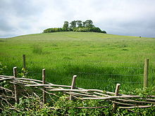 Round Hill from the south at Wittenham Clumps.
Wittenham Clumps is the commonly used name for a set of small hills in the flat Thames Valley, in the civil parish of Little Wittenham in the English county of Oxfordshire.
They are mostly grassed, but are wooded at the top with ancient Beech trees (planted in the 1740s), giving them a distinctive and prominent appearance. However, many of these have died or are dying. The area is a popular beauty spot, with a car park and paths for access by foot. It is maintained as a Nature Reserve by the Northmoor Trust.
Contents
Toponomy
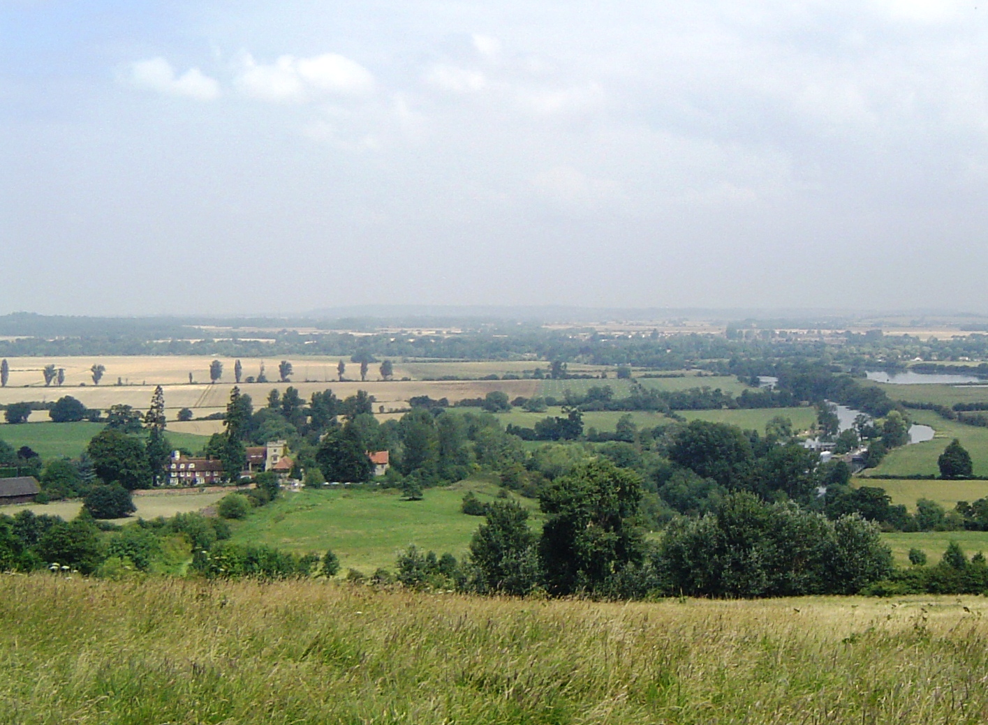
 View from Round Hill. Day's Lock and the River Thames curving along the tree line to the left
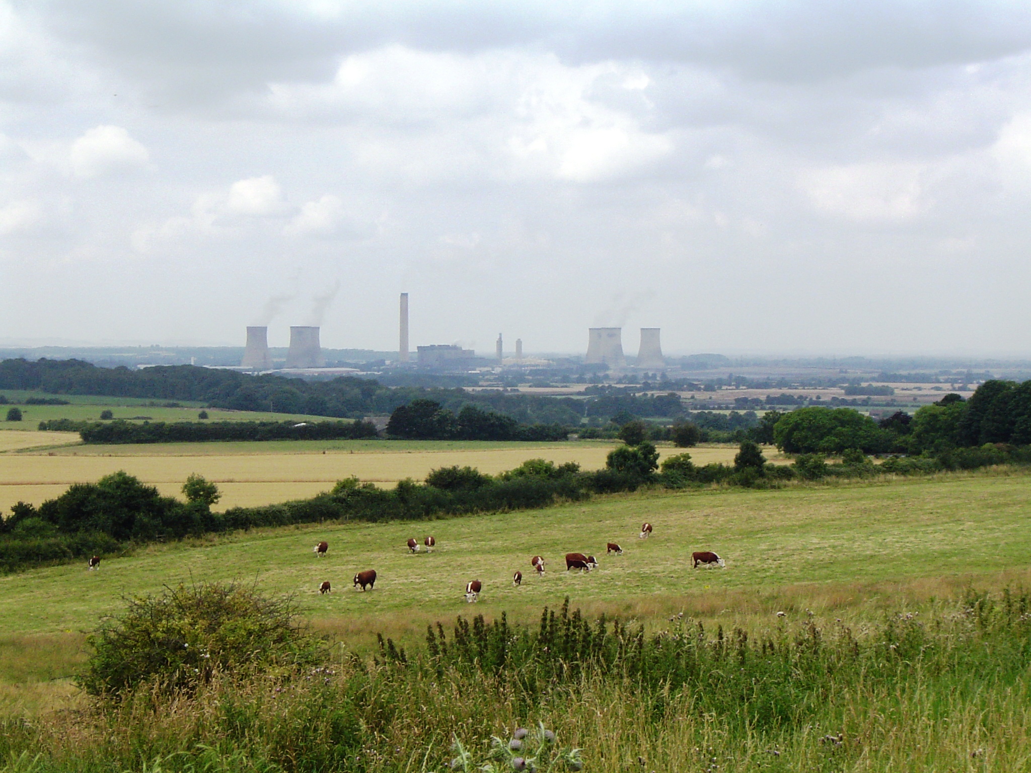
 Didcot Power Station "blending into the landscape" - viewed from Wittenham Clumps
Strictly speaking, the name Wittenham Clumps, or simply The Clumps, refers to the wooded summits of these hills, which are themselves more properly referred to as the Sinodun Hills. According to the Royal Berkshire History website, the name Sinodun derives from Celtic, Seno-Dunum, meaning 'Old Fort'. Alternatively, it has been suggested that the name is a scholarly creation, punning on the latin 'sinus' (bosom)[1]. Other lesser-used and more colloquial names for the Clumps include the Berkshire Bubs (since the Clumps were formerly in the county of Berkshire - the boundary was redrawn in 1974) and Mother Dunch's Buttocks (after a local Lady of the Manor named Dunch). The two main hills are called Castle Hill and Round Hill. A path through the wooded area at the top of Round Hill now enables access since 2005, after being closed for twenty years.
Location
Wittenham Clumps are located at grid reference SU569925, close to the River Thames and good views can be had from the Thames Path along the river. The panoramic views of the Oxfordshire countryside from the clumps themselves are also spectacular. Day's Lock and Dorchester Abbey are clearly visible in the valley to the north. The cooling towers of Didcot Power Station dominate the skyline to the west. To the north-east is Little Wittenham Wood, which borders the Thames, and to the south-east is Brightwell Barrow. The wooded area at the top of Castle Hill, which contains a public footpath, is now closed indefinitely due to the danger of falling trees.
Archaeology
There is a hillfort on Castle Hill. The earliest earthworks date to the late Bronze Age. More banks and ditches were added during the early Iron Age. Excavation has revealed that the Iron Age inhabitants caught fish and wild boar as well as herding cattle and sheep. There is also evidence of farming of barley and wheat. The fort appears to have been abandoned by the late Iron Age, the next occupants being Romans. An episode of Channel 4 programme 'Time Team' focused on the clumps in 2004.[2] In 2004 Castle Hill was under excavation by Oxford Archaeology, and the 'Time Team' were charged with investigating the surrounding landscape to see if it they could find any trace of activity that could be associated with the Clumps.
A total of seven hectares was surveyed using ground penetrating radar over the three days. The results highlighted a mass of underlying archaeology, including enclosure ditches, pits, possible buildings and other clusters of anomalies. The geophysics highlighted a large rectilinear enclosure which was subsequently singled out for excavation. This revealed the remains of a Romano-British house with tesserae (mosaic) floors and painted wall plaster. The area also contained an Iron-Age cobbled floor, together with post holes that could have related to a structure.
Further investigations found Iron-Age rubbish pits distributed all over the valley, suggesting widespread settlement throughout the period. Pottery finds indicated that most activity took place in the earlier and later phases of the period, with a quieter occupation phase in the middle. The geophysics surveys also uncovered more suspected Iron-Age enclosures and also what appeared to be a Roman road, which would have been associated with the site.
Poetry
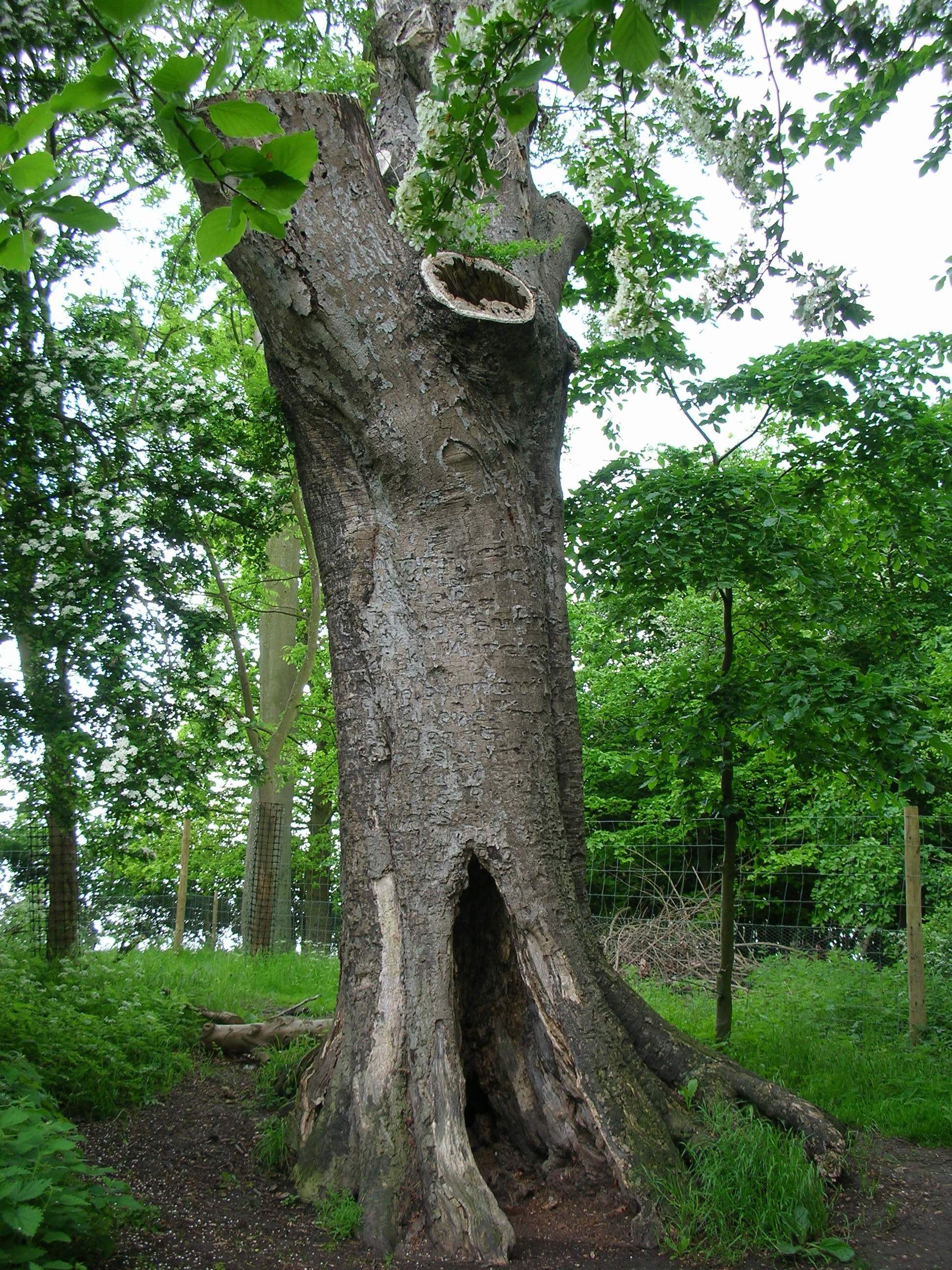
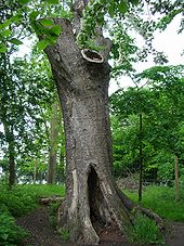 The Poem Tree, Castle Hill.Main article: The Poem Tree
The eastern side of Castle Hill is the location of the Victorian 'Poem Tree',[3] a beech tree with a poem carved into it by Joseph Tubb of Warborough Green in 1844–45.[4] There is now a stone commemorating the 150th anniversary of the carving.
Wittenham Clumps is said to be where Matthew Prior wrote Henry and Emma,[5] and this is commemorated by a plaque.
Art and music
Wittenham Clumps were repeatedly painted by the 20th century British artist Paul Nash.[6][7][8][9][10]
The Clumps was the filming location for the Radiohead webcast video of the band's song "Faust Arp".[11][12]
References
- ^ Coates, R. (2000), The Sinodun Hills, Little Wittenham, Berkshire, Journal of the English Place Name Society, vol. 32, pgs 23-25
- ^ "Time Team Wittenham Clumps". http://www.channel4.com/history/microsites/T/timeteam/2004_wit.html. Retrieved 5th February 2011.
- ^ The Poem Tree, Royal Berkshire History, UK.
- ^ Poem Tree, Northmoor Trust.
- ^ Prior, Matthew, 'Henry and Emma.
- ^ "Wittenham Clumps circa 1943–4". Tate Online. Tate Britain, UK. http://www.tate.org.uk/servlet/ViewWork?cgroupid=999999961&workid=10564. Retrieved June 07, 2011.
- ^ "Landscape of the Wittenham Clumps, 1936". Paul Nash. British Council, UK. http://collection.britishcouncil.org/collection/artist/5/18421/object/44883. Retrieved June 07, 2011.
- ^ "Artists and the Landscape: Paul Nash". Arts & Literature. Northmoor Trust, UK. http://www.northmoortrust.co.uk/timescape/research/arts/paul-nash. Retrieved June 07, 2011.
- ^ Baines, Christopher; Dillon, Anna. "Paul Nash and the Wittenham Clumps". The North Wessex Downs Area of Outstanding Natural Beauty, UK. http://www.nashclumps.org/. Retrieved June 07, 2011.
- ^ Landsape of the Moon's Last Phase by Paul Nash, Walker Art Gallery, Liverpool, UK.
- ^ Listen Against, Ladies & Gentlemen & Radiohead Webcast News, UK.
- ^ Raidiohead video, YouTube.
External links
- Northmoor Trust
- Little Wittenham at Royal Berkshire History
- Photograph, Geograph British Isles project
- Project Timescape
- Archaeological dig, Time Team, Channel 4
Categories:- Forests and woodlands of England
- Hill forts in Berkshire
- Hills of Oxfordshire
- Geography of the River Thames
- Nature reserves in Oxfordshire


Wikimedia Foundation. 2010.