- Niono
-
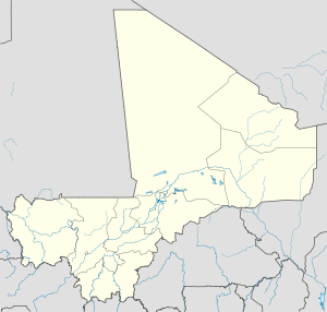
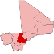
Niono — Commune and town — A woman walks down a side street in Niono, during the dry season, January 2003. Location within Mali Coordinates: 14°15′00″N 6°00′00″W / 14.25°N 6°W Country  Mali
MaliRegion Segou Cercle Niono Cercle Elevation 263 m (866 ft) Population (2004)[1] – Total 4,900 estimate Time zone GMT (UTC+0) Niono is a town and commune located in the Ségou Region of Mali. It is the seat of the Niono Cercle. As of 2004 there are approximately 50,000 inhabitants in the commune, while the town itself measures some 4,900 people.[2] The town is the capital of Niono Cercle, one of six subdivisions (Cercles) of Segou Region. It is located on the northwest edge of the Inner Niger Delta, near the main channel of the Niger river.
Contents
Settlement
While Niono existed as a town and important desert side salt and gold trade center from at least the time of the Mali Empire in the 12th century, much of the current city was built as a result of a large drainage and development project begun in the colonial period.[3]
Designed during the last decade of French rule as part of the Office du Niger project, and continued after independence by the Malian state, areas around the city center and far into the countryside are surrounded by a complex series of irrigation canals, which link to the nearby Niger River. The town and surrounding agricultural areas were part of a large scape project to drain swamps, divert water, and provide irrigation along the edges of the Inner Niger Delta, a huge area of seasonal lakes and wetlands in central Mali. The city's main industry is agriculture, because rice farmers utilize the adjacent canals for their water[4].
Architecture
The Great Mosque of Niono is perhaps the most internationally recognized site in the town having received the Aga Khan Award for Architecture in 1983[5]. Also notable are the canals themselves, leading some locals to refer to their city as the "Venice of Africa".
Development projects
Currently, there are at least two major humanitarian projects to ameliorate the lives of people in Niono and the outlying areas. Led by American and Malian Rotary Clubs and Engineers Without Borders (USA) Chapters, the groups surveyed in February 2008 a rainwater drainage. The drainage known as a "collecteur de pluies" in French runs 2 kilometers through the city center. During the rainy season, flooding causes havoc, and during the rest of the year, the drainage becomes a breeding ground for disease. The intent of the project is to construct mechanisms to minimize both flooding and unsanitary stagnant water in the drainage[4].
A second project is being coordinated by the Millenium Challenge Corporation, a United States government corporation. As part of a 5 year, $461 million compact with the Malian government, the corporation will rehabilitate the Niono-Goma Coura Road, which runs from Niono north to Goma Coura. It will also improve Alatona irrigation infrastructure, adjacent to the road[6].
References
- Location and altitude: Falling rain.com.
- Organisations operation in Niono, Mali. African Development Information Services, retrieved 2008-09-19.
- Integrated Disease Surveillance and Response: Mali, United States Centers for Disease Control, Case study on Malian Ministry of Health Integrated Disease Surveillance and Response (IDSR) from 1998, June 2004.
Coordinates: 14°15′N 6°00′W / 14.25°N 6°W Communes and towns of the Ségou Region, MaliCapital: Ségou
Bla Cercle Bla (Bla) · Beguene (Beguene) · Diaramana (Diaramana) · Diena (Diena) · Dougouolo (Dougouolo) · Falo (Falo) · Fani (Fani) · Kazangasso (Kazangasso) · Kemeni (Kemeni) · Korodougou (Nampasso) · Koulandougou (N'Toba) · Niala (Niala) · Samabogo (Samabogo) · Somasso (Somasso) · Tiemena (Tiemena) · Touna (Touna) · Yangasso (Yangasso) ·
Barouéli Cercle Macina Cercle Macina (Ke Macina) · Boky Were (Boky Were) · Folomana (Folomana) · Kokry (Kokry) · Kolongotomo (Kolongotomo) · Matomo (Matomo Marka) · Monimpebougou (Monimpebougou) · Saloba (Saro) · Sane (Saye) · Souleye (Souleye) · Tongue (Tongue) ·
Niono Cercle Ségou Cercle Ségou (Ségou) · Baguindadougou (Markanibougou) · Bellen (Sagala) · Boussin (Boussin) · Cinzana (Cinzana) · Diédougou (Yolo) · Diganibougou (Digani) · Dioro (Dioro) · Diouna (Diouna) · Dougabougou (Dougabougou) · Farako (Farako) · Farakou Massa (Komine) · Fatine (Fatine Marka) · Kamiandougou (Nonongo) · Katiena (Katiena) · Konodimini (Konodimini) · Markala (Diamarabougou) · Massala (Massala) · N'Koumandougou (Doura) · N'Gara (N'Gara) · Pelengana (Pelengana) · Sakoiba (Sakoiba) · Sama Foulala (Sama Foulala) · Samine (Samine) · Sansanding (Sansanding) · Sebougou (Sebougou) · Sibila (Sibila) · Soignebougou (Soignebougou) · Souba (Souba) · Togou (Togou) ·
San Cercle San (San) · Baramandougou (Baramandougou) · Dah (Dah) · Diakourouna (Diakourouna Nerisso) · Dieli (Dieli Felinso) · Djeguena (Djeguena) · Fion (Fion) · Kaniegue (Dioundiou Konkankan) · Karaba (Karaba) · Kassorola (Nianasso) · Kava (Heremakono) · Moribila (Moribila Kagoua) · N'Torosso (N'Torosso Bolokalasso) · N'Goa (N'Goa) · Niamana (Niamana) · Niasso (Niasso) · Ouolon (Ouolon) · Siadougou (Siella) · Somo (Somo) · Sourountouna (Sourountouna) · Sy (Sy) · Tene (Tene) · Teneni (Teneni) · Tourakolomba (Tourakolomba) · Waki (Waki) ·
Tominian Cercle Categories:- Populated places in the Ségou Region
- Communes of Mali
Wikimedia Foundation. 2010.


