- Monte Pissis
-
Monte Pissis 
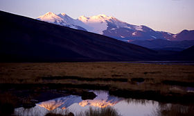
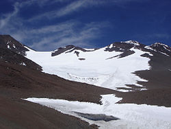
Monte Pissis from the northeastElevation 6,793 m (22,287 ft) Prominence 2,138 m (7,014 ft) Listing Ultra Location Location La Rioja Province, Argentina Range Andes Coordinates 27°45′16.6588″S 68°47′55.8749″W / 27.754627444°S 68.798854139°WCoordinates: 27°45′16.6588″S 68°47′55.8749″W / 27.754627444°S 68.798854139°W Geology Type Stratovolcano Climbing Easiest route Hike Monte Pissis is an extinct volcano in La Rioja Province, Argentina. The mountain is the third-highest in the Western Hemisphere, and is located about 550 km north of Aconcagua. Monte Pissis is named after Pedro José Amadeo Pissis, a French geologist who worked for the Chilean government. Due to its location in the Atacama Desert, the mountain has very dry conditions but there is an extensive glacier (with crevasses, this is unique in the region) on the North face.
Contents
Elevation dispute
In 1994 it was claimed by Argentine authorities that an advanced GPS survey had determined that the elevation of Monte Pissis was 6,882 m, and higher than Ojos del Salado, but SRTM data and several modern GPS surveys have proved that this widely reproduced and repeated claim is incorrect.[1][2][3]
In 2005, an Austrian performed a precise DGPS survey of Pissis' summit and found the elevation to be 6793m.[4] This was later confirmed by a Chilean-European expedition, which surveyed both Ojos del Salado and Monte Pissis. It has provisionally found the former to be 6,891 m and the latter 6,793 m.[5]
Normal route
The mountain is very high and remote, a long approach is required but the ascent is easy and does not require any specific climbing skill. Nevertheless, good climbing equipment and warms cloths and shoes are required as temperature during the night can drop as -30 degC and wind can be very strong. From the base of the mountains (4,500 m) several days of hike are required. The moutain is usually summitted directly from an high camp at 5,900 m at the hedge of the glacier.
See also
References
External links
Northern Volcanic Zone (6° N–3° S) Central Volcanic Zone (15°–27° S) Southern Volcanic Zone (33°–46° S) Quinchilca · Pirihueico · Chihuío · Mencheca · Mirador · Cerro Pantoja · Tronador · Sierra de SangraNote: volcanoes are ordered by latitude from north to south. Extinct volcanoes are those with 10,000 years without eruption. Categories:- Mountains of Argentina
- Stratovolcanoes
- Volcanoes of Argentina
- Geography of La Rioja Province
- Extinct volcanoes
- Polygenetic volcanoes
Wikimedia Foundation. 2010.

