- Chiquitos Province
-
Chiquitos — Province — 
FlagLocation of the Chiquitos Province within Bolivia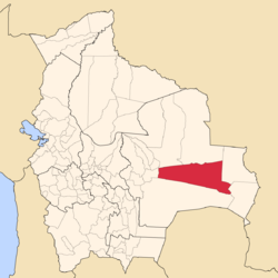 Provinces of the Santa Cruz Department
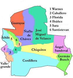
Coordinates: 18°0′S 60°0′W / 18°S 60°W Country  Bolivia
Department Santa Cruz Department Municipalities Cantons 9 Foundation January 23, 1826 Capital San José de Chiquitos Area - Total 12,134.8 sq mi (31,429 km2) Elevation 971 ft (296 m) Population (2001) - Total 59,754 - Density 4.9/sq mi (1.9/km2) Area code(s) BO.SC.CQ Website www.santacruz.gob.bo Chiquitos Province is one of the fifteen provinces of the Bolivian Santa Cruz Department, situated in the center of the department. Its capital is San José de Chiquitos.
The province was created on January 23, 1826, during the presidency of marshal Antonio José de Sucre.
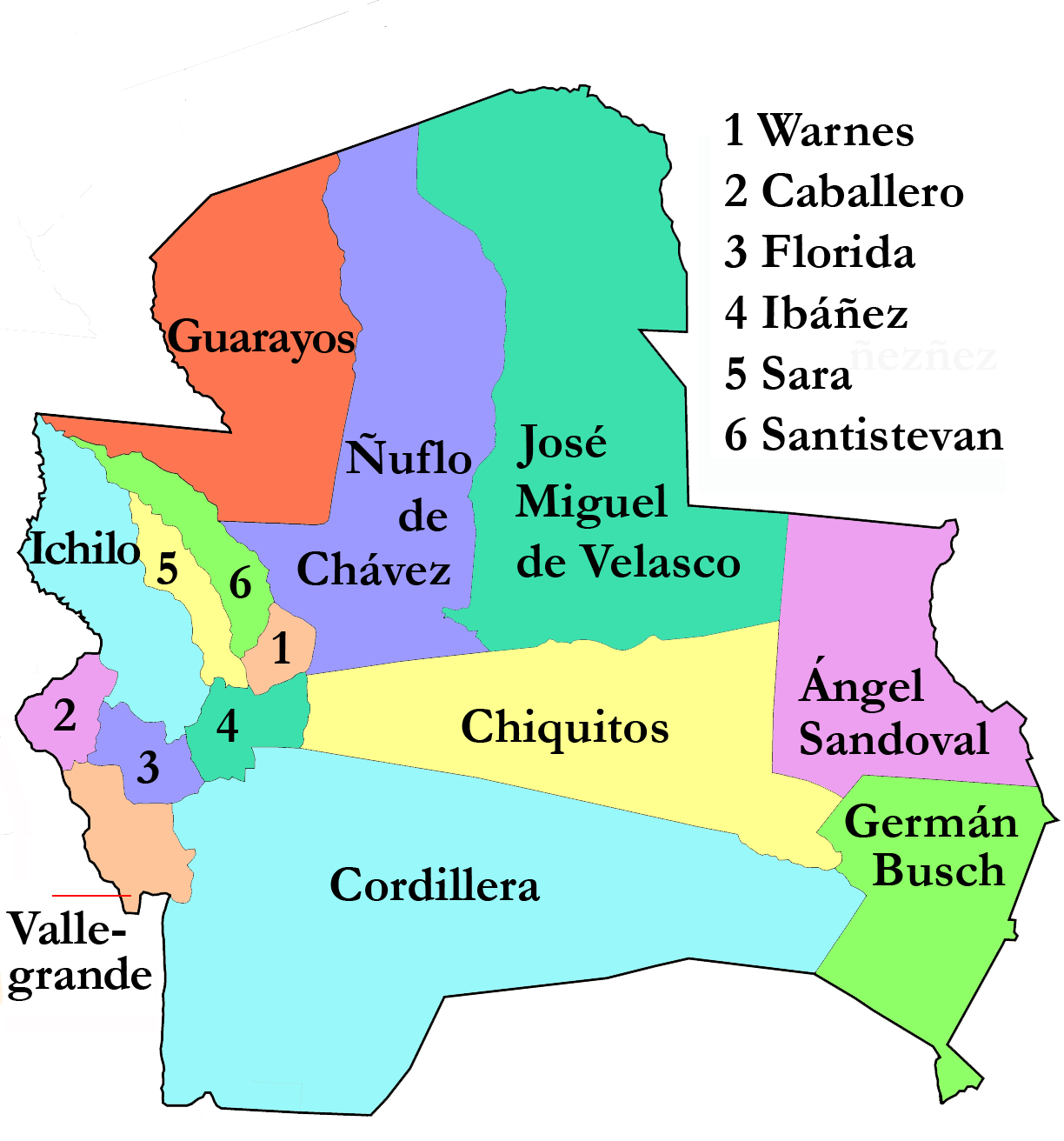
It forms the so called "Gran Chiquitanía" together with José Miguel de Velasco Province, Ñuflo de Chávez Province, Ángel Sandoval Province, and Germán Busch Province.
Contents
Location
Chiquitos Province is located between 17° 00' and 18° 37' South and between 58° 54' and 62° 45' West. It extends over 500 km from West to East, and up to 220 km from North to South.
The province is situated in the Bolivian lowlands and borders Ñuflo de Chávez Province in the northwest, Andrés Ibáñez Province in the west, Cordillera Province in the south, Germán Busch Province in the southeast, Ángel Sandoval Province in the east, and José Miguel de Velasco Province in the north.
Division
Chiquitos Province comprises three municipalities which are further subdivided into cantons.
Section Municipality Seat 1st San José de Chiquitos Municipality San José de Chiquitos 2nd Pailón Municipality Pailón 3rd Roboré Municipality Roboré Population
The population of Chiquitos Province has increased by circa 15 % over the recent five years, from 59,754 inhabitants (2001 census) to 68,445 inhabitants (2005 est.)[1].
Places of interest
- Kaa-Iya del Gran Chaco National Park and Integrated Management Natural Area
- Tucavaca Valley Municipal Reserve
References
External links
- General map of province
- Detailed map of province towns and rivers
- Population data (Spanish)
- Social data (Spanish)
Santa Cruz Department Andrés Ibáñez · Ángel Sandoval · Chiquitos · Cordillera · Florida · Germán Busch · Guarayos · Ichilo · Ignacio Warnes · José Miguel de Velasco · Manuel María Caballero · Ñuflo de Chávez · Obispo Santistevan · Sara · Vallegrande
Categories:


Wikimedia Foundation. 2010.