- Manuel María Caballero Province
-
Manuel María Caballero 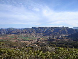
Panoramic view of Comarapa Location in Bolivia 
General Data Capital Comarapa Area 2,310 km²[1] Population 20,562 (2001) Density 8.7 inhabitants/km² (2001) ISO 3166-2 BO.SC.MC Santa Cruz Department 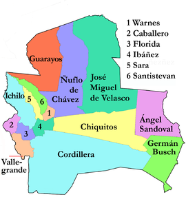
Manuel María Caballero Province is one of the fifteen provinces of the Bolivian Santa Cruz Department and is situated in the department's western parts. The province name honors deputy Manuel María Caballero from Vallegrande, one of the signatories of the Bolivian constitution (Constitución política) of 5 August 1861.
Contents
Location
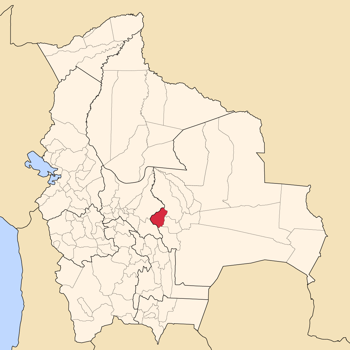
Manuel María Caballero Province is located between 17° 26' and 18° 15' South and between 64° 07' and 64° 50' West. It extends over 90 km from North to South, and 75 km from West to East.
The province is situated on the western edge of the Bolivian lowlands and borders Cochabamba Department in the West, Vallegrande Province in the South, Florida Province in the East, and Ichilo Province in the Northeast.
Population
The population of Manuel María Caballero Province has increased by circa 35 % over the recent two decades:
- 1992: 16,074 inhabitants (census)
- 2001: 20,562 inhabitants (census)
- 2005: 21,517 inhabitants (est.)[2]
- 2010: 22,916 inhabitants (est.)[3]
20.0 % of the population is urban population. (1992)
44.9 % of the population are younger than 15 years old. (1992)
95.4 % of the population speak Spanish, 43.8 % speak Quechua, and 1.6 speak Aymara. (1992)
70.1 % of the population have no access to electricity, 70.8 % have no sanitary facilities. (1992)
90.1 % of the population are Catholics, 8.4 % are Protestants. (1992)
Division
The province comprises two municipios:
- Comarapa Municipality – 14,660 inhabitants (2001)
- Saipina Municipality – 5,350 inhabitants (2001)
References
External links
- General map of province
- Detailed map of province towns and rivers
- Population data (Spanish)
- Social data (Spanish)
Santa Cruz Department Andrés Ibáñez · Ángel Sandoval · Chiquitos · Cordillera · Florida · Germán Busch · Guarayos · Ichilo · Ignacio Warnes · José Miguel de Velasco · Manuel María Caballero · Ñuflo de Chávez · Obispo Santistevan · Sara · Vallegrande
Categories:


Wikimedia Foundation. 2010.