- Mustinka River
-
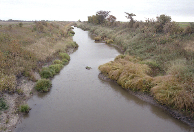
 A straightened and re-routed section of the Mustinka River in Redpath Township of Traverse County
The Mustinka River is a tributary of Lake Traverse, 68 mi (109 km) long,[1] in western Minnesota in the United States. Via Lake Traverse, the Bois de Sioux River, the Red River of the North, Lake Winnipeg, and the Nelson River, it is part of the watershed of Hudson Bay. The river drains an area of 909 square miles (2,350 km2).[2]
Course
The Mustinka River rises about 5 miles (8 km) south-southwest of Fergus Falls in southwestern Otter Tail County and initially flows generally southward into Grant County, passing through Stony Brook Lake and Lightning Lake. The river turns westwardly in southern Grant County and flows past Norcross into Traverse County, where it turns southwestward past Wheaton. It flows into the northern end of Lake Traverse from the west, about 7 miles (11 km) southwest of Wheaton.[3]
Much of the river's lower course has been straightened and channelized.
See also
- List of Minnesota rivers
References
- ^ U.S. Geological Survey. National Hydrography Dataset high-resolution flowline data. The National Map, accessed June 8, 2011
- ^ Waters, Thomas F. (1977). The Streams and Rivers of Minnesota. Minneapolis: University of Minnesota Press. ISBN 0-8166-0960-8.
- ^ DeLorme (1994). Minnesota Atlas & Gazetteer. Yarmouth, Maine: DeLorme. ISBN 0-89933-222-6
Categories:- Rivers of Minnesota
- Geography of Grant County, Minnesota
- Geography of Otter Tail County, Minnesota
- Geography of Traverse County, Minnesota
Wikimedia Foundation. 2010.