- Aniak Airport
-
Aniak Airport 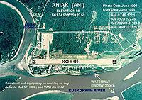
IATA: ANI – ICAO: PANI – FAA LID: ANI Location of airport in Alaska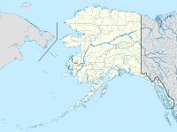
 ANI
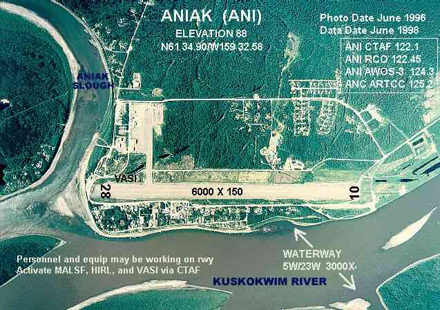
ANISummary Airport type Public Owner State of Alaska DOT&PF - Central Region Location Aniak, Alaska Elevation AMSL 88 ft / 27 m Coordinates 61°34′54″N 159°32′35″W / 61.58167°N 159.54306°W Runways Direction Length Surface ft m 5W/23W 3,000 914 Water 10/28 6,000 1,829 Asphalt Source: Federal Aviation Administration[1] Aniak Airport (IATA: ANI, ICAO: PANI, FAA LID: ANI)[2] is a public-use airport located on the Kuskokwim River in Aniak, a city in the Bethel Census Area of the U.S. state of Alaska. The airport is owned by the state.[1]
Contents
Facilities
Aniak Airport covers 1,722 acres (697 ha) and has one runway and one seaplane landing area:[1]
- Runway 10/28: 6,000 x 150 ft. (1,829 x 46 m), Surface: Asphalt
- Runway 5W/23W: 3,000 x 400 ft. (914 x 122 m), Surface: Water
Airlines and non-stop destinations
Airlines Destinations Era Alaska Anchorage, Chuathbaluk, Holy Cross, Kalskag, Shageluk [3] PenAir Anchorage References
- ^ a b c FAA Airport Master Record for ANI (Form 5010 PDF), effective 2007-03-15
- ^ Great Circle Mapper: ANI / PANI - Aniak, Alaska
- ^ Era Alaska Timetable (PDF). Retrieved April 17, 2011.
External links
- FAA Alaska Airport Diagram (GIF)
- Resources for this airport:
- AirNav airport information for PANI
- ASN accident history for ANI
- FlightAware airport information and live flight tracker for PANI
- NOAA/NWS latest weather observations for PANI
- SkyVector aeronautical chart for ANI
Categories:- Airports in the Bethel Census Area, Alaska
- Alaska airport stubs

Wikimedia Foundation. 2010.