- Kaposvár
Infobox Settlement
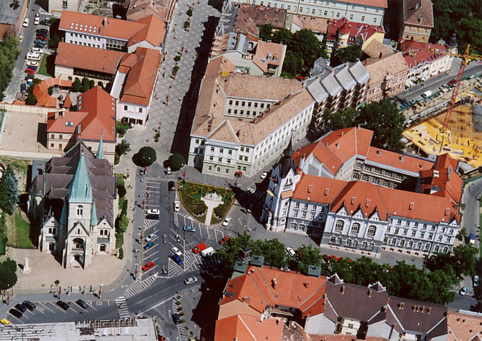
image_caption = Aerial view
image_shield = Kaposvár címere.png
subdivision_name = HUN
timezone=CET
utc_offset=+1
timezone_DST=CEST
utc_offset_DST=+2
map_caption = Location of Kaposvár
official_name=Kaposvár
pushpin_
pushpin_label_position =
pushpin_map_caption =Location of Kaposvár
pushpin_mapsize =_
subdivision_type1=County
subdivision_name1=Somogy
area_total_km2=113.59
population_total=67954
population_footnotes=
population_as_of=2005
population_density_km2=598.23
postal_code_type=Postal code
postal_code=7400
area_code=82
latd=46.36383
longd=17.78225Kaposvár (Croatian: "Kapošvar, Kapuš(ar), Kapušvar", German: "Kopisch, Ruppertsberg, Ruppertsburg", Turkish: "Kapoşvar", Serbian: Капошвар, "Kapošvar") is the
capital of the county ofSomogy inHungary . It lies convert|186|km|mi|0|abbr=on south‐west ofBudapest , straddling theriver Kapos .History
According to legend, the city was founded on seven hills like
Rome . The area had been inhabited already 5000 years BCE. Around 400 BCE Celtic tribes inhabited the area.The city was first mentioned as Kapos in the founding document of the Episcopate of
Pécs in 1009. The rectangular motte castle was reconstructed as a stone castle in the 15th century. The castle was destroyed in 1702 at the order ofLeopold I, Holy Roman Emperor .The Ottomans occupied the city after a five-day siege in 1555. It was freed from Ottoman rule in 1686.
In 1749 Kaposvár became the county seat. During the 1800s the city developed considerably, due to the importance of the
railway line between Budapest andZagreb . Kaposvár became an importantindustrial city .In 1950 the village of
Kaposszentjakab was annexed to the city; followed in 1973 byKaposfüred ,Toponár andTöröcske .In 1990 Kaposvár, as a city above 50,000 inhabitants, was elevated to the rank of city with county rights. Since 1993 it has been an episcopal seat. The
University of Kaposvár was founded on1 January 2000 .Geography
The town is enclosed by the gentle knolls of the subregion called Outer
Somogy from the north and by the bluff downhill forests of the other subregionZselic from the south. Kaposvár has already been an important intersection of several traffic roads before the regulation of theRiver Kapos , thus being the base for any kind of development for town and its citizens.Nowadays Kaposvár is a developing junction for rail- and public roads, having a tight connection to all the settlements of the agglomeration, as well as to further, over knoll ones. The European railway line from
Budapest towards theMediterranean leads through Kaposvár and other towns of the county.Tourist sights
*
Kaposvár Town Hall
*Rippl-Rónai Museum
*Csiky Gergely Theatre
*Dorottya house (18th century)
*Vaszary Gallery (former "Gallery of Somogy")
* St. Donat Chapel (Baroque , early 18th century)
* Ruins ofBenedictine Monastery of Kaposszentjakab (Romanesque and Gothic)
*Golden Lion Pharmacy
* Former nunneryTwin towns and partner towns
External links
* [http://www.kaposvar.hu/ Official website]
* [http://www.igm.hu/kaposvar/ History of the city] (Hungarian)
* [http://www.civertan.hu/legifoto/legifoto.php?page_level=278 Aerial photography: Kaposvár]
* [http://www.youtube.com/watch?v=qh4f3L_NCqc Kaposvár slide show with music]

Wikimedia Foundation. 2010.