- Millswood, South Australia
-
Millswood
Adelaide, South Australia
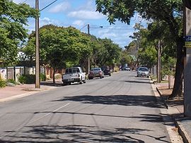
Millswood Crescent, looking towards the south-westPopulation: 2,079 (2006 Census)[1]
1,843 (2001 Census)[2]Postcode: 5034 LGA: City of Unley Millswood is an inner-southern suburb of Adelaide in the City of Unley. It is dissected by Goodwood Road, which travels north to the Adelaide central business district from the southern suburb of Pasadena. Millswood also had its own railway station along the Goodwood-Belair line, but this was closed in 1995. Goodwood Road passes under the railway line in a deep underpass which may flood during heavy rain.
References
- ^ Australian Bureau of Statistics (25 October 2007). "Millswood (State Suburb)". 2006 Census QuickStats. http://www.censusdata.abs.gov.au/ABSNavigation/prenav/LocationSearch?collection=Census&period=2006&areacode=SSC42056&producttype=QuickStats&breadcrumb=PL&action=401. Retrieved 2008-07-19.
- ^ Australian Bureau of Statistics (9 March 2006). "Millswood (State Suburb)". 2001 Census QuickStats. http://www.censusdata.abs.gov.au/ABSNavigation/prenav/LocationSearch?collection=Census&period=2001&areacode=SSC42031&producttype=QuickStats&breadcrumb=PL&action=401. Retrieved 2010-07-17.
Coordinates: 34°57′22″S 138°35′24″E / 34.956°S 138.590°E
Suburbs of the City of Unley Black Forest · Clarence Park · Everard Park · Forestville · Fullarton · Goodwood · Highgate · Hyde Park · Kings Park · Malvern · Millswood · Myrtle Bank · Parkside · Unley · Unley Park · WayvilleCategories:- Suburbs of Adelaide
- Adelaide geography stubs
Wikimedia Foundation. 2010.

