- Noxubee River
-
Noxubee River 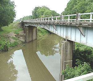
A bridge crossing of the Noxubee River at Macon, MississippiLength 140 mi (225 km) Source elevation 108 ft (32.9 m) 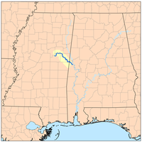
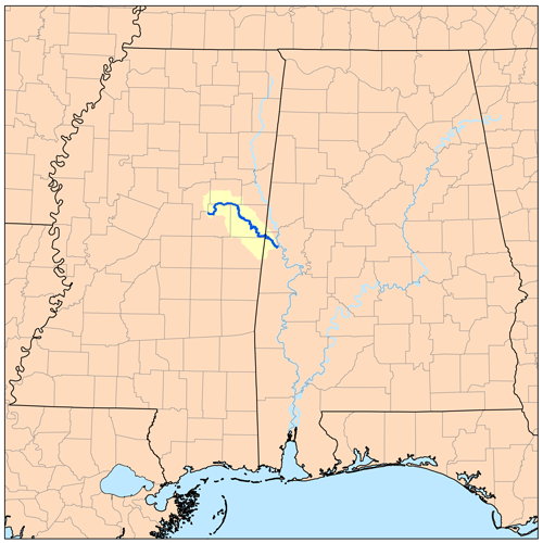
The Noxubee River (NAHKS-uh-bee) is a tributary of the Tombigbee River, about 140 mi (225 km) long, in east-central Mississippi and west-central Alabama in the United States. Via the Tombigbee, it is part of the watershed of the Mobile River, which flows to the Gulf of Mexico.
Contents
Course
The Noxubee rises in Choctaw Lake in the Tombigbee National Forest in Choctaw County, Mississippi, and flows generally southeastwardly through Winston, Oktibbeha and Noxubee Counties in Mississippi, and Sumter County in Alabama, through the Noxubee National Wildlife Refuge and past the town of Macon, Mississippi. It joins the Tombigbee River from the west, about 2 mi (3 km) west of Gainesville, Alabama.
Variant names
According to the Geographic Names Information System, the Noxubee River has also been known as:
- Hachcha Osi River
- Hatch Oose River
- Hatcha River
- Hatchaoose River
- Hatche Oose River
- Hatchoose River
- Nooksabba River
- Noxaby Creek
- Noxiby River
- Noxshubby River
- Noxube River
- Noxuby Creek
- Oaknoxaby River
- Oaknoxubee River
- Ohanexubee River
- Oka Noxubee
- Oka Onoxubba River
- Okanoxubee River
- Okenoxubbee River
- Okenoxubee River
- Olamoyubee River
- Ruisseau Nachebe Tchitou River
See also
- List of Alabama rivers
- List of Mississippi rivers
External links
References
- Columbia Gazetteer of North America entry
- DeLorme (1998). Alabama Atlas & Gazetteer. Yarmouth, Maine: DeLorme. ISBN 0-89933-274-9.
- DeLorme (1998). Mississippi Atlas & Gazetteer. Yarmouth, Maine: DeLorme. ISBN 0-89933-346-X.
- U.S. Geological Survey Geographic Names Information System: Noxubee River
Coordinates: 32°50′0″N 88°10′20″W / 32.833333°N 88.17222°W
Categories:- Rivers of Alabama
- Rivers of Mississippi
- Geography of Choctaw County, Mississippi
- Geography of Sumter County, Alabama
- Geography of Noxubee County, Mississippi
- Geography of Oktibbeha County, Mississippi
- Geography of Winston County, Mississippi
- Place names in Alabama of Native American origin

Wikimedia Foundation. 2010.