- Headwaters Forest
Infobox_protected_area | name = Headwaters Forest Reserve
iucn_category = Ia
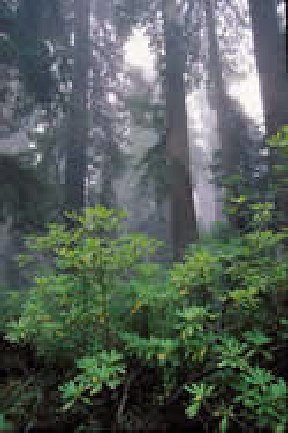 |thumb|288px|right|Headwaters Forest in northern California.
caption =
locator_x =
locator_y =
location =Eureka, California , USA
nearest_city =Eureka, California
lat_degrees =
lat_minutes =
lat_seconds =
lat_direction =
long_degrees =
long_minutes =
long_seconds =
long_direction =
area = 7,472 acres
established =March 1999
visitation_num = 8,000
visitation_year =2007 [ [http://www.blm.gov/pgdata/etc/medialib/blm/ca/pdf/pdfs/arcata_pdfs/headwaters_documents.Par.19453.File.dat/FY07ManagersReport.pdf 2007 BLM Managers Report] ]
governing_body =Bureau of Land Management / State of CaliforniaThe Headwaters Forest is a series of
old growth redwood groves measuring about 60,000 acres (240 km²). Located in the northwestern Coast Range region near Humbolt Bay of theU.S. state ofCalifornia , most of it was owned by the now defunctPacific Lumber Company , which was owned byCharles Hurwitz andMaxxam Inc . The Headwaters Forest has been the site of manytree sits and anti-logging demonstrations.Climate is characterized by maritime conditions of cool, wet and foggy winters and cool to warm cloudy summers. Elevations range from 100 feet to over 2,000 feet.
The Reserve
The portion of the forest called the Headwaters Forest Reserve was established in 1999 (H.R. 2107, Title V. Sec.501 [ [http://thomas.loc.gov/cgi-bin/query/F?c105:8:./temp/~mdbsbbPBHM:e220726: Library of Congress, text of H.R. 2107, Title V-PRIORITY LAND ACQUISITIONS, LAND EXCHANGES, AND MAINTENANCE] ] ). The reserve was created after a 15 year effort to save the ancient ecosystem (with some trees estimated at over two thousand years old), from being
clearcut . Almost 60 per cent of what is now the Reserve was harvested by mostly clearcutting with over 35 miles of road construction and over a hundred stream crossings which greatly degraded watershed ability to store and filter water runoff. The untouched portion, however, is dense, old-growth forest with pristine watershed conditions. [ [http://www.blm.gov/pgdata/etc/medialib//blm/ca/pdf/pdfs/arcata_pdfs/headwaters_final_eis.Par.0bc03c38.File.pdf/Chapter_3.pdf Environmental Impact Statement, Ch. 3. p.5] ]This reserve of 7,472 acres is public land and is under the stewardship of the US Department of the Interior,
Bureau of Land Management (BLM). Of the total acreage, 3,088 acres are old-growth redwood stands surrounded by 4,384 acres of previously harvested timberlands. [ [http://www.blm.gov/pgdata/etc/medialib/blm/ca/pdf/pdfs/arcata_pdfs/headwaters_documents.Par.19453.File.dat/FY07ManagersReport.pdf] 2007 BLM Manager Report] The reserve is located about 6 miles southeast ofEureka, CA .According to the BLM, "the reserve is set aside to protect and preserve the ecological and wildlife values in the area, particularly the stands of old-growth redwood that provide habitat for the threatened
Marbled Murrelet ,Northern Spotted Owl , native salmon stocks, and other old growth forest dependent species..."As well as the stream systems that provide habitat for the threatenedcoho salmon .Other forest trees in the Reserve include Douglas-fir, tanoak, Sitka spruce, western red ceder, western hemlock and red alder.There are limited distribution ( CNPS list 4) plants in the Reserve including the heart-shaped twayblade and Kellogg's Lily. [ [http://cnps.web.aplus.net/cgi-bin/inv/inventory.cgi/Go?_id=lilium_kelloggii&sort=DEFAULT&search=%20%7bCNPS_LIST%7d%20%3d%7e%20m%2fList%204%2fi%20 CNPS database, Kellogg's lily factsheet.] ]The Headwaters Forest Reserve is one of the few remaining refuges for the endangered seabird the Marbled Murrelet. Marbled Murrelets make their nests on large redwood tree branches between March 25 and September 15. The seabird nesting can be disastrously disrupted by human activity. Visitors are restricted from entering the forest during breeding season, approximately June 25 to August 1 [In 2007 Headwaters Forest Reserve was posted as closed from June 25 to July 20. On July 19 signage was altered to extend the closure to August 1.] .
It is the only forest reserve in the United States and is managed as a
nature reserve of the BLM'sNational Landscape Conservation System .Background
The federal legislation (
Public Law 105-83) authorizing the acquisition of the property resulted from an agreement between Department of the Interior and Pacific Lumber Company in September, 1996. This legislation established a specific boundary with access points, called for joint federal-state acquisition with the BLM the managing agency and the State of California having a conservation easement, and required a managemnt plan for the forest. The California state easement gives the state oversight responsibility to ensure "all human activities with the Headwaters Forest shall be consistent with the stated goals and purposes..." TheCalifornia Department of Fish and Game represent the state's interest. [ [http://www.blm.gov/pgdata/etc/medialib//blm/ca/pdf/pdfs/arcata_pdfs/headwaters_final_eis.Par.0f9598a2.File.pdf/Chapter_1.pdf] Headwaters Final Environmental Impact Statement, Ch.1, p.2]The Agreement
The agreement had two main parts: first, it provided $380 million dollars of public funds for the purchase of the Reserve. Second, it required a Habitat Conservation Plan (HCP) be developed and approved to allow limited logging on the remaining 211,000 acres of Pacific Lumber Company timberland. [http://www.lao.ca.gov/1999/050499_headwaters/050499_headwaters.html An LAO Report, Opportunities and Challenges for the State-The Headwaters Forest] Legislative Analyst Office of the state of California.]
Federal and state legislation
H.R. 2107 was passed by the US Congress on October 1997 which committed the government's share of $250 million of the purchase price.
California provided its share of $130 million in Chapter 615, Statutes of 1998 with a requirement of stricter conditions regarding the Habitat Conservation Plan. Specifically, wider no-cut buffer zones, probitions on logging in certain areas, and a requirement for watershed analysis. Also, Chapter 615 authorized purchase of two additional portions, the Owl Creek, and the Grizzly Creek properties. Lastly, it providedHumbolt County with $12 million as economic assistance.Notes
External links
* [http://www.blm.gov/ca/arcata/headwaters.html Headwaters Forest Reserve]
* [http://www.wilderness.org/WhereWeWork/California/headwaters.cfm Headwaters Forest Reserve National Conservation Area]
* [http://www.headwaterspreserve.org/the-forest.php Bay Area Coalition for Headwaters]
Wikimedia Foundation. 2010.