- Cartwright, New South Wales
Infobox Australian Place | type = suburb
name = Cartwright
city = Sydney
state = nsw
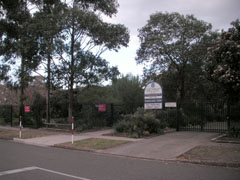
caption = Cartwright Public School
lga = City of Liverpool
postcode = 2168
pop = 2100 (2006)
est = 1972
area =
propval =
stategov = Liverpool
fedgov = Fowler
near-nw = Miller
near-n = Sadleir
near-ne = Ashcroft
near-w = Miller
near-e = Liverpool
near-sw = Prestons
near-s = Prestons
near-se = Lurnea
dist1 = 38
dir1 = south-west
location1= SydneyCartwright is a
suburb in south-westernSydney , in the state ofNew South Wales ,Australia . Cartwright is located 38kilometres south-west of theSydney central business district , in the local government area of the City of Liverpool.Geography
It is bounded by the suburbs of Prestons, Miller, Ashcroft, Sadlier, and Liverpool. Housing in the area is a combination of houses and flats. Cabramatta Creek forms the northern (Ashcroft/Sadlier) and west boundary (Miller), Maxwells Creek the east boundary (Liverpool), and Hoxton Park Rd the south boundary (Prestons). There is an extensive network of shared pathways interconnecting the many cul-de-sacs present in the area. A bridge also links it to Miller, crossing over Cabramatta Creek. Liverpool City BMX Club also has its grounds in Powell Park. There is also McGirr Park in the north-east.
History
Cartwright was officially declared a suburb in 1972 and was developed as part of the Green Valley Housing Estate in the 1960s. It was named after Robert Cartwright who was the reverend of St Luke's church in Liverpool and who received a land grant in the local area. [ "The Book of Sydney Suburbs", Compiled by Frances Pollen, Angus & Robertson Publishers, 1990, Published in Australia ISBN 0-207-14495-8 ]
Education
Cartwright Public school was opened in 1967. Macarthur Community College is also located within the schools grounds. There are some mixed businesses nearby.
Transport
It is served by bus services T80 (Ash stop, not Cartwright), along the dedicated T-Way bus lane, and Busabout bus routes 851, 853, 854, 855. The nearest rail station is Liverpool, on the South Line. The main arterial road is Hoxton Park Road, leading to the Hume Highway in the east, connecting to Cowpasture Rd in the west.
Demographics
According to the 2006 census, Cartwright had a population of 2084. There was a significant housing commission population with 290 of the suburb's 914 dwellings belonging to the Department of Housing. The median household income of $509 per week was half that of the nation as a whole and unemployment at 17.6% was more than three times the national average. The majority of residents were Australian born, with minorities born in
Vietnam (5.9%),Lebanon (2.8%),New Zealand (2.1%) andFiji (1.7%).Census 2006 AUS | id = SSC11195 | name = Cartwright (State Suburb) | quick = on | accessdate = 2008-07-07]References
External links
* http://www.macarthurcc.com.au/s/locations/cartwright_public_school
Wikimedia Foundation. 2010.