- Clermont-l'Hérault
-
Clermont-l'Hérault
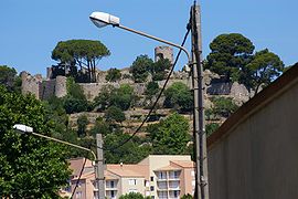
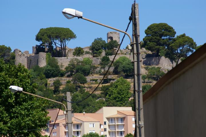
Château des Guilhem 
 Clermont-l'Hérault
Administration Country France Region Languedoc-Roussillon Department Hérault Arrondissement Lodève Canton Clermont-l'Hérault Intercommunality Communauté de communes du Clermontais Mayor Alain Cazorla
(2008–2014)Statistics Elevation 40–322 m (130–1,056 ft)
(avg. 92 m/302 ft)Land area1 32.49 km2 (12.54 sq mi) Population2 8,097 (208) - Density 249 /km2 (640 /sq mi) INSEE/Postal code 34079/ 34800 1 French Land Register data, which excludes lakes, ponds, glaciers > 1 km² (0.386 sq mi or 247 acres) and river estuaries. 2 Population without double counting: residents of multiple communes (e.g., students and military personnel) only counted once. Coordinates: 43°37′41″N 3°25′59″E / 43.6280555556°N 3.43305555556°E
Clermont-l'Hérault is a commune in the Hérault department in southern France.
It lies 30 minutes from Montpellier, 40 km (25 mi) from the sea.
Contents
Sights
The town is built on the slope of a hill ("Pioch Castel") which is crowned by an ancient castle (Château des Guilhem) and skirted by the Rhonel, a tributary of the Lergue. It has an interesting chapel "Les Pénitents"(Penitents) recently restored, built in southern Gothic style. It is now a cultural centre. Also of interest is Saint Paul's church, begun in the 12th century, and finished in the 14th century.
Close by is the large man-made Lac du Salagou.
History
The town was several times taken and retaken in the religious wars of the 16th century.
Twin towns
Clermont-l'Hérault has town partnerships with Patchway (England) and Gauting (Germany).
References
 This article incorporates text from a publication now in the public domain: Chisholm, Hugh, ed (1911). Encyclopædia Britannica (11th ed.). Cambridge University Press.
External link and reference
Categories:- Communes of Hérault
- Hérault geography stubs

Wikimedia Foundation. 2010.