- Gümüşhane
Infobox Settlement
settlement_type =
subdivision_type = Country
subdivision_name = TUR
timezone=EET
utc_offset=+2
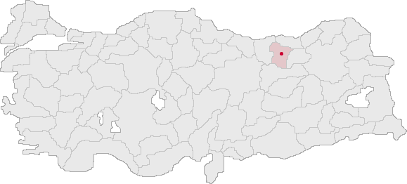
map_caption =Location of Gümüşhane within Turkey.
timezone_DST=EEST
utc_offset_DST=+3official_name = Gümüşhane
image_caption =
image_blank_emblem =
blank_emblem_type =
subdivision_type1=Region
subdivision_name1 = Black Sea
subdivision_type2=Province
subdivision_name2 = Gümüşhane| population_total = 30,270
population_as_of =2000
population_footnotes =
population_density_km2 =
area_total_km2 =
elevation_m =
latd =40
latm =27
latNS =N
longd =39
longm =28
longEW =E
postal_code_type=Postal code
postal_code = 29x xx
area_code =
blank_info = 29|blank_name=Licence plate
leader_name =
website = [http://www.gumushane.bel.tr/ http://www.gumushane.bel.tr/]Gümüşhane is a city in northeastern
Turkey and the seat ofGümüşhane Province . The city lies along the Harsit River, at an elevation of 5,000 feet (1,500 m), about 40 miles (65 km) southwest ofTrabzon . The name literally means "silver town" and is derived from the silver (Turkish gümüş) mines nearby.External links
* [http://www.gumushane.gov.tr Governor's official website]
* [http://www.gumushane.bel.tr Municipality's official website]
Wikimedia Foundation. 2010.
