- Bluestone River
Geobox|River
name = Bluestone River
native_name =
other_name =
other_name1 =
image_size = 300
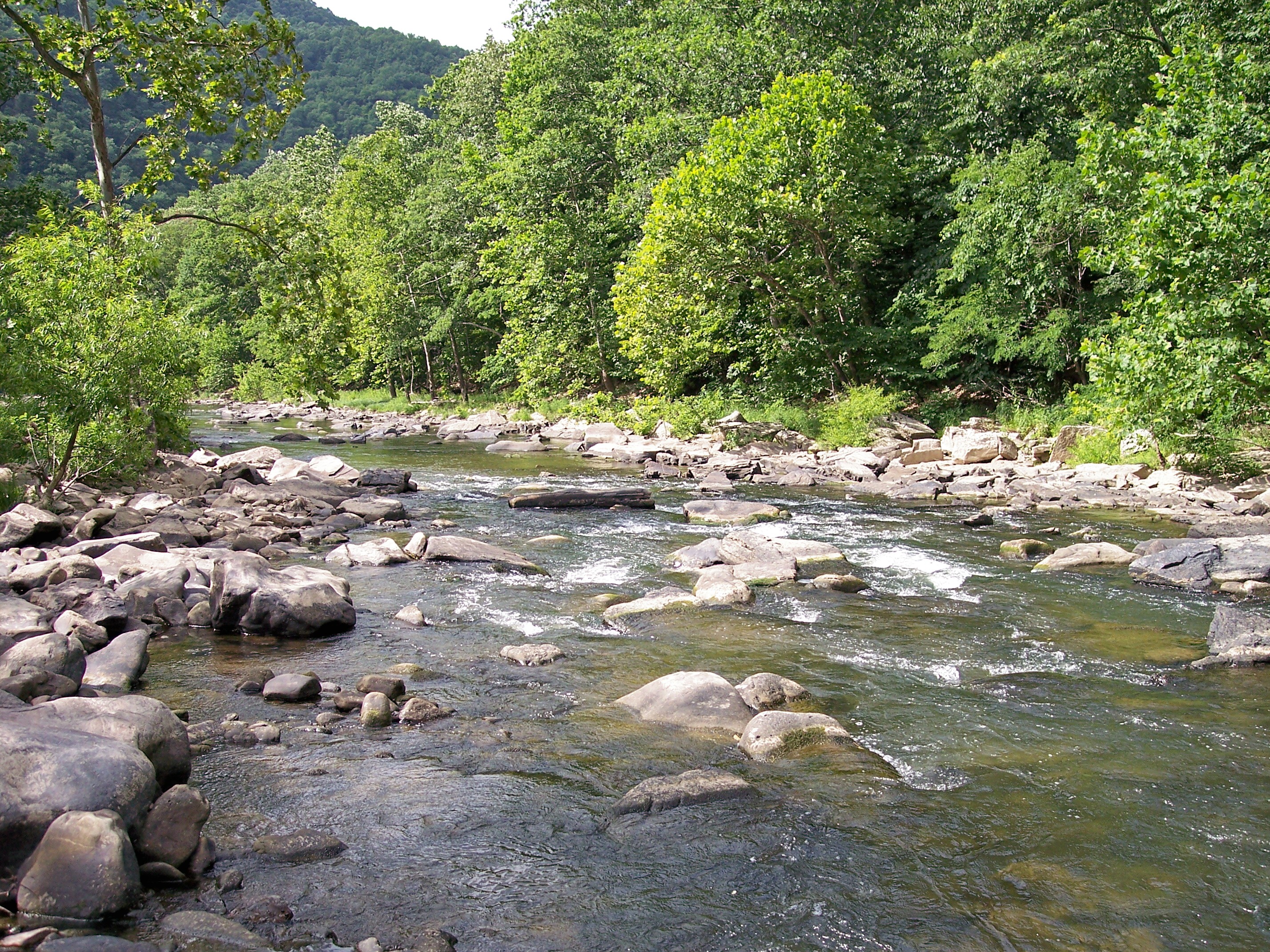
image_caption = Bluestone River inPipestem Resort State Park
country = United States
country_
state = Virginia
state1 = West Virginia
state_
region_type = Counties
region = Tazewell VA
region1 = Mercer WV
region2 = Summers WV
length_imperial = 77
length_note =
watershed_imperial =
watershed_note =
discharge_location = Pipestem,West Virginia
discharge_average_imperial = 741
discharge_max_imperial = 7760
discharge_max_note = (1987)
discharge_min_imperial = 148
discharge_min_note = (1963)
discharge_note = cite web
url = http://waterdata.usgs.gov/nwis/uv?03179000
title = USGS 03179000 BLUESTONE RIVER NEAR PIPESTEM, WV
work = National Water Information System
accessdate = 2008-04-24
publisher =U.S. Geological Survey ]
source_name = East River Mountain
source_location = Tazewell County
source_region =
source_state = Virginia
source_lat_d = 37
source_lat_m = 10
source_lat_s = 19
source_lat_NS = N
source_long_d = 81
source_long_m = 24
source_long_s = 58
source_long_EW = W
source_coordinates_note = cite gnis|1550405|Bluestone River|2004-04-24]
source_elevation_imperial = 3589
source_elevation_note = cite web
url = http://gisdata.usgs.gov/XMLWebServices/TNM_Elevation_Service.asmx/getElevation?X_Value=-81.416111&Y_Value=37.171944&Elevation_Units=FEET&Source_Layer=-1&Elevation_Only=FALSE
title = Bluestone River Source
work = Elevation Query
accessdate = 2008-04-24
publisher =U.S. Geological Survey ]
source_length_imperial =
source1_name =
source1_location =
source1_region =
source1_state =
source1_lat_d =
source1_lat_m =
source1_lat_s =
source1_lat_NS = N
source1_long_d =
source1_long_m =
source1_long_s =
source1_long_EW = W
source1_coordinates_note =
source1_elevation_imperial =
source1_elevation_note =
source1_length_imperial =
source1_note =
source_confluence_location =
source_confluence_region =
source_confluence_state =
source_confluence_lat_d =
source_confluence_lat_m =
source_confluence_lat_s =
source_confluence_lat_NS = N
source_confluence_long_d =
source_confluence_long_m =
source_confluence_long_s =
source_confluence_long_EW = W
source_confluence_coordinates_note =
source_confluence_elevation_imperial =
source1_elevation_confluence_note =
mouth_name = New River inBluestone Lake
mouth_location = Summers County
mouth_district =
mouth_region =
mouth_state = West Virginia
mouth_country =
mouth_lat_d = 37
mouth_lat_m = 36
mouth_lat_s = 44
mouth_lat_NS = N
mouth_long_d = 80
mouth_long_m = 54
mouth_long_s = 52
mouth_long_EW = W
mouth_coordinates_note =
mouth_elevation_imperial = 1424
mouth_elevation_note =
tributary_left = Little Bluestone River
tributary_left1 =
tributary_right = Blacklick Creek
tributary_right1 =
free_name =
free_value =
map_size = 300
map_caption =The Bluestone River is a
tributary of the New River, 77 mi (124 km) long, in southwesternVirginia and southernWest Virginia in theUnited States . [http://www.bartleby.com/69/2/B07602.html Columbia Gazetteer of North America entry] ] Via the New, Kanawha and Ohio Rivers, it is part of the watershed of theMississippi River . An 11 mi (18 km) portion of its lower course is designated as theBluestone National Scenic River . [ [http://www.nps.gov/blue/ Bluestone National Scenic River website] ]Course
The Bluestone rises on East River Mountain in
Tazewell County, Virginia and flows generally northeastwardly through Mercer and Summers Counties in West Virginia, passing the towns of Bluefield in Virginia and Bramwell and Montcalm in West Virginia. [DeLorme (2005). "Virginia Atlas & Gazetteer". Yarmouth, Maine: DeLorme. ISBN 0-89933-326-5]DeLorme (1997). "West Virginia Atlas & Gazetteer". Yarmouth, Maine: DeLorme. ISBN 0-89933-246-3] It joins the New River about 4 mi (6.4 km) south of Hinton as part ofBluestone Lake , which is formed by aU.S. Army Corps of Engineers dam on the New. The Bluestone's National Scenic River segment is located mostly in Summers County, as isPipestem Resort State Park , which lies along agorge formed by the river. [ [http://www.pipestemresort.com/ Pipestem Resort State Park website] ]Little Bluestone River
The Little Bluestone River [Gnis|1542035|Little Bluestone River] is a minor tributary of the Bluestone in Summers County, fewer than 10 mi (15 km) in length from its formation by the confluence of two streams, White Oak Branch and Jumping Branch.
Variant names
According to the
Geographic Names Information System , the Bluestone River has also been known as: [Gnis|1550405|Bluestone River]
*Big Bluestone River
*Blue Stone Creek
*Blue Stone River
*Bluestone Creek
*Mec-ce-ne-ke-ke-ce-pe-we
*Mec-cen-ne-ke-ke
*Mo-mom-ga-sen-eka-ce-peee also
*
List of Virginia rivers
*List of West Virginia rivers
*List of National Wild and Scenic Rivers External links
* [http://www.lrh.usace.army.mil/projects/lakes/bln/ Bluestone Lake website]
* [http://www.bluestonesp.com/ Bluestone State Park website]References

Wikimedia Foundation. 2010.