Rushcutters Bay, New South Wales
- Rushcutters Bay, New South Wales
Infobox Australian Place | type = suburb
name = Rushcutters Bay
city = Sydney
state = nsw
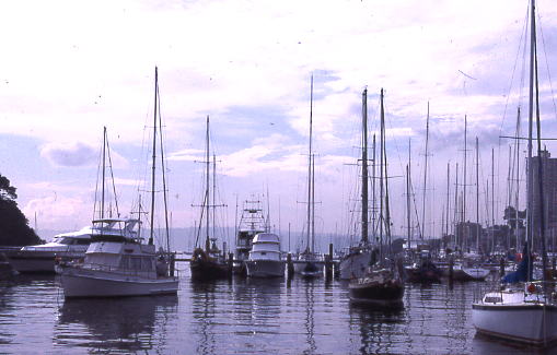
caption = Rushcutters Bay
lga = City of Sydney
postcode = 2011
pop = 2216 (2001 census)
area = 0.2
est =
propval =
stategov = Sydney
fedgov = Wentworth
dist1 = 3
dir1 = east
location1= Sydney CBD
near-nw = Potts Point
near-n = Elizabeth Bay
near-ne = "Port Jackson"
near-w = Potts Point
near-e = Darling Point
near-sw = Darlinghurst
near-s = Paddington
near-se = Edgecliff
Rushcutters Bay is a harbourside eastern suburb of Sydney, in the state of New South Wales, Australia. Rushcutters Bay is located 3 kilometres east of the Sydney central business district, in the local government area of the City of Sydney. [Gregory's Sydney Street Directory, Gregory's Publishing Company, 2007]
The suburb of Rushcutters Bay sits beside the bay it takes its name from, on Sydney Harbour. It is surrounded by the suburbs of Elizabeth Bay, Darlinghurst, Paddington, Darling Point. Kings Cross is a locality on the western border.
History
The area was first known as 'Rush Cutting Bay' because the swampy land was covered in tall rushes, that were used by early settlers for thatching houses. In 1878, convert|6|acre|m2 were reserved for recreation and after reclamation work was completed, Rushcutters Bay Park was created. Rushcutters Bay was once the site of the famous Sydney Stadium. ["The Book of Sydney Suburbs", Frances Pollen, Angus & Robertson Publishers, 1990, Published in Australia ISBN 0-207-14495-8]
On Boxing Day 1908 at the Stadium, Tommy Burns lost his heavyweight title against the legendary Jack Johnson, who was the first African-American to win a world title.
References
External links
Wikimedia Foundation.
2010.
Look at other dictionaries:
Elizabeth Bay, New South Wales — Infobox Australian Place | type = suburb name = Elizabeth Bay city = Sydney state = nsw caption = Elizabeth Bay House lga = City of Sydney postcode = 2011 pop = 4775 (2001 census) area = 0.3 est = propval = stategov = Sydney fedgov = Wentworth… … Wikipedia
Darling Point, New South Wales — Darling Point Sydney, New South Wales Darling Point Population … Wikipedia
Potts Point, New South Wales — Infobox Australian Place | type = suburb name = Potts Point city = Sydney state = nsw caption = View across Potts Point to the Sydney CBD, from St Neot Avenue. lga = City of Sydney postcode = 2011 est = pop = 7,165 area = 0.7 propval =… … Wikipedia
Darling Harbour, New South Wales — Darling Harbour looking towards the east Darling Harbour is a locality of the city centre of Sydney, Australia. It is a large recreational and pedestrian precinct that is situated on western outskirts of the Sydney central business district. The… … Wikipedia
Moore Park, New South Wales — Moore Park Sydney, New South Wales Moore Park, New South Wales Postcode … Wikipedia
Dawes Point, New South Wales — Dawes Point Sydney, New South Wales Sydney Harbour Bridge, viewed from Observatory Hill Population … Wikipedia
Millers Point, New South Wales — Millers Point Sydney, New South Wales Sydney Observatory … Wikipedia
Kings Cross, New South Wales — Infobox Australian Place | type = locality name = Kings Cross city = Sydney state = nsw | caption = El Alamein Fountain lga =City of Sydney near nw = Potts Point near n = Potts Point near ne = Elizabeth Bay near w = Woolloomooloo near e =… … Wikipedia
Edgecliff, New South Wales — Infobox Australian Place | type = suburb name = Edgecliff city = Sydney state = nsw caption = Edgecliff Centre, New South Head Road lga = Municipality of Woollahra postcode = 2027 pop = area = est = propval =… … Wikipedia
Darlinghurst, New South Wales — Darlinghurst Sydney, New South Wales Taylor Square Population … Wikipedia