- Steinfurt (district)
Infobox German district
name=Steinfurt
state=North Rhine-Westphalia
capital=Steinfurt
regierungsbezirk=Münster
area=1,792.097
population=438,765
population_as_of=2002
density=245
carsign=ST
url=http://www.kreis-steinfurt.de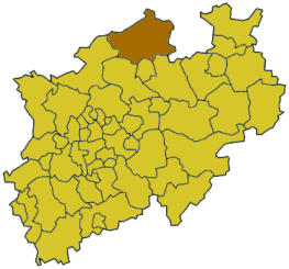
Steinfurt is a "Kreis" (district) in the northern part of
North Rhine-Westphalia ,Germany . Neighboring districts areBentheim ,Emsland , district-freeOsnabrück and the Osnabrück district, Warendorf, district-freeMünster , Coesfeld, Borken.Geography
The district is situated at the Lower Saxon border, north of
Münster . The Ems river runs through the district from south to north. Highest elevation is the "Westerbecker Berg" with 234m, lowest point is the Bentlage castle at 32m.History
In late medieval times Steinfurt became an independent earldom. Originally it was a part of the earldom of
Bentheim , before it became independent in1454 .1804 Steinfurt was reunited with Bentheim, before it became a part of thePrussia nprovince of Westphalia in1815 . The new government in1816 created the districts Steinfurt and Tecklenburg.In
1975 the old district Steinfurt was merged with the district Tecklenburg, and together withGreven andSaerbeck from the former district Münster the current district was formed.Coat of arms
Towns and municipalities
External links
* [http://www.kreis-steinfurt.de Official website] (German)
* [http://www.lwl.org/westfaelische-geschichte/portal/Internet/ku.php?tab=pro&ID=43 Corpus juris of the Principality of Münster / Steinfurt, Anholt, Gemen]
Wikimedia Foundation. 2010.