- Palmas, Tocantins
Infobox City
name = Palmas
settlement_type = Municipality
official_name = The Municipality of Palmas
nickname = "Capital Ecológica" ("Ecological Capital")
motto = "Essa terra é nossa" ("This Land is Ours")
imagesize = 250px
image_caption = Skyline of Palmas at night
image_
mapsize = 250px
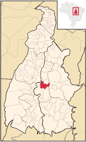
map_caption = Location of Palmas in the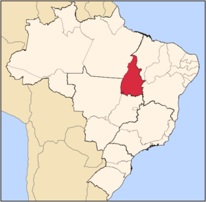
subdivision_type = Country
subdivision_type1 = Region
subdivision_type2 = State
subdivision_name = flag|Brazil
subdivision_name1 = North
subdivision_name2 =
leader_title =Mayor
leader_name = Raul Filho (PT)
leader_title1 =
leader_name1 =
leader_title2 =
leader_name2 =
leader_title3 =
leader_name3 =
established_title = Founded
established_date =May 20 1989
established_title2 =
established_date2 =
established_title3 =
established_date3 =
area_magnitude =
area_total_km2 = 2218.9
area_total_sq_mi =
area_land_km2 =
area_land_sq_mi =
area_water_km2 =
area_water_sq_mi =
area_water_percent =
area_urban_km2 =
area_urban_sq_mi =
area_metro_km2 =
area_metro_sq_mi =
population_as_of =2005
population_note =
population_total = 208,165
population_density_km2 = 93.8
population_density_sq_mi =
population_metro =
population_density_metro_km2 =
population_density_metro_sq_mi =
population_urban =
timezone =
utc_offset =
timezone_DST =
utc_offset_DST =
latd= |latm= |lats= |latNS=
longd= |longm= |longs= |longEW=
elevation_m = 230
elevation_ft =
postal_code_type =
postal_code =
blank_name = HDI (2000)
blank_info = 0.800 – high
website = [http://www.palmas.to.gov.br Palmas, Tocantins]Palmas is the capital of the
Brazilian state of Tocantins. According toIBGE estimates from July 2005, the city had 208,165 inhabitants. It has an area of 2474,95 km².Palmas is located at the state geographic centre. The average altitude is 700 m (2296 ft). The city is located between these
hill s and the river Tocantins. In the east Palmas is bordered by the Serra do Lajeado. The city is clearly investing ingarden s, squares, flower beds and parcs. Palmas atnight is like an illumination mirage in contrast with the calm shades of the Serra do Carmo slopes. The yearly average temperature variation is between 24°C (75°F) and 28°C (82°F) during the rain season (October -March) and 28°C (82°F) and 35°C (95°F) during the dry season (May-September). There is only little to moderate wind.Humidity : 76%. Palmas has several parks that offer some refreshment and calmness in the city that can be hot and restless.Palmas was founded in 1990, with the purpose of being the capital of the newest Brazilian state Tocantins, which was established after the promulgation of the new 1988 Brazilian Constitution. The city has a well-designed road system, and its urban zoning is modelled on that of
Brasília . It has - for instance- a beautiful symmetrical park in the city centre. In 2002, the Lajeado Hydroelectric Power Plant reservoir was completed, at which point the city gained manyriver beach es, and also the huge Ponte da Amizade Presidente Fernando Henrique Cardoso, which crosses over 8 kilometers (5 miles) over the reservoir, connecting Palmas with the major highwayBR-153 .The TO-050 is the north-south
highway at the east of Palmas parallel to thehill s and theriver . On the west side of the river is the BR-153 fromBrasília toBelém , the largestroad that crosses the state.The Praça dos Girassóis (
Square ofSunflower s) is an urban square in the city's birthplace, where government facilities are based. A newairport was inaugurated in 2002, 20 km (12.42 mi) from the downtown. Palmas has long and wideavenue s, landscaped areas for parking and rotatory, known as "queijinhos".Street s andquarter s in Palmas have no names but numbers, similar toBrasília . It has the second lowestpopulation density of the state capitals inBrazil , preceded only by Boa Vista (which does however have more inhabitants: 242,179). Thepopulation growth rate of Palmas is the highest of the country. Palmas is planned for 2 million inhabitants. [ [http://www.brasilbar.com/palmas/index.html Palmas Tocantins The center of Brasil and a center for entrepreneurs and ecotourists ] ]The Palmas Airport connects Palmas with many Brazilian cities.
The city is home to the Federal University of Tocantins.
Geography
Tocantins forms the boundary between the
Amazon Rainforest and the coastalsavanna . As a result, the state's geography is varied. Manyriver s cross through the state (including one of the same name), and there are over 20 archaeologically significant sites found in Tocantins.Climate
An
equatorial climate is a type oftropical climate in which there is nodry season – all months have meanprecipitation values of at least 60 mm. It is usually found atlatitude s within five degrees of theequator – which are dominated by theIntertropical Convergence Zone . The equatorial climate is denoted "Af" in theKöppen climate classification .Tropical rainforest is the natural vegetation in equatorial regions.Vegetation
The Amazon represents over half of the planet's remaining
rainforest s and comprises the largest and most species-rich tract oftropical rainforest in theworld . Wet tropical forests are the most species-richbiome , and tropical forests in theAmericas are consistently more species rich than the wet forests inAfrica andAsia .Turner, I.M. 2001. "The ecology of trees in the tropical rain forest".Cambridge University Press , Cambridge. ISBN 0-521-80183-4] As the largest tract of tropical rainforest in the Americas, the Amazonian rainforests have unparalleledbiodiversity . More than 1/3 of all species in the world live in the Amazon Rainforest. [ [http://www.worldwildlife.org/wildplaces/amazon/index.cfm Amazon Rainforest, Amazon Plants, Amazon River Animals] ]History
The area where Palmas was build, was originaly used by several
farm s. Before 1990 the only village on that location was Vila Canela, near the river Tocantins, and near the Graciosa beach. This village and the beach are since 2002 on the bottom of the newlake . The flat area of Palmas is right between the river and the Serra do Lajeado hills in the east, and thevegetation is the typical 'cerrado '. In 1989, Miracema was the temporary capital of the state. One of the first drawings of the new capital by the architects Luiz Fernando Cruvinel Teixeira e Walfredo de Oliveira Filho. On top the Lajeado hills, at the bottom the beach. As from 20 May 1989 some roads and baracas where build and in 1990 the government could start creating to its dreams from a new location: Palmas. Mr. Campos decided he wanted to start a city with a complete newinfrastructure , based on the experience of other new cities in Brazil. Therefore a new area was looked after. It was decided to take the east side of the river, so the forgotten east side of the state would develop as well. You will often read the location was chosen because it is the geodesic center ofBrazil .At the time before the lake, the
Tocantins River made some curves, forming the letter S, looking from above. It is said that mister Siquera Campos liked the S, and that added to the choice of the location for Palmas. When the area was chosen in January 1989, Campos decided he wanted the Palacio, the state headquarter, to be build on the highest place in Palmas. Although thearchitect s said the hill is to soft to build on, it was build. The temporary Palacinho, said to be the first building in Palmas, still exists not far from the new one. It is kept as amonument , and since 2002 used as amuseum of Tocantins history.You´ll notice most main crossings in the city are roundabouts. This minimizes the number of traffic lights and indeed you can cross the city very quickly.Economy
The most dynamic areas of commercial activities
civil engineering ,furniture ,food anddrink s. The JK is the main street for shopping,bank s andrestaurant s. Palmas has several airconditioned shopping centers.The largest is Palmas Shopping. An ideal place to cool off, have a
coffee or havelunch . Palmas has several river beaches with sand and infrastructure. When the Orla project is finished, Palmas will have 15 km (9 mi) of beach, attracting manytourists .The
GDP for the city was R$ 1,733,266,000 (2005 ). [cite book|url=http://www.ibge.gov.br/home/estatistica/economia/pibmunicipios/2005/tab01.pdf|title=GDP|publisher=IBGE |location=Palmas, Brazil|format=PDF|isbn=85-240-3919-1|accessdate=2007-07-18|year=2005|language=Portuguese]The
per capita income for the city was R$ 8,326 (2005 ). [cite book|url=http://www.ibge.gov.br/home/estatistica/economia/pibmunicipios/2005/tab01.pdf|title=per capita income|publisher=IBGE |location=Palmas, Brazil|format=PDF|isbn=85-240-3919-1|accessdate=2007-07-18|year=2005|language=Portuguese]Education
Portuguese is the official national language, and thus the primary language taught in schools. But English and Spanish are part of the official
high school curriculum.Educational institutions
*
Universidade Federal do Tocantins (UFT);
* Centro Universitário Luterano de Palmas (Ceulp-Ulbra);
* Faculdade Católica do Tocantins (Católica do Tocantins);
* Fundação Universidade do Tocantins (Unitins);
* Faculdade Objetivo;
* and a few others.Infrastructure
National Airport
The facility occupies one of
Brazil ’s largest airport sites and has privileged location near the Lageado Hydroelectric Station.Designed with a modern concept of visual communication, the new Palmas Airport Complex contains an Aeroshopping area, a program developed by Infraero aiming to turn Brazil’s main airports into true commercial centers with their own brand and identity.The passenger terminal has 12.300 square meters of constructed area and capacity to serve up to 370 thousand people a year. It has a food court, cultural space,shop s, panoramic deck, elevators and air conditioning. The runway can receive aircraft the size of a Boeing 767. There are three taxiways and aprons for general aviation, making operations more flexible. The airport has full infrastructure that includes a control tower and installations for the Air Navigation Group, fire brigade, a covered equipment parking area, canteen and training rooms, two aircraft fueling stations, a gate with electronic entry control, guard booths. parking and flight protection buildings, besides a 4 km (2.48 mi) access road linking the airport to the Tocantins capital city’s main thoroughfare.Highways
Rodovia Coluna Prestes (TO-050), that connects with
Brasília .BR-153 and BR-010.ports
In sports, the most notable
football (soccer) club in the city is Palmas FR, which plays at Nilton SantosStadium .References
External links
Template group
list =


Wikimedia Foundation. 2010.