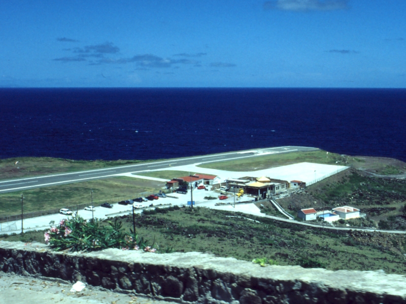
- Juancho E. Yrausquin Airport
Infobox Airport
name = Juancho E. Yrausquin Airport
nativename =

IATA = SAB
ICAO = TNCS
type = closed for commercial aviation
owner =
operator =Winair
city-served =
location =Saba ,Netherlands Antilles
elevation-f = 60
elevation-m = 18
website =
metric-rwy = y
r1-number = 12/30
r1-length-f = 1,300
r1-length-m = 400
r1-surface = Paved
footnotes =Juancho E. Yrausquin Airport airport codes|SAB|TNCS is the only
airport on theCaribbean island ofSaba , in theNetherlands Antilles . It is well known among experienced fliers for the way in which airplanes must approach or take off from the airport.The following video on You Tube shows a landing at the airport, as seen from the cockpit of a DHC-6 [http://www.youtube.com/watch?v=6RU_fk6zNmc YouTube]
Information
Some aviation experts are of the general opinion that the airport is one of the most dangerous in the world, even though no major tragedies have happened at the facility. The airport's sole runway is marked with an X at each end, to indicate to commercial pilots that the airport is closed for commercial aviation.
The danger arises from the airport's physical position. It is flanked on one side by high hills, and on the other side and at both ends of the runway by cliffs dropping into the sea. This creates the possibility that an airplane might overshoot the runway during landing or takeoff and end up in the sea or on the cliffs.
Although the airport is marked as a non-commercial facility, airlines are able to land there by obtaining waivers from the Netherlands Antilles' Civil Aviation Authority.
Yrausquin Airport can be seen from some places in
Saint Martin .Facilities
Large jet
aircraft are unable to land at the airport, because the runway is too short (approx. [http://www.airgorilla.com/airports/caribbean/neth-antilles/saba-sab.html 1,300 ft or 396 m] , thus arguably the World's shortest commercial aviation runway). However, smaller airplanes (DHC-6, BN-2 and helicopters) are common sights there. There is a small ramp and terminal on the north side of the runway. The ramp also has a designated helipad. The terminal building houses offices for Winair, immigration and security, a fire department with one fire truck and a tower. The tower is an advisory service only and does not provide air traffic control. Aviation fuel is not available on the island of Saba.Airlines and destinations
*
WinAir (St. Maarten, St. Eustatius, St. Kitts)The only airline currently serving Yrausquin airport is locally ownedWindward Islands Airways , which operates daily flights toSt. Maarten ,St. Eustatius andSt. Kitts aboard a DHC-6 Twin Otter. The flight to St. Maarten takes about twelve minutes. Windward Express Airways also provides charter service to Saba aboard a BN-2 Islander.External links
* [http://www.fly-winair.com Winair] - local airline
* [http://www.airliners.net/search/photo.search?placesearch=Saba%20-%20Yrausquin%20%28SAB%20%2F%20TNCS%29&distinct_entry=true Photos] of J. Yrausquin Airport from Airliners
* [http://www.world-airport-codes.com/netherlands-antilles/j.-yrausquin-6435.html J. Yrausquin Airport details] from World Airport Codes
*WikiMapia|17.6453|-63.2205|16
*NWS-current|TNCS
*ASN|SAB
Wikimedia Foundation. 2010.
