- Etnedal
Infobox_Kommune
name=Etnedal
idnumber=0541
county=Oppland
landscape=Valdres
capital=Bruflat
governor=Jan Arild Berg (Sp)
governor_as_of=2003
arearank=220
area=459
arealand=443
areapercent=0.14
population_as_of=2004
populationrank=378
population=1,410
populationpercent=0.03
populationdensity=3
populationincrease=-6.7
demonym=Etnedøl
language=Neutral
lat_deg=60| lat_min=58| lat_sec=2| lon_deg=9| lon_min=39| lon_sec=13
utm_zone=32V| utm_northing=6759341 |utm_easting=0535396| geo_cat=adm2nd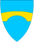
munwebpage=www.etnedal.kommune.noEtnedal is a municipality in the county of
Oppland , Norway.Etnedal was created as a new municipality January 1, 1894 - after the merger of the areas
Nordre Etnedal (fromNord-Aurdal ) andBruflat (fromSør-Aurdal ).Name
The Norse form of the name was "Etnardalr". The first element is the genitive case of the river name Etna (Norse "Etn"), the last element is "dalr" m 'valley, dale'. The meaning of the river name is unknown (maybe derived from "etja" 'push forward' or "eta" 'eat').
Coat-of-arms
The coat-of-arms is from 1989, and shows the old Lunde bridge.
Geography
Etnedal is bordered on the east by
Nordre Land , on the south bySør-Aurdal , and on the west and north byNord-Aurdal .Etnedal is part of the traditional district of
Valdres in central, southernNorway , situated betweenGudbrandsdal andHallingdal . Valdres also includes the municipalitiesNord-Aurdal ,Sør-Aurdal ,Øystre Slidre ,Vestre Slidre , andVang .The river Etna flows through the municipality, then into
Nordre Land municipality and then down intoRandsfjorden .Economics
Occupations in the municipality include animal husbandry and lumbering, but there is also some industry and tourism.
What to see in Etnedal Municipality
The old King's road to Bergen passes through this area. The Etnedal coat of arms shows the old stone bridge Lundebru, which is Northern Europe's largest stone-arch bridge. It was built in 1829 on the King's road. A portion of the King's road was refurbished and turned into a footpath in 1992 and is now a natural and cultural walking path.
External links
* [http://www.etnedal.kommune.no The Etnedal Municipality site] , — in Norwegian
Wikimedia Foundation. 2010.