- Daylesford (SEPTA station)
-
Daylesford
SEPTA regional rail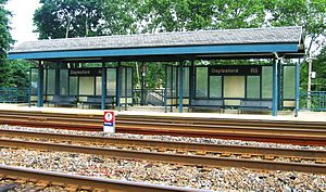
Daylesford stationStation statistics Address Lincoln Highway and Daylesford Road
Daylesford, PACoordinates 40°02′35″N 75°27′38″W / 40.04295°N 75.4606°WCoordinates: 40°02′35″N 75°27′38″W / 40.04295°N 75.4606°W Lines Paoli/Thorndale LineConnections SEPTA Suburban Bus: 105 Structure Platformed-plexiglass shelter Platforms 2 side platforms Tracks 4 Parking 147 Spaces Other information Owned by SEPTA Fare zone 4 Services Preceding station SEPTA Following station toward ThorndalePaoli/Thorndale Line toward Temple UniversityDaylesford Station is a commuter rail station located in the western suburbs of Philadelphia at Glenn Avenue and Lancaster Avenue in Daylesford, Pennsylvania.[1] It is served by most Paoli/Thorndale Line trains.
Station site
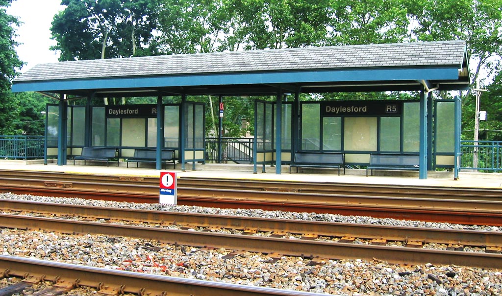
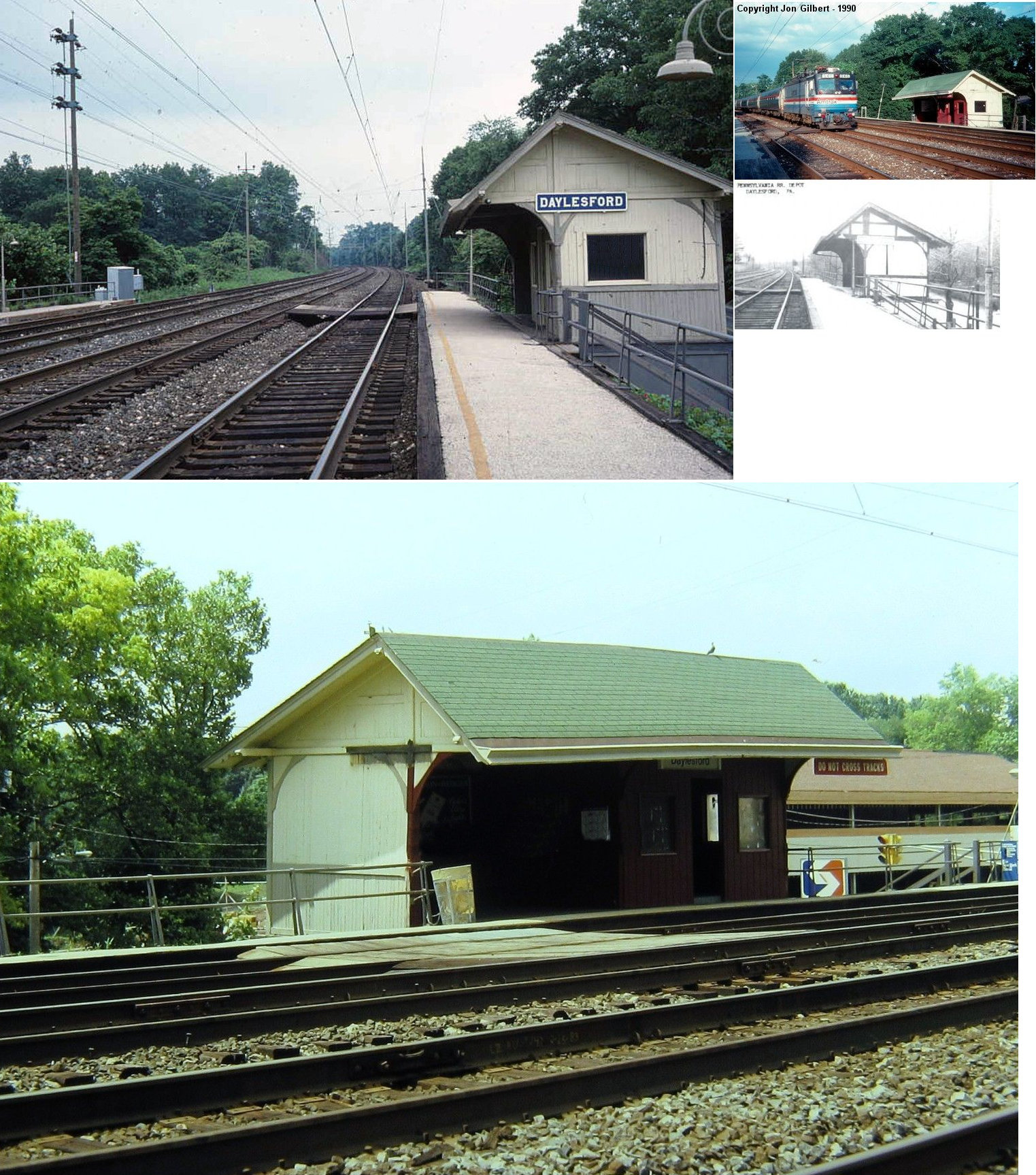
Daylesford Station has no station building. There is a shelter for eastbound waiting passengers. This station replaced an older wooden shelter built by the Pennsylvania Railroad that was located on Lincoln Highway and Conestoga Lane. It was razed in 2000.
There is no ticket office at this station. There are 147 parking spaces at the station. This station is 18.6 track miles from Philadelphia's Suburban Station. In 2003, the average total weekday boardings at this station was 213.
References
External links
Categories:- SEPTA Regional Rail stations
- Stations along Pennsylvania Railroad lines
- Pennsylvania Main Line
- Transportation in Chester County, Pennsylvania
- Pennsylvania railway station stubs
- SEPTA stubs
Wikimedia Foundation. 2010.