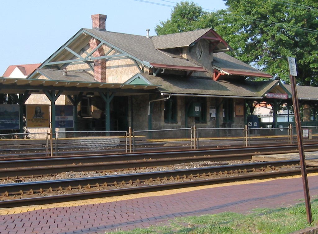
Wynnewood (SEPTA station)
- Wynnewood (SEPTA station)
Infobox Station
name=Wynnewood
type=SEPTA regional rail

image_size=
image_caption=
address=
coordinates=
line=
other=
structure=
platform=2 side platforms
levels=
tracks=4
parking=
bicycle=
baggage_check=
passengers=
pass_year=
pass_percent=
pass_system=
opened=1870
closed=
rebuilt=
electrified=1915
ADA=
code=
owned=SEPTA
zone=2
former=
services=s-rail|title=SEPTA
mpassengers=Wynnewood Station is an above-ground commuter rail station located in the western suburbs of Philadelphia at Wynnewood & Penn Roads, Wynnewood, Pennsylvania 19096 [ [http://maps.google.com/maps?q=Wynnewood+%26+Penn+Roads,+Wynnewood,+PA&spn=0.020175,0.028049&hl=en Wynnewood] on "Google Maps"] . It is served by most R5 Paoli-Thorndale trains with the exception of a few express runs.
The station was built in 1870 by the Pennsylvania Railroad, [ [http://www.west2k.com/pastations/montgomerypa.htm Existing Stations in Montgomery County, Pennsylvania] ] and is one of the historic station buildings on this line built before 1930.
The ticket office at this station is open weekdays 6:10 a.m. to 1:35 p.m. excluding holidays. There are 116 parking spaces at the station. This station is 7.4 track miles from Suburban Station. In 2003, the average total weekday boardings at this station was 659. The station now also houses a coffee shop named Quaker Coffee.
Barack Obama held a rally at the station, drawing a crowd of 6,500 on April 19 2008 several days before the Democratic Primary in Pennsylvania.Fact|date=April 2008
References
External links
* [http://www.septa.org/maps/click_map/wynnewood.html SEPTA - Wynnewood Station]
Wikimedia Foundation.
2010.
Look at other dictionaries:
Wynnewood Road (SEPTA station) — Infobox Station name=Wynnewood Road type=SEPTA rapid transit image size=250 image caption= address=Wynnewood and Haverford Roads Haverford Township, Pennsylvania. coordinates= line= rail color box|system=SEPTA|line=Route 100 other= structure=… … Wikipedia
Narberth (SEPTA station) — Narberth Station SEPTA regional rail Narberth Station Station statistics … Wikipedia
Overbrook, Philadelphia, Pennsylvania — Overbrook High School at 59th Street and Lancaster Avenue Overbrook is a neighborhood northwest of West Philadelphia, Philadelphia, Pennsylvania. The area contains an assortment of housing from large, old homes to row homes to 3 4 story apartment … Wikipedia
Lower Merion Township, Pennsylvania — Geobox Township name = Lower Merion Township native name = other name = other name1 = category = Township image size = image caption = flag size = symbol = symbol size = nickname = motto = country = United States state = Pennsylvania region =… … Wikipedia
Norristown High Speed Line — SEPTA N 5 car #144 enters the Gulph Mills Station in Upper Merion, Pennsylvania. Overview … Wikipedia
Philadelphia Main Line — For other uses, see Main Line (disambiguation). Wayne Station on SEPTA s Paoli/Thorndale line after renovations in 2010 … Wikipedia
Narberth, Pennsylvania — Coordinates: 40°00′27″N 75°15′44″W / 40.0075°N 75.26222°W / 40.0075; 75.26222 … Wikipedia
Merion, Pennsylvania — This article is about the community in Pennsylvania. For the golf club, see Merion Golf Club. For the cricket club, see Merion Cricket Club. Coordinates: 39°59′36″N 75°15′04″W / … Wikipedia
Pennsylvania Main Line — The Main Line is a collection of affluent towns in the western suburbs of Philadelphia named after the Main Line of the Pennsylvania Railroad (currently Amtrak s Keystone Corridor and SEPTA s R5 line). History The area comprising the Main Line… … Wikipedia
Schuylkill Valley Metro — The Schuylkill Valley Metro was a proposal for a 62 mile railway system that would link Philadelphia, Pennsylvania with the city of Reading, Pennsylvania in central Berks County, USA, using both sides of the SEPTA R6 system, as well as two… … Wikipedia

