- Sarankot
-
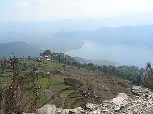
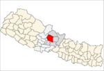
Sarangkot — Village Development Committee — Sarankot, overlooking Pokhara and lake. Location in Nepal Coordinates: 28°14′30″N 83°58′0″E / 28.24167°N 83.966667°ECoordinates: 28°14′30″N 83°58′0″E / 28.24167°N 83.966667°E Country  Nepal
NepalZone Gandaki Zone District Kaski District Population (1991) - Total 5,060 Time zone Nepal Time (UTC+5:45) Sarankot or Sarangkot is Village Development Committee in Kaski District in the Gandaki Zone of northern-central Nepal. At the time of the 1991 Nepal census it had a population of 5,060 persons residing in 1,010 individual households.[1]
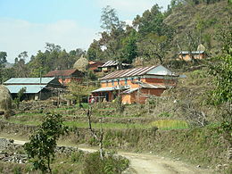
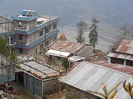
The village is located on a mountainside ridge at an altitude of 1600m with panoramic Himalayan views. From Sarankot, on the northern direction we can see Dhawalagiri in the far west . Annapurna range is visible when the weather is clear on the same side. On the southern direction the village overlooks the city of Pokhara and its lake on the north-western outskirts of the city.
References
- ^ "Nepal Census 2001". Nepal's Village Development Committees. Digital Himalaya. http://www.digitalhimalaya.com/collections/nepalcensus/form.php?selection=1. Retrieved September 30, 2008.
External links
VDCs Arba Vijaya, Armala, Begnas, Bhachok, Bhadaure Tamagi, Bharat Pokhari, Chapakot, Dangsing, Deurali, Dhampus, Dhikure Pokhari, Dhital, Ghachok, Ghandruk, Hansapur, Hemaja, Kahun, Kalika, Kasikot, Kritinachnechaur, Lahachok, Lamachaur, Lekhnath, Lumle, Lwangghale, Machhapuchchhre, Majhthana, Mala, Mauja, Mijuredada, Namarjung, Nirmalpokhari, Parche, Pumdibhumdi, Puranchaur, Rakhi, Reevan, Rupakot, Saimarang, Salyan, Sarangkot, Sardikhola, Shisuwa, Siddha, Sildujure, Thumakodada, Thumki, Valam
Villages Categories:- Populated places in Kaski District
- Gandaki Zone geography stubs
Wikimedia Foundation. 2010.

