- Sarandí del Arapey
-
Not to be confused with Termas del Arapey.
Sarandí del Arapey — Village —  Location in Uruguay
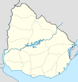
 Sarandí del Arapey
Coordinates: 30°59′18″S 56°12′53″W / 30.98833°S 56.21472°WCoordinates: 30°59′18″S 56°12′53″W / 30.98833°S 56.21472°W Country  Uruguay
Department Salto Department Population (2004) – Total 215 Time zone UTC -3 Postal code 50018 Sarandí del Arapey is a village or populated centre in the eastern part of the Salto Department of northwestern Uruguay. It is located 8 kilometres (5.0 mi) into a road that splits from Route 30 in a westward direction, 17 kilometres (11 mi) northwest of Masoller of Rivera Department and 75 kilometres (47 mi) southeast of Artigas, the capital city of Artigas Department.
Population
In 2004, Sarandí del Arapey had a population of 215.[1]
Year Population 1963 201 1975 179 1985 162 1996 200 2004 215 Source: Instituto Nacional de Estadística de Uruguay[2]
References
- ^ "2004 Census of Salto department" (XLS). INE. 2004. http://www.ine.gub.uy/fase1new/Salto/Cuadro7_15.XLS. Retrieved 11 July 2011.
- ^ "1963–1996 Statistics / S" (DOC). Instituto Nacional de Estadística de Uruguay. 2004. http://www.ine.gub.uy/biblioteca/toponimico/TOPOletraS.doc. Retrieved 9 July 2011.
External links
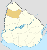
 Salto Department of UruguayCapital: Salto
Towns and
villagesBelén • Colonia 18 de Julio • Constitución • Pueblo Lavalleja • Rincón de Valentín • Salto • San Antonio
Mineral spas Termas del Daymán • Termas del Arapey
Sights Categories:- Uruguay geography stubs
- Populated places in the Salto Department


Wikimedia Foundation. 2010.