- Sapps Still, Georgia
-
Sapps Still is an unincorporated community in rural north Coffee County, Georgia, United States.
Contents
History
Sapps Still was the site of a turpentine still in the early 1900s until the still exploded due to a fire. Later, a lumber mill was built in its place. Ruins and remains of both facilities can still be seen. The dry kiln for the lumber mill still stands; after the mill closed in the 1950s, it was used until the 1990s as a farm storage barn. A rail spur[1] that passed through Sapps Still connected the barge and steamboat wharf on the Ocmulgee River at Relee ~5 miles to the north with the county seat of Douglas, Georgia, and from there to other rail lines. The rail spur was used to ship naval stores from the turpentine still and, later, lumber from the lumber mill. The Relee-to-Sapps-Still line closed in 1950, and the Sapps-Still-to-Douglas line closed in 1958.[2]
Geography
Sapps Still is located at 31°42'58"N 82°56'15"W (31.7160206, -82.9373684). The highest elevation is 322'.[3] Sapps Still sits at the junction of Sapps Still Road (Coffee County unimproved road #498)[4] and US Highway 441. Sapps Still is 131 miles driving distance NW of Jacksonville, Florida; 180 miles driving distance SE of Atlanta, Georgia; and 98 miles driving distance SE of Macon, Georgia. An abandoned telephone long-distance microwave relay tower stands approximately .5 miles south of Sapps Still on the east side of US Highway 441, and is often cited as a landmark.[5]
References
- Map of Georgia and Florida Railways and Connections in 1918 from Official Guide of the Railways, April 1918; Georgia's Railroad History & Heritage. Retrieved 2010-6-28.
- Abandonments Georgia and Florida Railway, Georgia's Railroad History & Heritage. Retrieved 2010-6-28.
- USGS Geographic Names Information System (GNIS) Feature Detail Report for Sapps Still, GA Retrieved 2010-6-28.
- Georgia DOT County Maps (Downloadable PDF) Retrieved 2010-6-28.
- Trails.com Topo Map showing Sapps Still and microwave radio tower. Retrieved 2010-6-29.
- Ward, Warren P.. Ward's history of Coffee County : A story dealing with the past and present of Coffee County. Beginning with the early settlers about the year 1800,--discussing the Creek Indians and the Pioneers. Leading up to the creation of Coffee County in 1854--Old families, old schools and churches, showing the conditions during the Civil War and ending up with the spirit of progress, which is evident in better schools, and a more intelligent civilization. Showing that Coffee County, in South Georgia is God's country and a good place to live in the year 1930. Press of Foote & Davies Co., Atlanta, copyright 1930. Retrieved 2010-7-11.
External links
- 1955 railway line & waterway map of Coffee County - Galileo
- Coffee County Georgia Wikipedia Article
- Coffee County, Cities and Counties, The New Georgia Encyclopedia
- Coffee County statistical data at City-Data.com
- RailGa.com - Georgia's Railroad History and Heritage
Coordinates: 31°42′58″N 82°56′15″W / 31.71611°N 82.9375°W
Municipalities and communities of Coffee County, Georgia County seat: Douglas Cities 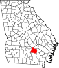
Unincorporated
communitiesSapps Still | West Green
Categories:- Populated places in Coffee County, Georgia
- Unincorporated communities in Georgia (U.S. state)

Wikimedia Foundation. 2010.