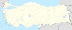
- Ovacuma
-
Ovacuma — Town — Location in Turkey Coordinates: 41°27′N 32°45′E / 41.45°N 32.75°ECoordinates: 41°27′N 32°45′E / 41.45°N 32.75°E Country  Turkey
Province Karabük Province District Safranbolu Government – Mayor Elevation 360 m (1,195 ft) Population (2010) – Total 2,006 Time zone EET (UTC+2) – Summer (DST) EEST (UTC+3) Postal code 78640 Area code(s) 0370 Licence plate 78 Ovacuma is a town in Safranbolu district of Karabük Province, Turkey. The town is situated in the mountainous area along a valley of a creek with the same name. At 41°27′N 32°45′E / 41.45°N 32.75°E the distance to Safranbolu is 28 kilometres (17 mi) and the distance to Karabük is 35 kilometres (22 mi). The population of the town is 2006[1] as of 2010. The town was formed by merging seven neighbouring villages in 1998 and it is quite dispersed. The main economic activity of the town depends on forestry.[2]
References
- ^ "Turkstat". Turkish Statistical Institute. http://rapor.tuik.gov.tr/reports/rwservlet?adnksdb2=&ENVID=adnksdb2Env&report=idari_yapi_09sonrasi.RDF&p_il1=78&p_yil=2010&p_dil=2&desformat=html. Retrieved 2011.
- ^ Mayor's page (Turkish)
Categories:- Populated places in Karabük Province
- Black Sea Region
- Towns in Turkey
- Safranbolu District
- Turkey geography stubs
Wikimedia Foundation. 2010.

