- Outer Drive Bridge
-
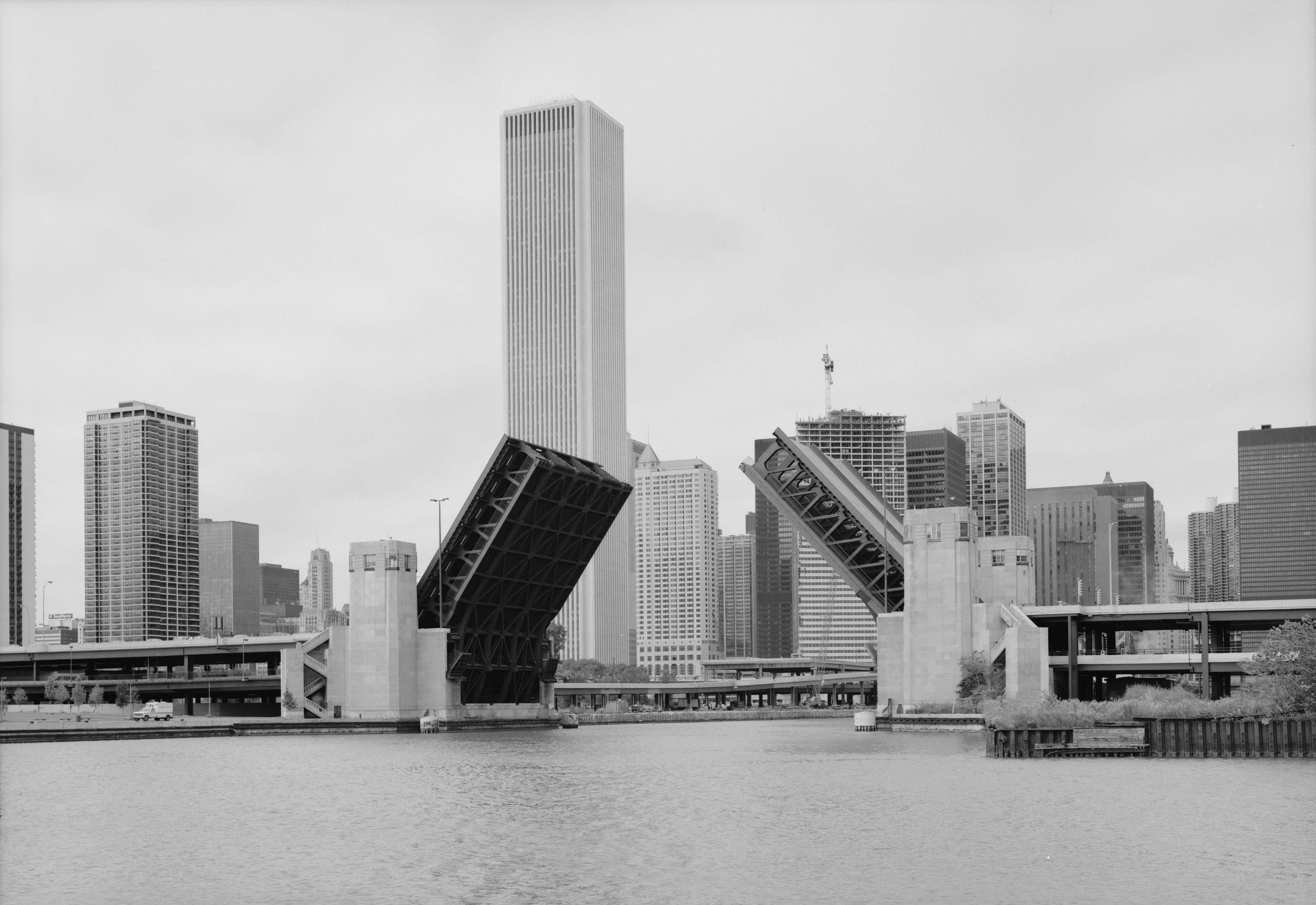
Outer Drive Bridge 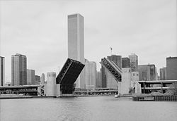
The double-decker Outer Drive Bridge across the Chicago RiverCarries Motor vehicles, pedestrians Crosses Chicago River Locale Chicago Design Double-leaf, double-deck, fixed counterweight, trunnion bascule bridge Coordinates 41°53′18.3″N 87°36′50.6″W / 41.888417°N 87.614056°WCoordinates: 41°53′18.3″N 87°36′50.6″W / 41.888417°N 87.614056°W The Outer Drive Bridge, also known as the Link Bridge was started in 1929 and completed in 1937 as part of Ickes’s Public Works Administration in Chicago. It was planned by the Chicago Plan Commission, using Hugh E. Young as the consulting engineer, was designed by the Strauss Engineering Company, built by the American Bridge Company, and erected by Ketler and Elliot Company.
Contents
Significance/Purpose
The building of this bridge was meant to create many jobs for Chicagoans and ease traffic flow on Michigan Ave and in the Loop. The Outer Drive Bridge runs along the shore of Lake Michigan from the far South Side of the city to the Loop, across the Chicago River, and connects the south to the north side of the city. In 1937 it was the longest, widest, and heaviest bascule bridge in the world.
Funds
While the completion of the Outer Drive was considered one of the most important projects in the PWA it took many years to complete. A main issue was funding. Due to a lack of provided security by Chicago Park Districts, the allotment for the bridge was revoked until the districts were all in position to comply. The total cost of the Outer Drive is estimated at $11,563,000.
Economic Justification
Calculations based on a traffic flow of 40,000 vehicles per day on a saving of eight minutes between Oak St. and Seventh St., made possible by the use of the bridge rather than Michigan Ave and on a delay cost estimated to be one cent per car per minute show that the saving in vehicle operation should amount to $584,000 per annum, which, capitalized at 5% would indicate that $23,360,000 could properly be spent to eliminate this delay. This shows that the Outer Drive bridge project is economically reasonable, showing a possible saving of $11,797,000.
Bridge Operation
According to Engineering News-Record “Each leaf is to be operated by two sets of gear trains, consisting of four sets of gear reductions. Each gear train is connected to two 100-hp. main operating motors, only one of which is to be used at a time. The time required for opening or closing the bridge against a 28-m.p.h. wind is stated to be 57.6 sec, of which 10 sec. is for acceleration and 2.86 sec. for deceleration. The main operating racks are bolted to the underside of the outside trusses, the pitch radius being 20 ft. The operating pinion, with a pitch diameter of 40 in, is mounted on a shaft of the gear train.
Heavy locking devices are provided at the center of the bridge and at the rigid in its closed position. The center lock in addition to holding the leaves together in their closed position, also transmits live load shear from one leaf to the other. This center lock consists of a set of four female castings bolted to the river end of one leaf, and a second set of four male units bolted to the river end of the other leaf, all castings being on the centerlines of the trusses. The male unit consists of two castings forming a toggle.
Heel or rear locks are necessary to prevent the leaves from opening when live loads pass over the part of the bridge between the trunnions and the rear break in the floor. Each leaf is provided with two pairs of rear locks, each pair being placed between the inside and outside trusses. The four locks of a leaf are connected by shafting, and operation by means of two 15-hp. motors set either side of the centerline of the bridge” (April 22, 1937).
References
- "Historic American Buildings Survey/Historic American Engineering Record". http://lcweb2.loc.gov/cgi-bin/ampage?collId=pphhdatapage&fileName=il/il0600/il0619/data/hhdatapage.db&recNum=2. Retrieved 2 June 2011.
- “A Record Size Bascule,” Engineering News-Record, v. 118 (April 22, 1937): 583-587.
- “Chicago Gets Added PWA Funds for Outer Drive Completion,” Engineering News-Record, v. 115 (December 5, 1935): 795-796.
- “Continuous Girders Top Rigid Frame Viaduct Bents,” Engineering News-Record, V. 118 (May 6, 1937): 671-673.
- “Lakefront Boulevard Link Forms Milestone in Chicago Plan,” Engineering News-Record, v. 118 (April 15, 1937): 546-548.
External links
- "Historic American Buildings Survey/Historic American Engineering Record: Chicago River Bascule Bridge, Outer Drive, Spanning Chicago River at Outer (Lakeshore) Drive, Chicago, Cook, IL". http://lcweb2.loc.gov/cgi-bin/ampage?collId=pphhphoto&fileName=il/il0600/il0619/photos/browse.db&action=browse&recNum=0&title2=Chicago%20River%20Bascule%20Bridge,%20Outer%20Drive,%20Spanning%20Chicago%20River%20at%20Outer%20%28Lakeshore%29%20Drive,%20Chicago,%20Cook,%20IL&displayType=1. Retrieved 2 June 2011.
- "Chicago River Bascule Bridge, Outer Drive, Spanning Chicago River at Outer (Lakeshore) Drive, Chicago, Cook, IL". http://www.loc.gov/pictures/item/IL0619/. Retrieved 2 June 2011.
- "Dedication of the Outer Drive Bridge: Aerial View". http://newdeal.feri.org/library/f35a.htm. Retrieved 2 June 2011.
- "Outer Drive Bridge Dedication, 1937". http://www.encyclopedia.chicagohistory.org/pages/6413.html. Retrieved 2 June 2011.
Categories:- Bridges in Chicago, Illinois
- Bascule bridges
- Road bridges in Illinois
- Pedestrian bridges in Illinois
Wikimedia Foundation. 2010.