- Outat El Haj
-
Outat El Haj — Town — Country  Morocco
Region Fès-Boulemane Region Province Boulemane Province Population (2004) – Total 13,945 Time zone WET (UTC+0) – Summer (DST) WEST (UTC+1) Outat El Haj is a town in Boulemane Province, Fès-Boulemane, Morocco. According to the 2004 census it has a population of 13,945.[1]
The population is estimated around 20.000, although the small enclaves surrounding the town may add the same figure to the population. The population consists primarily of Berber tribes from the villages in the middle Atlas mountains (Beni Hayoune, Oulad Ali, Tsiouant...)and Arab tribes from the low lands towards Guercif and Talsint. The most influential family is the Qbabou family who own a considerable part of the lands, the family's origins are from Beni Hayoune a small village on the banks of the river cheg-el-ard.
Outat el Hadj is well known for its olive tree gardens and its exquisite olive oil.
References
Capital: FesProvinces 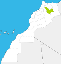
Cities Coordinates: 33°20′N 3°41′W / 33.333°N 3.683°W
Categories:- Populated places in the Fès-Boulemane Region
- Morocco geography stubs

Wikimedia Foundation. 2010.