- Otok, Međimurje County
-
Otok — Village — Location of Otok in Croatia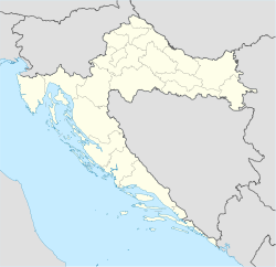
 Otok
OtokCoordinates: 46°19′52″N 16°34′59″E / 46.33111°N 16.58306°E Country Croatia County Međimurje County Municipality Prelog Population (2001) – Total 339 Time zone CET (UTC+1) – Summer (DST) CEST (UTC+2) Postal code 40323 Prelog Area code(s) 040 Otok (Hungarian: Ottok) is a village in Međimurje County, Croatia.
The village is located around 2 kilometres east of the town of Prelog, and is administratively part of its wider area (municipality). The Drava flows into Lake Dubrava just outside the village. In the 2001 census, the village had a population of 339.
In a 1226 charter, an estate named Otok was mentioned as being located near Prelog. The local chapel was built in 1926.[1]
References
- ^ A short description of the village (Croatian)
Categories:- Populated places in Međimurje County
- Međimurje County geography stubs

Wikimedia Foundation. 2010.