- Jablunkov
Infobox City
official_name = Jablunkov
native_name = Jabłonków
nickname =
motto =
settlement_type = Town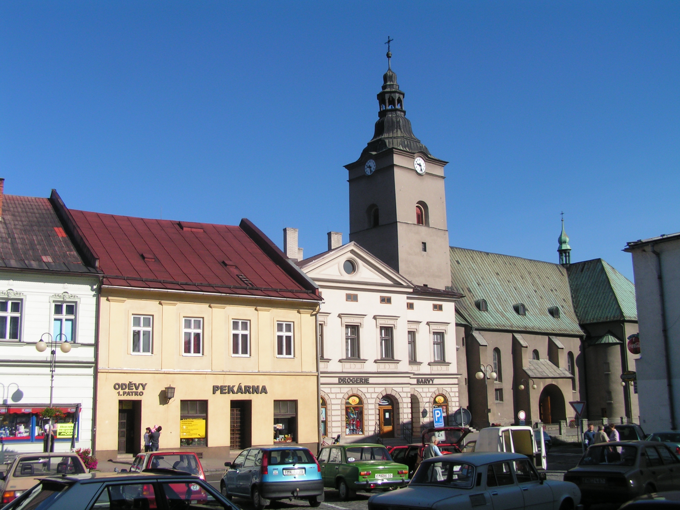
imagesize =
image_caption = Part of town square with Catholic church
image_
image_shield = Jablunkov-znak.png
pushpin_label_position = none
pushpin_map_caption = Location in the Czech Republic
subdivision_type = Country
subdivision_name =Czech Republic
subdivision_type1 = Region
subdivision_name1 = Moravian-Silesian
subdivision_type2 = District
subdivision_name2 = Frýdek-Místek
leader_title =Mayor
leader_name = Petr Sagitarius
established_title = First mentioned
established_date = 1435
established_title2 = Town rights
established_date2 = 1560
area_magnitude = 1 E8
area_total_km2 = 10.39
population_as_of = 2006
population_note =
population_total = 5750
population_density_km2 = auto
latd = 49
latm = 34
lats = 28
latNS = N
longd = 18
longm = 45
longs = 58
longEW = E
elevation_m = 386
postal_code_type = Postal code
postal_code = 739 91
website = [http://www.jablunkov.cz/ http://www.jablunkov.cz/]
footnotes =Jablunkov ( Audio-IPA|Jablunkov.ogg| [ˈjablʊŋkof] ; Polish: Audio-nohelp|Jablonkow.ogg|"Jabłonków", _de. Jablunkau) is a town in
Frýdek-Místek District ,Moravian-Silesian Region of theCzech Republic . It has a population of 5,750 (2006), 23% of the population are the Poles. [cite web |url= http://www.czso.cz/sldb/sldb2001.nsf/obce/598259?OpenDocument |title= 2001 census data |accessdate= |author= |date= |work= |publisher=Czech Statistical Office ] Jablunkov lies between the Silesian andMoravian-Silesian Beskids mountain ranges, in the historical region ofCieszyn Silesia , and is the easternmost town of the country. TheLomná River flows into theOlza River in the town.History
According to historians, the beginnings of Jablunkov are to be found in the place where the present-day village of Hrádek is located. It was first mentioned in a written document in 1435. In 1447
Magyars completely destroyed the settlement. In 1560 Wacław III,Duke of Cieszyn , granted town rights to the town. It continuously developed and by the end of the 16th century it had a mayor and a city council. The town profited from its location in theJablunkov Pass . It was located on an ancient trade route going from theMediterranean Sea to theBaltic Sea . The route was used by merchants ofancient Rome ; frequent discoveries ofRoman coins confirm that. Important trading routes toKraków (north) and toUpper Hungary (east) also run through the town. It became more and more important and also rich, as many citizens lived by trading. In the middle of the 17th century, it had, together with a suburb and a village of Pioseczna, 750 inhabitants. In the 18th century most of citizens worked in trade, craftsmanship and farming. At the end of the 19th century, many new buildings were built. A newArt Nouveau town hall was built in 1905. After the division ofCieszyn Silesia in 1920 it became a part ofCzechoslovakia . In October 1938 it was annexed byPoland together with whole region known asZaolzie , and duringWorld War II was a part ofNazi Germany . After the war it once again became part of Czechoslovakia.Landmarks and culture
The most important landmarks are the historic town square with a fountain and statue of the Virgin Mary from 1655, the Roman Catholic church built in 1620, and the Elizabethan Monastery. The latter was established by the priest Wawrzyniec Piontek, who wanted to improve medical treatment in the town: the nearest hospital was located in
Ostrava . The Elizabethan hospital was built in 1856. It was located near the Olza River and was frequently flooded. A decision was taken to build a new one, which began operating in 1932. In 1948 the monastery and its properties were seized by the Communists, who forbade the further induction of new sisters. Former Elizabethan sisters were ordered to work in a state farm (JZD) with cattle. In 1989, after the fall of communism, it was returned to the Elizabethan sisters. The monastery in Jablunkov is one of only three Elizabethan monasteries in the Czech Republic, the other two being inPrague andBrno . There is also asanatorium in Jablunkov. It was built in 1933-1935 and is a valuable landmark of modern architecture. It is surrounded by a park planted in 1936-1938. There are more than 500 species of trees and shrubs in the park. Several sculptures are also located in the park.The most popular cultural event is the annual
Gorolski Święto , or "Highlander's Festival" in English, organized every year in August since 1948 by thePolish Cultural and Educational Union (PZKO). It is a showcase of localPolish folklore and traditions that attracts visitors from all ofZaolzie and also from foreign countries.People
*
Oskar Zawisza , Polish priest and publicist, was born hereFootnotes
References
* cite book
last = Cicha
first = Irena
coauthors = Kazimierz Jaworski, Bronisław Ondraszek, Barbara Stalmach and Jan Stalmach
title = Olza od pramene po ujście
publisher = Region Silesia
date = 2000
location = Český Těšín
pages =
doi =
isbn = 80-238-6081-X* cite journal
last = Szpyrc
first = Antoni
authorlink =
coauthors =
title = Perła w koronie
journal =Zwrot
volume = 7
issue = 2007
pages = 8–9
date =
doi =
id =External links
* [http://www.jablunkov.cz/ Official website]

Wikimedia Foundation. 2010.