- Orehovica, Croatia
-
Not to be confused with Orahovica, a town and municipality in Virovitica-Podravina County, Croatia.
Orehovica — Municipality — Orehovica Municipality
Općina OrehovicaLocation of Orehovica in Croatia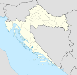
 Orehovica
Coordinates: 46°20′N 16°31′E / 46.333°N 16.517°E Country Croatia County Međimurje County Government – Municipal mayor Franjo Bukal Area – Total 28.33 km2 (10.9 sq mi) Population (2001) – Total 2,769 – Density 97.7/km2 (253.1/sq mi) Time zone CET (UTC+1) – Summer (DST) CEST (UTC+2) Postal code 40322 Orehovica Area code(s) 040 Website www.orehovica.hr Orehovica is a village and municipality in Međimurje County, Croatia. There are three villages in the municipality – Orehovica, Podbrest and Vularija.
In the 2001 census, the population of the municipality was 2,769 – 1,659 in Orehovica, 698 in Podbrest and 412 in Vularija. The majority of the people identified themselves as Croats during the census.
The name Orehovica is derived from oreh, meaning "walnut" in the Kajkavian dialect of Croatian language, spoken in Međimurje County. The municipality's coat of arms simply depicts a walnut shell on white background.
External links
- Municipality's website (Croatian)
Subdivisions of Međimurje County Towns 
Municipalities Belica · Dekanovec · Domašinec · Donja Dubrava · Donji Kraljevec · Donji Vidovec · Goričan · Gornji Mihaljevec · Kotoriba · Mala Subotica · Nedelišće · Orehovica · Podturen · Pribislavec · Selnica · Strahoninec · Sveta Marija · Sveti Juraj na Bregu · Sveti Martin na Muri · Šenkovec · Štrigova · VratišinecCategories:- Međimurje County geography stubs
- Municipalities of Croatia
- Populated places in Međimurje County


Wikimedia Foundation. 2010.