- Old Iron Town, Utah
-
Iron City — Ghost town — Ruins at Old Iron Town
Nickname(s): Old Iron Town Location of Iron City in Utah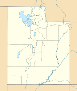
 Iron City
Coordinates: 37°36′00″N 113°27′01″W / 37.6°N 113.45028°WCoordinates: 37°36′00″N 113°27′01″W / 37.6°N 113.45028°W Country United States State Utah County Iron Founded 1868 Abandoned 1876 Named for Iron deposits Elevation[1] 5,846 ft (1,782 m) GNIS feature ID 1444069[1] Old Iron Town, originally Iron City, is a ghost town in Iron County, in the U.S. state of Utah. It is located in Dixie National Forest, about 22 miles (35 km) from Cedar City. The settlement was founded in 1868 as a second attempt to mine iron from Iron Mountain after a disappointing yield from Cedar City. The colony lasted until 1876, when strife from the Edmunds–Tucker Act and the Panic of 1873 forced its closure. The site was added to the National Register of Historic Places in 1971.
History
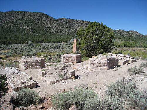
 The remains of a blast furnace at Old Iron Town.
Brigham Young left Nauvoo, Illinois to establish Salt Lake City in 1847. Young quickly realized that the fastest way to an independent Mormon state was to make the new colony self-sufficient. One important resource in this regard was iron, which was very expensive to ship from the eastern United States. The city of Parowan was founded in 1851 to provide iron for the settlers, which was mined in nearby Iron Mission (Cedar City). Mismanagement plagued these new settlements, and only 400 short tons (360 t) of iron were produced over a six-year period.
Iron was nonetheless needed for continued Mormon prosperity, so a second attempt at mining the region was made in 1868. The newly formed Union Iron Works organized an establishment at the southern base of Iron Mountain on Pinto Creek, west of Cedar City. By the third year, over 2,500 pounds (1,100 kg) of iron was mined every day. The company expanded in 1873 and continued to mine ore for three more years. At its peak, the settlement included a schoolhouse, blacksmith, charcoal furnaces, and a foundry. The city was abandoned in 1876. An attempt was made to revive mining from Iron Mountain, but the church was struggling with litigation over the Edmunds–Tucker Act and the Panic of 1873.
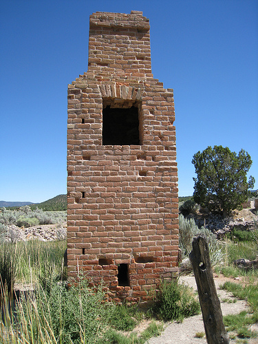
Today, the ruins feature a preserved beehive style charcoal oven and a furnace known as an "Arastra", which prepared sands for molds. Parts of the original foundry remain, including the chimney. The site was fenced off by the Sons of Utah Pioneers. It is currently within grounds designated as the Dixie National Forest. The Frontier Homestead State Park Museum in Cedar City provides information about and artifacts from the site. The ruins are found on Iron Town Road, which intersects with Utah State Route 56. The site was added to the National Register of Historic Places on May 14, 1971 as Old Iron Town.
References
Municipalities and communities of Iron County, Utah Cities Cedar City | Enoch | Parowan

Towns CDPs Unincorporated
communitiesBeryl | Hamilton Fort | Lund | Modena
Ghost town Old Iron Town
Categories:- Geography of Iron County, Utah
- Ghost towns in Utah
- Mining communities in Utah
- National Register of Historic Places in Utah
- Populated places established in 1868


Wikimedia Foundation. 2010.