- Oksovsky
-
Oksovsky (English)
Оксовский (Russian)- Urban-type settlement[1] - 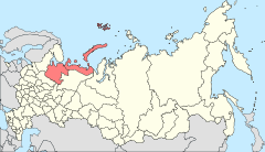
Location of Arkhangelsk Oblast in Russia
 Oksovsky
Coordinates: 62°36′21″N 39°54′40″E / 62.60583°N 39.91111°ECoordinates: 62°36′21″N 39°54′40″E / 62.60583°N 39.91111°E Administrative status Country Russia Federal subject Arkhangelsk Oblast Administrative district Plesetsky District[1] Municipal status (as of July 2011) Municipal district Plesetsky Municipal District[2] Urban settlement Oksovskoye Urban Settlement[2] Administrative center of Oksovskoye Urban Settlement[2] Statistics Population (2010 Census,
preliminary)2,051 inhabitants[3] Population (2002 Census) 2,207 inhabitants[4] Time zone MSD (UTC+04:00)[5] Founded 1961[6] Postal code(s) 164270[7] Dialing code(s) +7 81832[8] Oksovsky (Russian: Оксовский) is an urban locality (an urban-type settlement) in Plesetsky District of Arkhangelsk Oblast, Russia, located 28 kilometers (17 mi) west of Plesetsk, on the right bank of the Onega River. Municipally, it is the administrative center of Oksovskoye Urban Settlement, one of the eight urban settlements in the district. Population: 2,051 (2010 Census preliminary results);[3] 2,207 (2002 Census);[4] 2,877 (1989 Census).[9].
Contents
History
The former village of Navolok, close to Oksovsky, is a historical landmark. Before 1926, Navolotskaya Volost existed with the administrative center in Navolok. In 1926, the volost was transformed into a selsoviet, and on July 15, 1929 Plesetsky District was established. The administrative center of Oksovsky Selsoviet was located in the village of Navolok. In 1930, Oksovsky Selsoviet was merged with nearby Paberezhsky Selsoviet, and in 1961, the urban-type settlement of Oksovsky was established, and the selsoviet transformed into the settlement soviet. In 1985, the urban-type settlement of Severoonezhsk was established by splitting it from Oksovsky.[6]
In the beginning of 1970, there were plans to built an aluminum production plant close to the bauxite deposits (which were discovered on the left bank of the Onega, currently Severoonezhsk). It was planned that the plant would be served by a city with the population of approximately 100,000, with the name of Severorossiysk, located on both banks of the Onega. The plans were supported by Hungary and Bulgaria, who were interested in becoming the shareholders. The plans have never been realized.[10]
Geography and location
Oksovsky is located on the right bank of the Onega River, several kilometers downstream from the mouth of the Iksa River, the left tributary of the Onega. On the left bank of the Onega, across Oksovsky, the urban-type settlement of Severoonezhsk is located.
Economy
Industry
The economy of Oksovsky is based on forestry.[11]
Transport
Oksovsky (Navoloki railway station) is at the end of the rairoad line which connects in Puksa to the line between Moscow and Arkhangelsk (Konosha-Obozyorskaya stretch). There is a railway bridge to Severoonezhsk (Iksa railway station) across the Onega, connecting to the railroad to the west, to Undozero and Yangory. This line is one of the biggest railways in Russia which does not belong to Russian Railways. The owner of the railway is the State Department of Corrections. Plans to extend this line to Medvezhyegorsk have not been realized.
Until the 1990s, the Onega was heavily used for timber rafting and logging, and Oksovsky was one of the points where timber was transported from the river.
There is a road connecting Oksovsky to the village of Denislavye located on the highway which is a historic trading route between Kargopol with Arkhangelsk. The highway also connects to Plesetsk.
The Onega is not navigable in Oksovsky because of the rapids.
References
Notes
- ^ a b Государственный комитет Российской Федерации по статистике. Комитет Российской Федерации по стандартизации, метрологии и сертификации. №ОК 019-95 1 января 1997 г «Общероссийский классификатор объектов административно-территориального деления. Код 11 250 568 000», в ред. изменения №168/2011 от 1 октября 2011 г. (State Statistics Committee of the Russian Federation. Committee of the Russian Federation on Standardization, Metrology, and Certification. #OK 019-95 January 1, 1997 Russian Classification of Objects of Administrative Division . Code 11 250 568 000, as amended by the Amendment #168/2010 of October 1, 2011. ).
- ^ a b c Архангельское областное Собрание депутатов. Областной закон №258-внеоч.-ОЗ от 23 сентября 2004 г. «О статусе и границах территорий муниципальных образований в Архангельской области (текст в ред. от 15 февраля 2010 г.)», в ред. Областного закона №309-23-ОЗ от 7 июля 2011 г «О внесении изменений и дополнений в отдельные Областные законы в сфере организации и осуществления местного самоуправления». Вступил в силу со дня официального опубликования. Опубликован: "Волна", №38, 8 октября 2004 г. (Arkhangelsk Oblast Council of Deputies. Oblast Law #258-vneoch.-OZ of September 23, 2004 On the Status and Borders of the Territories of the Municipal Formations in Arkhangelsk Oblast (text of rev. of February 15, 2010), as amended by the Oblast Law #309-23-OZ of July 7, 2011 On Amending and Supplementing Several Oblast Laws on the Subject of Organization and Implementation of the Local Self-Government. Effective as of the day of the official publication).
- ^ a b Федеральная служба государственной статистики (Federal State Statistics Service) (2011). "Предварительные итоги Всероссийской переписи населения 2010 года (Preliminary results of the 2010 All-Russian Population Census)" (in Russian). Всероссийская перепись населения 2010 года (All-Russia Population Census of 2010). Federal State Statistics Service. http://www.perepis-2010.ru/results_of_the_census/results-inform.php. Retrieved 2011-04-25.
- ^ a b Федеральная служба государственной статистики (Federal State Statistics Service) (2004-05-21). "Численность населения России, субъектов Российской Федерации в составе федеральных округов, районов, городских поселений, сельских населённых пунктов – районных центров и сельских населённых пунктов с населением 3 тысячи и более человек (Population of Russia, its federal districts, federal subjects, districts, urban localities, rural localities—administrative centers, and rural localities with population of over 3,000)" (in Russian). Всероссийская перепись населения 2002 года (All-Russia Population Census of 2002). Federal State Statistics Service. http://www.perepis2002.ru/ct/doc/1_TOM_01_04.xls. Retrieved 2010-03-23.
- ^ Правительство Российской Федерации. Постановление №725 от 31 августа 2011 г. «О составе территорий, образующих каждую часовую зону, и порядке исчисления времени в часовых зонах, а также о признании утратившими силу отдельных Постановлений Правительства Российской Федерации». Вступил в силу по истечении 7 дней после дня официального опубликования. Опубликован: "Российская Газета", №197, 6 сентября 2011 г. (Government of the Russian Federation. Resolution #725 of August 31, 2011 On the Composition of the Territories Included into Each Time Zone and on the Procedures of Timekeeping in the Time Zones, as Well as on Abrogation of Several Resolutions of the Government of the Russian Federation. Effective as of after 7 days following the day of the official publication).
- ^ a b "МО "Оксовское"" (in Russian). МО "Плесецкий район". http://www.moples.ru/index.php?id=29. Retrieved 3 August 2011.
- ^ "List of postal codes" (in Russian). Russian Post. http://info.russianpost.ru/database/ops.html. Retrieved 3 August 2011.
- ^ "Телефонный код Оксовского, Арх. обл." (in Russian). Командировка.ру. http://www.komandirovka.ru/cities/oksovskijj_arkh._obl./how_call/. Retrieved 3 August 2011.
- ^ "Всесоюзная перепись населения 1989 г. Численность наличного населения союзных и автономных республик, автономных областей и округов, краёв, областей, районов, городских поселений и сёл-райцентров. (All Union Population Census of 1989. Present population of union and autonomous republics, autonomous oblasts and okrugs, krais, oblasts, districts, urban settlements, and villages serving as district administrative centers.)" (in Russian). Всесоюзная перепись населения 1989 года (All-Union Population Census of 1989). Demoscope Weekly (website of the Institute of Demographics of the State University—Higher School of Economics. 1989. http://demoscope.ru/weekly/ssp/rus89_reg.php. Retrieved 2010-03-23.
- ^ Лукашов, Виталий (7 July 2004). "Проект "Северороссийск"". Независимый взгляд (Arkhangelsk) (18). http://www.arhpress.ru/neboz/2004/7/7/9.shtml. Retrieved 6 August 2011.
- ^ Оксовский. Great Soviet Encyclopedia. http://bse.sci-lib.com/article084044.html.
Sources
- Архангельское областное Собрание депутатов. Областной закон №65-5-ОЗ от 23 сентября 2009 г. «Об административно-территориальном устройстве Архангельской области», в ред. Областного закона №150-12-ОЗ от 4 мая 2010 г «О внесении изменений и дополнений в отдельные областные законы». Вступил в силу через десять дней со дня официального опубликования. Опубликован: "Волна", №43, 6 октября 2009 г. (Arkhangelsk Oblast Council of Deputies. Oblast Law #65-5-OZ of September 23, 2009 On the Administrative and Territorial Structure of Arkhangelsk Oblast, as amended by the Oblast Law #150-12-OZ of May 4, 2010 On Amending and Supplementing Certain Oblast Laws. Effective as of the day ten days after the official publication).
Categories:- Urban-type settlements in Arkhangelsk Oblast

Wikimedia Foundation. 2010.