- Ogle County Airport
-
Ogle County Airport IATA: none – ICAO: none – FAA LID: C55 Summary Airport type Public Owner Ogle County Pilots Inc. Serves Mount Morris, Illinois Elevation AMSL 929 ft / 283 m Coordinates 42°02′14″N 89°23′34″W / 42.03722°N 89.39278°WCoordinates: 42°02′14″N 89°23′34″W / 42.03722°N 89.39278°W Maps Location of Ogle County in Illinois Location of airport in Ogle County
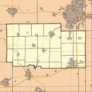
 C55
C55Runways Direction Length Surface ft m 9/27 2,640 805 Turf Statistics (2008) Aircraft operations 6,500 Based aircraft 14 Source: Federal Aviation Administration[1] Ogle County Airport (FAA LID: C55) is a public use airport located two nautical miles (2.3 mi, 3.7 km) southeast of the central business district of Mount Morris, a village in Ogle County, Illinois, United States. The airport is privately owned by Ogle County Pilots Inc.[1]
Facilities and aircraft
Ogle County Airport covers an area of 42 acres (17 ha) at an elevation of 929 feet (283 m) above mean sea level. It has one runway designated 9/27 with a turf surface measuring 2,640 by 200 feet (805 x 61 m).[1]
For the 12-month period ending December 31, 2008, the airport had 6,500 general aviation aircraft operations, an average of 17 per day. At that time there were 14 aircraft based at this airport: 93% single-engine and 7% ultralight.[1]
References
- ^ a b c d FAA Airport Master Record for C55 (Form 5010 PDF). Federal Aviation Administration. Effective 30 June 2011.
External links
- Aerial photo as of 8 April 1999 from USGS The National Map
- Resources for this airport:
- AirNav airport information for C55
- FlightAware airport information and live flight tracker
- SkyVector aeronautical chart for C55
Categories:- Airports in Illinois
- Ogle County, Illinois


Wikimedia Foundation. 2010.