- Ocean Park, Uruguay
-
Ocean Park — Resort — Location in Uruguay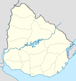
 Ocean Park
Coordinates: 34°52′30″S 55°8′25″W / 34.875°S 55.14028°WCoordinates: 34°52′30″S 55°8′25″W / 34.875°S 55.14028°W Country  Uruguay
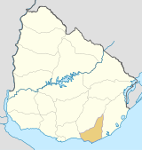
Department Maldonado Department Population (2004) - Total 63 Time zone UTC -3 Postal code 20004 Area code(s) +598 42 Ocean Park is a resort (balneario) in the Maldonado Department of Uruguay. It is located on the coast of Río de la Plata, about 6 kilometres (3.7 mi) west of Punta Ballena and 7 kilometres (4.3 mi) (by road) east of the resort Punta Negra. It borders the resort Sauce de Portezuelo to the west and to the resort Chihuahua to the east, with the stream Arroyo del Portero separating it with the later. It north limit is the Ruta Interbalnearia, also marked as Route 93 for this area, and across it are the resort La Capuera and the Capitán de Corbeta Carlos A. Curbelo International Airport, both of which are on the coast of Laguna del Sauce.
Population
In 2004, Ocean Park had a population of 63 permanent inhabitants[1] and 194 dwellings.[2]
Year Population Dwellings 1963 10 4 1975 4 3 1985 16 10 1996 35 20 2004 63 194 Source: Instituto Nacional de Estadística de Uruguay[3]
References
- ^ "2004 Census of Maldonado department Frame 7" (XLS). INE. 2004. http://www.ine.gub.uy/fase1new/Maldonado/Cuadro7_10.XLS. Retrieved 28 July 2011.
- ^ "2004 Census of Maldonado department Frame 12" (XLS). INE. 2004. http://www.ine.gub.uy/fase1new/Maldonado/Cuadro12_10.XLS. Retrieved 28 July 2011.
- ^ "1963–1996 Statistics / O" (DOC). Instituto Nacional de Estadística de Uruguay. 2004. http://www.ine.gub.uy/biblioteca/toponimico/TOPOletraO.doc. Retrieved 28 July 2011.
External links
 Coast of Maldonado
Resorts
and
LandformsSolís (Punta Animas, Pta Solís) • Bella Vista • Las Flores • Playa Verde (Pta Piedras) • Playa Hermosa • Playa Grande (Pta de los Burros) • Piriápolis (Playa de la Rambla, Pta Fria, Playa San Francisco) • Punta Colorada (Pta Colorada, Playa Punta Colorada) • Punta Negra (Pta Negra, Playa Pta Negra) • Sauce de Portezuelo • Ocean Park • Chihuahua (Barra del Potrero, see also: Laguna del Sauce) • Punta Ballena (Playa Solanas, Portezuelo, Pta Ballena, Playa de las Grutas, Pta del Chileno) • Pinares - Las Delicias (Playa de Pinares, Playa Mansa) • Punta del Este (Puerto Jardin, Playa Honda, Puerto Canon, Pta del Este, Playa de los Ingleses, Pta del Vapor, Playa Brava) • San Rafael - El Placer (Playa San Rafael, Pta de la Barra) • El Tesoro - La Barra (Barra de Maldonado, Pta Maldonado, Playa de la Barra) • El Chorro • Manantiales (Pta Manantiales, Playa Bikini, Pta de Piedras) • Balneario Buenos Aires • Edén Rock • Santa Mónica (Barra de José Ignacio, Laguna Garzón) • Faro José Ignacio (Playa Juanita, Pta José Ignacio) • Arenas de José Ignacio (Playa Garzón)
Glossary : Balneario = Resort , Barra = Mouth (of river) , Laguna = Lagoon , Playa = Beach , Puerto = Port , Punta (or Pta) = Point, Small Peninsula Maldonado Department of UruguayCapital: Maldonado Towns and
villagesAiguá • Balneario Buenos Aires • Barrio Hipódromo • Barrio Los Aromos • Cerro Pelado • El Tesoro • Garzón, Uruguay • Gerona • Gregorio Aznárez • Hipódromo • La Sonrisa • Maldonado • Pan De Azúcar • Pinares - Las Delicias • Piriápolis • Playa Grande • Punta Del Este • San Carlos • San Rafael - El Placer • Villa Delia
Sights Arboretum Lussich • Casapueblo • Cerro Pan de Azúcar • Monumento al Ahogado • Punta Ballena
Categories:- Uruguay geography stubs
- Populated places in the Maldonado Department
- Beaches of Uruguay


Wikimedia Foundation. 2010.