- Oaks Bottom Wildlife Refuge
-
Oaks Bottom Wildlife Refuge 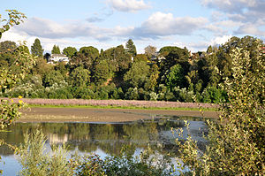
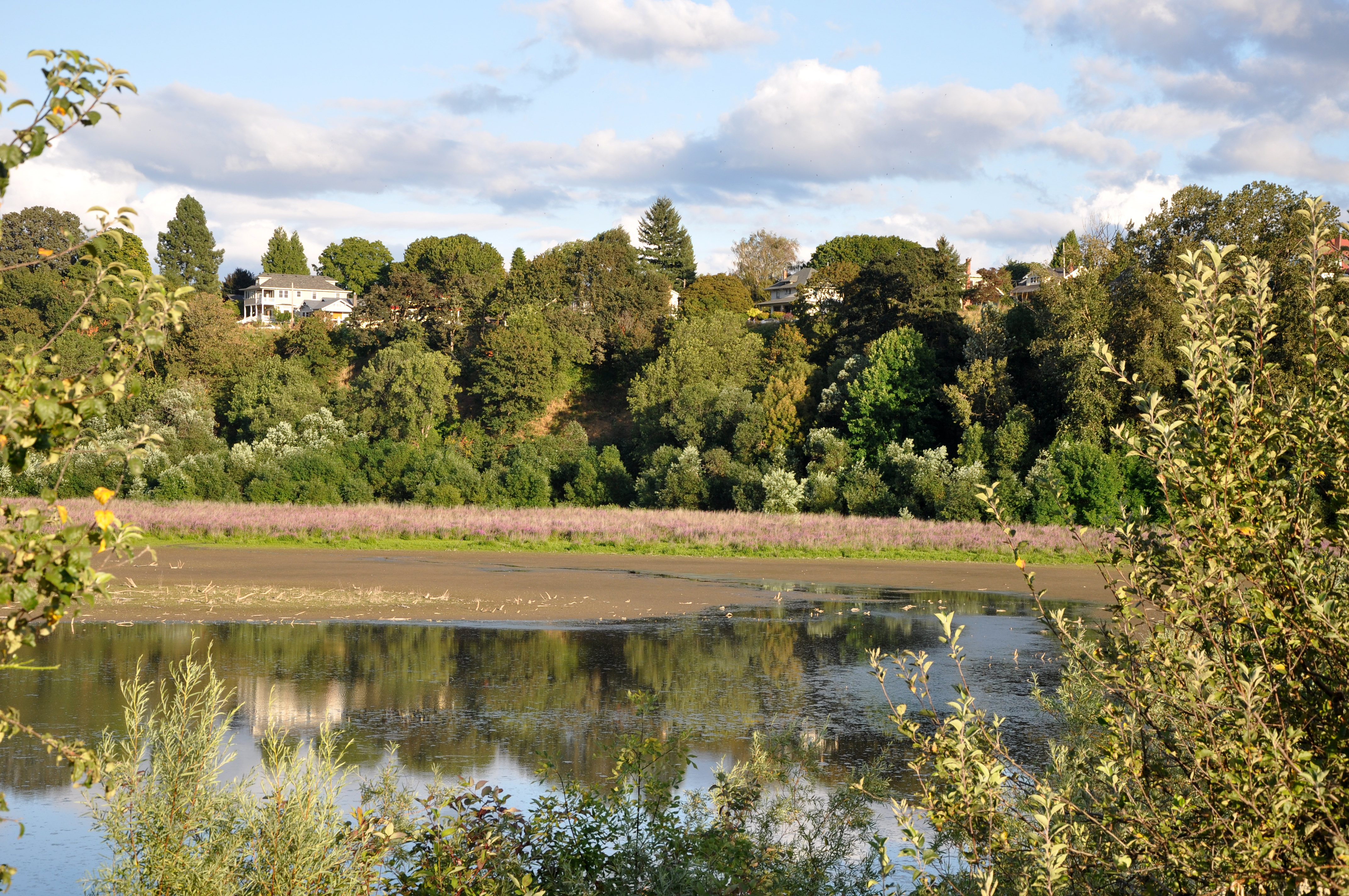
Part of the wetlands at Oaks BottomType Urban park Location Portland, Oregon Coordinates 45°28′13″N 122°39′34″W / 45.47028°N 122.65944°WCoordinates: 45°28′13″N 122°39′34″W / 45.47028°N 122.65944°W[1] Area 141.22 acres (57.15 ha) Created 1959 Operated by Portland Parks & Recreation Status Open 5 a.m. to midnight; north parking lot closes at 10 p.m. Oaks Bottom Wildlife Refuge is a city park of about 141 acres (57 ha) in southeast Portland, in the U.S. state of Oregon. Located in a floodplain along the east bank of the Willamette River near Sellwood, the park is known for attracting a wide variety of birds.[2] In 1988, the park was named Portland's first wildlife refuge,[3] and in 2004, it was designated the city's first migratory bird park.[4]
Contents
Description
The enlongated park, which parallels the river, includes a large shallow lake on the east side of the Springwater Corridor. The Corridor is a hiking and biking path that also runs parallel to the river between Sellwood and downtown Portland.[5] Between the lake and the Corridor is a Portland Traction rail line on a berm.[3] Slightly south of the refuge are Sellwood Park and Sellwood Riverfront Park, and Oaks Amusement Park is to the west, near the river.[3] To the east, the top of a bluff above the lake is mainly residential, though one of the buildings is a mausoleum and crematorium with a huge Great Blue Heron mural overlooking the wetlands.[3] A 1-mile (1.6 km) hiking trail wraps around the east side of the lake beneath the bluff. A side trail connects the east trail with Sellwood Park.[5] To the north are mixed woodlands, shrubs, and a few open fields, and a trail crossing the north section of the refuge links the Corridor to a parking lot at the top of the bluff.[5] West of the north part of the refuge are two islands, East and Hardtack, that belong to the Ross Island group in the Willamette.[3] Ross Island is the site of a heron rookery.[2]
History
Before the Bottom became a park, the raised bed of the rail line had largely separated the wetlands from the river.[3] The south part of the wetlands had been altered by a sanitary landfill that the city acquired in 1969 to prevent its development as industrial land.[2] The city later filled the north end of the park with debris from construction of Interstate 405 through downtown Portland.[3] The plan in the early 1970s was to fill the rest of the wetlands and to use the space for museums, perhaps a motocross course, and a gondola lift to transport visitors from the top of the bluff to the park.[3] Public pressure from the Audubon Society of Portland, the Sellwood-Moreland Improvement Society, and The Nature Conservancy helped persuade the city to stop filling the wetlands.[3] In 1988, after many years of debate, officials designated Oaks Bottom as the first urban wildlife refuge in Portland.[3] Since then, Friends of Oaks Bottom, a volunteer group, has helped the city's parks department with trail maintenance, habitat restoration, and information services.[2]
In 2004, the park was named the city's first migratory bird park. Portland was one of five cities to receive $50,000 grants from the US Fish and Wildlife Service to establish such parks. Thousands of migratory birds visit the refuge during their annual north–south flights.[4]
Flora and fauna
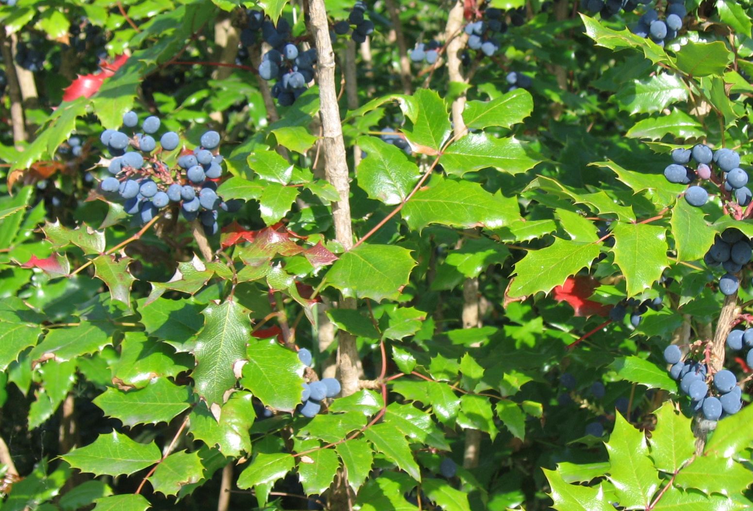
 Oregon-grape, a shrub found in Oaks Bottom
As of 2010, more than 185 bird species have been recorded in the refuge including herons, egrets, hawks, Osprey, shorebirds, gulls, terns, hummingbirds, woodpeckers, grebes, falcons, vultures, waterfowl, and many others.[5] Vegetation, which varies from one part of the refuge to another, includes Oregon white oak, Pacific Madrone, ash, and black locust trees; ferns, Oregon-grape, Scotch broom, and poison oak, as well as rushes, sedges, and other plants.[3] Invasive species, gradually being replaced by physical removal and burning, include reed canary grass, purple loosestrife, Himalayan blackberry, and others.[3]
To regulate the flow of water into and out of the wetlands, the parks department adds or removes boards at a small dam near the railroad berm. The idea is to replicate conditions that existed when the wetlands were fully connected to the river.[3] Part of the water in the wetlands comes from natural springs, and part of the water comes from the river, when it runs high in the winter.[6] Beavers have at times foiled the plan by damming the small stream that carries water between the lake and the river. The parks department has foiled the rodents by running a perforated pipe through the beaver dam.[3]
References
- ^ "Oaks Bottom Wildlife Refuge". Geographic Names Information System. United States Geological Survey. May 26, 2004. http://geonames.usgs.gov/pls/gnispublic/f?p=gnispq:3:::NO::P3_FID:2040337. Retrieved December 10, 2010.
- ^ a b c d "Oaks Bottom Wildlife Refuge". City of Portland. 2010. http://www.portlandonline.com/parks/finder/index.cfm?action=ViewPark&PropertyID=490. Retrieved December 10, 2010.
- ^ a b c d e f g h i j k l m n Houck, Michael C.; Cody, M.J., eds (2000). Wild in the City: A Guide to Portland's Natural Areas. Portland, Oregon: Oregon Historical Society Press. pp. 68–73. ISBN 0-87595-273-9.
- ^ a b Fitzgibbon, Joe (May 6, 2004). "Oak Bottom's High-Flying Fete". The Oregonian: p. Living Portland Zoner North Zoner E08.
- ^ a b c d Hinkle, Christopher (January 2010). "Oaks Bottom Bird List" (PDF). City of Portland. http://www.portlandonline.com/bes/fish/index.cfm?c=31006&a=280023. Retrieved December 11, 2010.
- ^ Nkrumah, Wade (September 22, 2005). "Pretty or not, it's a purple habitat eater". The Oregonian: p. Portland Zoner 10.
External links
Categories:- Parks in Portland, Oregon
- Urban public parks
- Protected areas established in 1959
Wikimedia Foundation. 2010.