Oakamoor railway station

Oakamoor railway station
Oakamoor
Oakamoor Railway Station.jpg
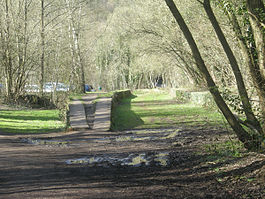
Platform remains in 2009.
Location
Place Oakamoor
Area Staffordshire Moorlands, Staffordshire
Coordinates 52°59′47″N 1°55′13″W / 52.99647°N 1.92040°W / 52.99647; -1.92040Coordinates: 52°59′47″N 1°55′13″W / 52.99647°N 1.92040°W / 52.99647; -1.92040
Operations
Pre-grouping North Staffordshire Railway
Post-grouping LMS
London Midland Region
Platforms 3
History
1 September 1849 opened
5 January 1965 closed to passengers
Disused railway stations in the United Kingdom
Closed railway stations in Britain
A B C D–F G H–J K–L M–O P–R S T–V W–Z
Portal icon UK Railways portal

Oakamoor railway station is a closed railway station in the Churnet Valley, Staffordshire. The station was opened in 1849 as part of the Churnet Valley Line constructed by the North Staffordshire Railway. Serving the village of Oakamoor the station remained open until 1965 when all services were withdrawn, A little north of the station, freight traffic from Oakamoor Sand Sidings continued until 1988.

Preservation

The track as far as the sand sidings remains and is now owned by the Churnet Valley Railway (CVR). It is not yet in regular use and on 21 September 2008, the first service for 20 years ran to Oakamoor with a CVR shareholders' special.

The railway track down the Churnet Valley to the former station at Alton has been converted to a footpath.

Preceding station Disused railways Following station
Kingsley and Froghall   North Staffordshire Railway
Churnet Valley Line
  Alton

External links


Wikimedia Foundation. 2010.

Игры ⚽ Поможем написать реферат

Look at other dictionaries:

  • Alton railway station, Staffordshire — Infobox UK disused station name = Alton manager = North Staffordshire Railway owner = LMS London Midland Region locale = Alton borough = Staffordshire Moorlands, Staffordshire platforms = 2? caption = The remains of Alton railway station line =… …   Wikipedia

  • Oakamoor — Coordinates: 53°00′00″N 1°55′00″W / 53.000°N 1.91667°W / 53.000; 1.91667 …   Wikipedia

  • Oakamoor tunnel — South entrance to Oakamoor Tunnel close to Oakamoor Station Oakamoor Tunnel was a 497yd tunnel located north of Oakamoor railway station on the former Uttoxeter to North Rode section of the North Staffordshire Railway. The tunnel opened in 1849… …   Wikipedia

  • Churnet Valley Railway — Churnet Valley Railway …   Wikipedia

  • North Staffordshire Railway — Locale North Staffordshire United Kingdom Dates of operation 1845–1923 Successor London, Midland and Sco …   Wikipedia

  • Cheadle, Staffordshire — Not to be confused with Cheadle, Greater Manchester. Coordinates: 52°59′06″N 1°59′11″W / 52.9849°N 1.9865°W / 52.98 …   Wikipedia

  • Stafford to Manchester Line — Stafford Manchester Line Overview Locale Cheshire Greater Manchester Staffordshire Stoke on Trent West Midlands (region) North West England Operation Opened …   Wikipedia

  • A52 road — UK road routebox road= A52 length mi= length km= direction= East West start= Newcastle under Lyme destinations= Stoke on Trent Ashbourne Derby Nottingham Grantham Boston Skegness end= Mablethorpe construction date= completion date= junctions=… …   Wikipedia

  • Denstone — Coordinates: 52°57′54″N 1°51′22″W / 52.965°N 1.856°W / 52.965; 1.856 …   Wikipedia

  • Froghall — infobox UK place country = England official name= Froghall population …   Wikipedia

Share the article and excerpts

Direct link
Do a right-click on the link above
and select “Copy Link”