- Notre-Dame-des-Sept-Douleurs, Quebec
-
Notre-Dame-des-Sept-Douleurs — Parish Municipality — 
Coordinates: 48°00′N 69°27′W / 48°N 69.45°WCoordinates: 48°00′N 69°27′W / 48°N 69.45°W Country  Canada
Province  Quebec
Region Bas-Saint-Laurent Regional county Rivière-du-Loup Settled Incorporation 1874 Government[1] – Type Parish Municipality – Mayor Gilbert Delage – Federal riding Montmagny—L'Islet—Kamouraska—Rivière-du-Loup – Prov. riding Rivière-du-Loup Area[2] – Land 11.61 km2 (4.5 sq mi) Population (2006)[2] – Total 62 – Density 5.3/km2 (13.7/sq mi) Time zone EST (UTC-5) – Summer (DST) EDT (UTC-4) Postal Code G0L 1K0 Area code(s) 418 (898 exchange) Website www.ileverte.qc.ca  Lighthouse on Île Verte.
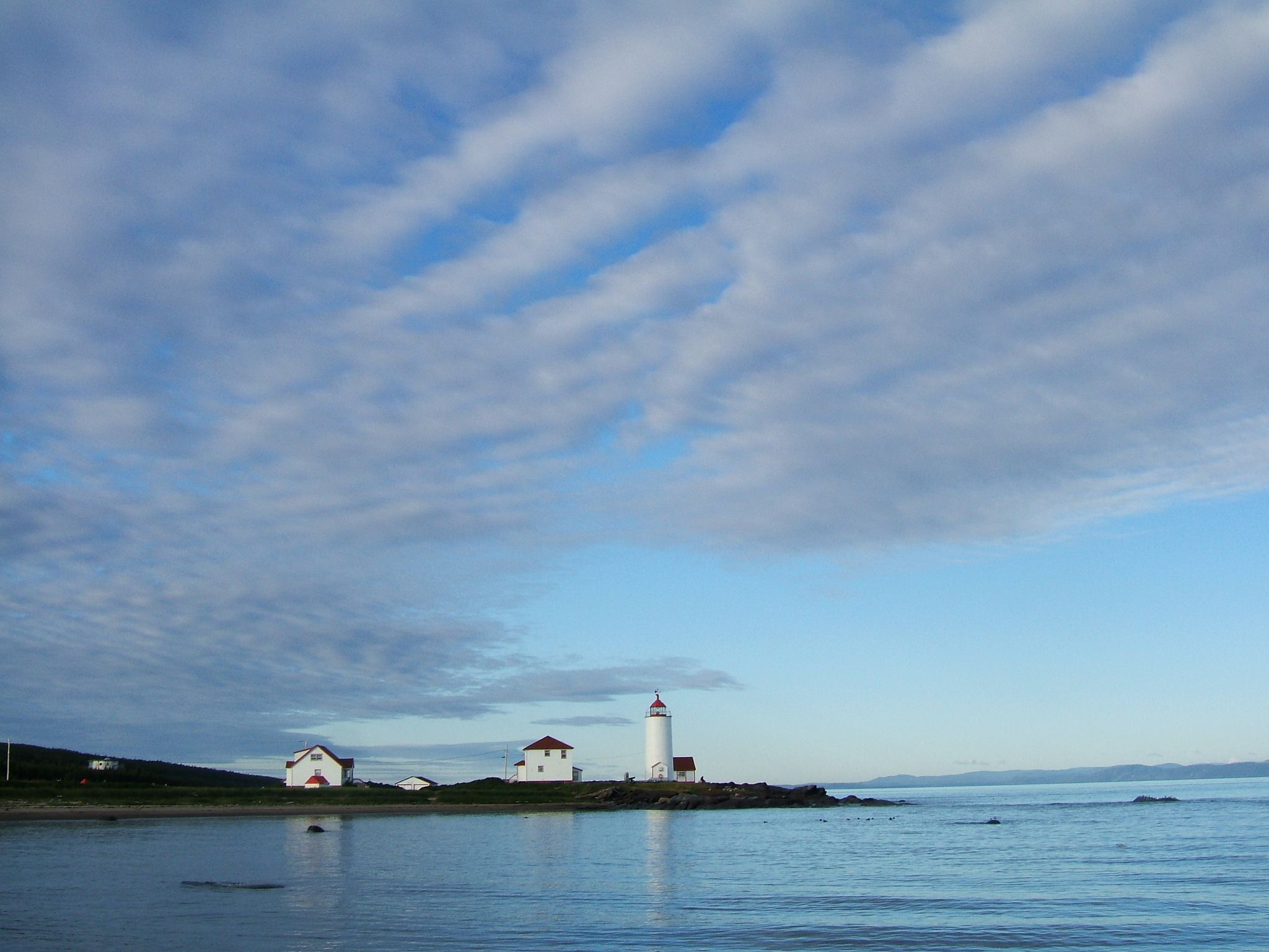
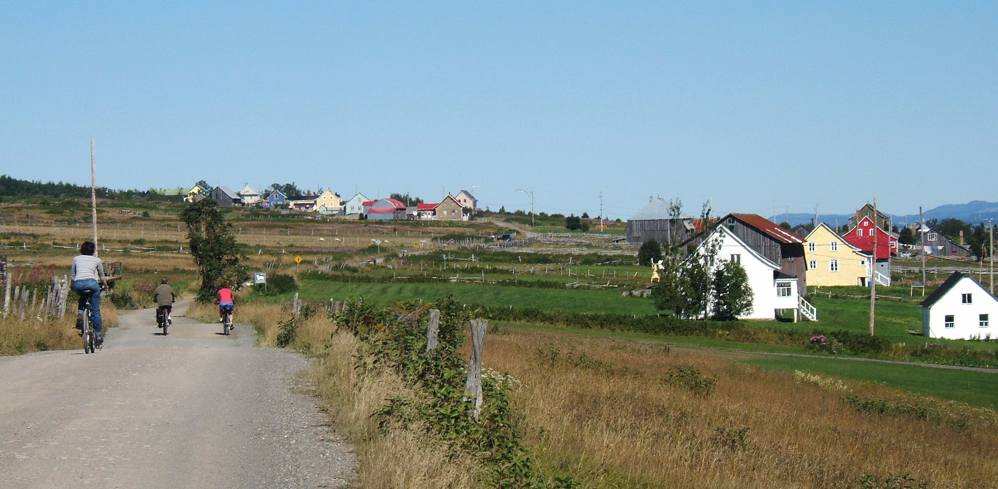
Notre-Dame-des-Sept-Douleurs (French, meaning "Our Lady of Seven Sorrows") is an island municipality in the Bas-Saint-Laurent region of Quebec, Canada, part of the Rivière-du-Loup Regional County Municipality. It is located on and contiguous with Île Verte (French for "Green Island") in the Saint Lawrence River, about 20 kilometres (12 mi) north-east of Rivière-du-Loup.
With a population of only 62 persons, Notre-Dame-des-Sept-Douleurs is one of the smallest municipalities in Canada.
The main economic activity is fishing. Many fish smokehouses are present on the island. The presence of the oldest lighthouse in Quebec (built in 1809), its pastoral character, and heritage homes also attracts some tourism.[3]
History
The island was first mentioned in the Jesuit Reports of 1663 following a shipwreck which forced Henri Nouvel(fr) to stay there for about ten days.[3]
Some 200 years later in 1874, the municipality was formed out of the parish of La Décollation-de-Saint-Jean-Baptiste on November 18, which led to its name "Notre-Dame-des-Sept-Douleurs" since this date corresponded to the Day of Our Lady of Sorrows on the liturgical calendar at that time. However the municipality only existed on paper. The community formed in isolation and life on the island was governed by traditional customs, so people had little need for municipal management, which would have been a family affair anyway. Finally on February 5, 1912, the first council meeting took place.[3]
Demographics
Population:[4]
- Population in 2006: 62 (2001 to 2006 population change: 40.9 %)
- Population in 2001: 44
- Population in 1996: 42
- Population in 1991: 44
Total private dwellings, excluding seasonal cottages: 35 (total: 89)
Mother tongue:
- English as first language: 0 %
- French as first language: 100 %
- English and French as first language: 0 %
- Other as first language: 0 %
References
- ^ Ministère des Affaires Municipales, Régions et Occupation du territoire - Répertoire des municipalités: Notre-Dame-des-Sept-Douleurs
- ^ a b Statistics Canada 2006 Census - Community Profiles: Notre-Dame-des-Sept-Douleurs
- ^ a b c "Notre-Dame-des-Sept-Douleurs (Municipalité de paroisse)" (in French). Commission de toponymie du Québec. http://www.toponymie.gouv.qc.ca/ct/topos/carto.asp?Speci=44874&Latitude=48&Longitude=-69,45&Zoom=1700. Retrieved 2009-01-07.
- ^ Statistics Canada: 1996, 2001, 2006 census

Saint Lawrence River Saint Lawrence River / Baie-Sainte-Catherine 
Saint Lawrence River, ferry to L'Isle-Verte  Notre-Dame-des-Sept-Douleurs

Saint Lawrence River / Cacouna Administrative divisions of Bas-Saint-Laurent (Region 01)Regional county municipalities
and equivalent territoriesMunicipalities Causapscal · Amqui · Matane · Métis-sur-Mer · Mont-Joli · Rimouski · Trois-Pistoles · Rivière-du-Loup · Dégelis · Notre-Dame-du-Lac · Cabano · Pohénégamook · Saint-Pascal · La Pocatière
Categories:- Incorporated places in Bas-Saint-Laurent
- Parish municipalities in Quebec
Wikimedia Foundation. 2010.