- Nokeng tsa Taemane Local Municipality
-
Nokeng tsa Taemane Local Municipality — Local municipality — Location in Gauteng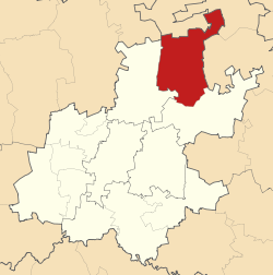
Coordinates: 25°30′S 28°30′E / 25.5°S 28.5°ECoordinates: 25°30′S 28°30′E / 25.5°S 28.5°E Country South Africa Province Gauteng District Metsweding District Seat Rayton Area – Total 1,968 km2 (759.8 sq mi) Population (2007)[1] – Total 49,389 – Density 25.1/km2 (65/sq mi) – Households 14,838 Racial makeup[2] (2007) – Black African 65.12% – White 31.95% – Coloured 1.27% – Indian or Asian 1.67% Languages[3] (2001) – Sepedi 28.76% – Afrikaans 27.37% – Setswana 7.65% Time zone SAST (UTC+2) Municipal code GT461 Website http://www.nokengmun.co.za/ Nokeng tsa Taemane Local Municipality was a local municipality in the Metsweding District of Gauteng in South Africa.
Due to years of financial mismanagement by the ANC-led council[citation needed], the municipality was found to be no longer viable. Thus Nokeng tsa Taemane, along with the Metsweding District, was disestablished and absorbed into the Tshwane Metropolitan Municipality on 18 May 2011, the date of the 2011 municipal election.[4]
The name is in Sepedi and Sesotho, meaning “rivers of diamonds”. The municipality was given the name because of the vast number of rivers and springs in the area and also the diamonds generated around the Caledon.[5]
It encompassed the following towns:[6]
- Cullinan/Rayton
- Roodeplaat
- Elands River
- Pienaarsrivier
References
- ^ "Community Survey, 2007: Basic Results Municipalities" (PDF). Statistics South Africa. http://www.statssa.gov.za/Publications/P03011/P030112007.pdf. Retrieved 2009-10-20.
- ^ "Community Survey 2007 interactive data". Statistics South Africa. http://www.statssa.gov.za/community_new/content.asp?link=interactivedata.asp. Retrieved 19 October 2009.
- ^ "Census 2001 interactive data". Statistics South Africa. http://www.statssa.gov.za/census01/html/C2001Interactive.asp. Retrieved 19 October 2009.
- ^ Shonisani, Tshifhiwa (27 February 2011). "Bronkhorstspruit residents to march against proposed merger". The Citizen. http://www.citizen.co.za/citizen/content/en/citizen/local-news?oid=175739&sn=Detail&pid=334&Bronkhorstspruit-residents-to-march-against--proposed-merger-. Retrieved 9 March 2011.
- ^ South African Languages - Place names
- ^ Department of Home Affairs website, accessed 15 September 2008.
Municipalities in the Province of Gauteng, South Africa Provincial Capital: JohannesburgMetropolitan District
and LocalCategories:- Local Municipalities of Metsweding

Wikimedia Foundation. 2010.